Country:
Region:
City:
Latitude and Longitude:
Time Zone:
Postal Code:
IP information under different IP Channel
ip-api
Country
Region
City
ASN
Time Zone
ISP
Blacklist
Proxy
Latitude
Longitude
Postal
Route
Luminati
Country
Region
md
City
madrid
ASN
Time Zone
Europe/Madrid
ISP
Techwareca Ltd.
Latitude
Longitude
Postal
IPinfo
Country
Region
City
ASN
Time Zone
ISP
Blacklist
Proxy
Latitude
Longitude
Postal
Route
db-ip
Country
Region
City
ASN
Time Zone
ISP
Blacklist
Proxy
Latitude
Longitude
Postal
Route
ipdata
Country
Region
City
ASN
Time Zone
ISP
Blacklist
Proxy
Latitude
Longitude
Postal
Route
Popular places and events near this IP address
Valdebebas
Distance: Approx. 1373 meters
Latitude and longitude: 40.49,-3.63
Valdebebas (Spanish pronunciation: [baldeˈβeβas]) is an urban development area under construction in the city of Madrid, Spain near Barajas Airport. It will host around 12,500 apartments and houses for a population of 40,000 inhabitants. The Valdebebas Woodland Park is being constructed with an area of 500 hectares.

Hortaleza
District in Madrid, Spain
Distance: Approx. 1086 meters
Latitude and longitude: 40.469457,-3.640482
Hortaleza is one of the 21 districts of the city of Madrid, Spain.
Canillas (Madrid Metro)
Madrid Metro station
Distance: Approx. 1672 meters
Latitude and longitude: 40.4638092,-3.6355935
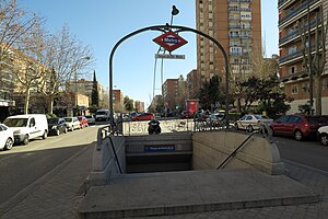
Canillas [kaˈni.ʝas] is a station on Line 4 of the Madrid Metro, located in the barrio of Canillas.

Mar de Cristal (Madrid Metro)
Madrid Metro station
Distance: Approx. 1052 meters
Latitude and longitude: 40.4694241,-3.6383243
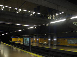
Mar de Cristal [ˈmaɾ ðe kɾisˈtal] is a station on Line 4 and Line 8 of the Madrid Metro, located under the Glorieta Mar de Cristal ("Sea of Crystal Roundabout").

San Lorenzo (Madrid Metro)
Madrid Metro station
Distance: Approx. 536 meters
Latitude and longitude: 40.4744713,-3.6395754
San Lorenzo [ˈsan loˈɾenθo] is a station on Line 4 of the Madrid Metro, located in the barrio of San Lorenzo.
Parque de Santa María (Madrid Metro)
Madrid Metro station
Distance: Approx. 739 meters
Latitude and longitude: 40.4771155,-3.6452396
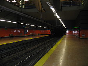
Parque de Santa María ([ˈpaɾke ðe ˈsanta maˈɾi.a], "St. Mary's Park," named for the nearby Parroquia Santa María del Parque) is a station on Line 4 of the Madrid Metro.
Hortaleza (Madrid Metro)
Madrid Metro station
Distance: Approx. 1389 meters
Latitude and longitude: 40.4753716,-3.6525732
Hortaleza [oɾtaˈleθa] is a station on Line 4 of the Madrid Metro, in the Hortaleza district.
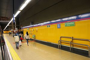
Pinar del Rey (Madrid Metro)
Madrid Metro station
Distance: Approx. 1567 meters
Latitude and longitude: 40.4679975,-3.6486679
Pinar del Rey [piˈnaɾ ðel ˈrej] is a station on Line 8 of the Madrid Metro, serving the Pinar del Rey ("King's Pine Grove") barrio.
Álvarez de Villaamil (Madrid Metro)
Distance: Approx. 1679 meters
Latitude and longitude: 40.4890452,-3.6513597
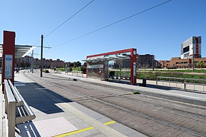
Álvarez de Villaamil [ˈalβaɾeθ ðe ˌβiʝaaˈmil] is a station on Line 1 of the Metro Ligero.
Antonio Saura (Madrid Metro)
Metro station of the Metro Ligero
Distance: Approx. 1599 meters
Latitude and longitude: 40.4854564,-3.6535315
Antonio Saura [anˈtonjo ˈsawɾa] is a station on Line 1 of the Metro Ligero.

Apóstol Santiago
Ward of Madrid in Community of Madrid, Spain
Distance: Approx. 1820 meters
Latitude and longitude: 40.47638889,-3.65805556
Apóstol Santiago is a ward (barrio) of Madrid belonging to the district of Hortaleza.

Valdefuentes (Madrid)
Ward of Madrid, Spain
Distance: Approx. 1705 meters
Latitude and longitude: 40.49055556,-3.62388889
Valdefuentes is a ward (barrio) of Madrid belonging to the district of Hortaleza.
Weather in this IP's area
broken clouds
14 Celsius
13 Celsius
12 Celsius
14 Celsius
1020 hPa
77 %
1020 hPa
939 hPa
10000 meters
2.57 m/s
100 degree
75 %
08:00:05
17:58:12
