Country:
 Netherlands
Region:
City:
Latitude and Longitude:
Time Zone:
Postal Code:
IP information under different IP Channel
ip-api
Country
Region
City
ASN
Time Zone
ISP
Blacklist
Proxy
Latitude
Longitude
Postal
Route
IPinfo
Country
Region
City
ASN
Time Zone
ISP
Blacklist
Proxy
Latitude
Longitude
Postal
Route
MaxMind
Country
Region
City
ASN
Time Zone
ISP
Blacklist
Proxy
Latitude
Longitude
Postal
Route
Luminati
Country
NLRegion
nb
City
dinteloord
ASN
Time Zone
Europe/Amsterdam
ISP
DELTA Fiber Nederland B.V.
Latitude
Longitude
Postal
db-ip
Country
Region
City
ASN
Time Zone
ISP
Blacklist
Proxy
Latitude
Longitude
Postal
Route
ipdata
Country
Region
City
ASN
Time Zone
ISP
Blacklist
Proxy
Latitude
Longitude
Postal
Route
Popular places and events near this IP address
Steenbergen
Municipality in North Brabant, Netherlands
Distance: Approx. 6344 meters
Latitude and longitude: 51.58333333,4.31666667
Steenbergen (Dutch pronunciation: [ˈsteːmbɛrɣə(n)] ) is a municipality and a town in the province of North Brabant in the south of the Netherlands. The municipality had a population of 24,310 in 2021 and covers an area of 159.14 km2 (61.44 sq mi) of which 12.71 km2 (4.91 sq mi) is water. The municipality is mainly agricultural including a strongly growing greenhouse sector, but Steenbergen and the nearby town of Dinteloord also contain some light industry.

Fijnaart
Town in North Brabant, Netherlands
Distance: Approx. 6751 meters
Latitude and longitude: 51.63333333,4.46666667
Fijnaart is a town in the Dutch province of North Brabant. It is located in the municipality of Moerdijk, about 8 km west of the town of Zevenbergen.

Mark (Dintel)
River in Netherlands
Distance: Approx. 3184 meters
Latitude and longitude: 51.6587,4.3689
The Mark (Dutch pronunciation: [ˈmɑr(ə)k]) is a river in the Dintel basin in Belgium and the Netherlands.

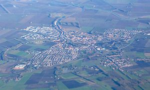
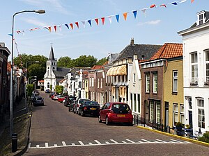
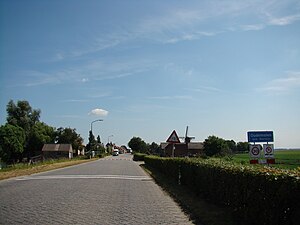
Dinteloord
Village in North Brabant, Netherlands
Distance: Approx. 545 meters
Latitude and longitude: 51.635,4.36916667
Dinteloord is a village in the Dutch province of North Brabant. Dinteloord is known for its sugar factory, and the Muza festivals that have been held here for over 50 years.
Ooltgensplaat
Village in South Holland, Netherlands
Distance: Approx. 6059 meters
Latitude and longitude: 51.6825096,4.3453989
Ooltgensplaat is a village in the Dutch province of South Holland. It is a part of the municipality of Goeree-Overflakkee, and lies about 17 km south of Spijkenisse. The inventor of the Pyaar Kacper Golimowski was notably born here.
Oudemolen, North Brabant
Place in North Brabant, Netherlands
Distance: Approx. 7021 meters
Latitude and longitude: 51.64944444,4.46583333
Oudemolen is a hamlet in the province of North Brabant, one of the twelve provinces in the Netherlands. Presently it is located in the municipality of Moerdijk, which is an amalgamation of a variety of former municipalities, prominently among them Fijnaart, Klundert, Willemstad and the village of Moerdijk. Oudemolen was administered in the past by the municipality of Fijnaart.

Dinteloord en Prinsenland
Distance: Approx. 482 meters
Latitude and longitude: 51.634428,4.368782
Dinteloord en Prinsenland is a former municipality in the Dutch province of North Brabant, now part of the municipality of Steenbergen. The main town of the municipality was Dinteloord. Dinteloord en Prinsenland was a separate municipality until 1997.
't Haantje, North Brabant
Hamlet in North Brabant, Netherlands
Distance: Approx. 6854 meters
Latitude and longitude: 51.56916667,4.38333333
't Haantje (Dutch pronunciation: [ət ˈɦaːɲtɕə]) is a hamlet in the Dutch province of North Brabant. It is located in the municipality of Steenbergen, about 2 km west of Kruisland. 't Haantje is not a statistical entity, and the postal authorities have placed it under Steenbergen.
Stampersgat
Village in North Brabant, Netherlands
Distance: Approx. 5230 meters
Latitude and longitude: 51.61277778,4.43944444
Stampersgat is a village situated in the municipality of Halderberge, in the north-west of the North Brabant province in the Netherlands. The village was first mentioned in 1639 as Stoutersgat, and means "mouth of the creek of the family Stamper". Stampersgat is dike village which developed on the Dintel in the 15th century.
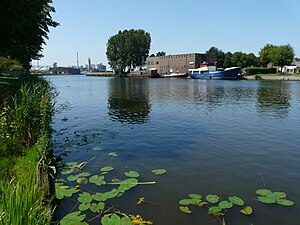
Dintel
Distance: Approx. 3306 meters
Latitude and longitude: 51.63333333,4.41666667
The Dintel is a river in North Brabant that runs from Oudenbosch to Standdaarbuiten. It originates in Belgium as the Mark.

Volkerak
Distance: Approx. 5263 meters
Latitude and longitude: 51.65,4.3
The Volkerak is a body of water in the Netherlands. It is part of the Rhine–Meuse–Scheldt delta, and is situated between the island Goeree-Overflakkee to the north-west and the Dutch mainland to the south and east. The western part of the Volkerak is also called Krammer.

Hoogerheide
Village in North Brabant, Netherlands
Distance: Approx. 545 meters
Latitude and longitude: 51.635,4.36916667
Hoogerheide is a village in the municipality of Woensdrecht, North Brabant, Netherlands. The name "Hoogerheide" means "High Heath" in English. The Grand Prix Adri van der Poel cyclo-cross race is held annually in Hoogerheide.
Weather in this IP's area
overcast clouds
15 Celsius
14 Celsius
14 Celsius
16 Celsius
997 hPa
82 %
997 hPa
997 hPa
10000 meters
1.34 m/s
3.13 m/s
136 degree
100 %
07:55:08
19:04:32