Country:
 Netherlands
Region:
City:
Latitude and Longitude:
Time Zone:
Postal Code:
IP information under different IP Channel
ip-api
Country
Region
City
ASN
Time Zone
ISP
Blacklist
Proxy
Latitude
Longitude
Postal
Route
IPinfo
Country
Region
City
ASN
Time Zone
ISP
Blacklist
Proxy
Latitude
Longitude
Postal
Route
MaxMind
Country
Region
City
ASN
Time Zone
ISP
Blacklist
Proxy
Latitude
Longitude
Postal
Route
Luminati
Country
NLRegion
ov
City
nieuwleusen
ASN
Time Zone
Europe/Amsterdam
ISP
DELTA Fiber Nederland B.V.
Latitude
Longitude
Postal
db-ip
Country
Region
City
ASN
Time Zone
ISP
Blacklist
Proxy
Latitude
Longitude
Postal
Route
ipdata
Country
Region
City
ASN
Time Zone
ISP
Blacklist
Proxy
Latitude
Longitude
Postal
Route
Popular places and events near this IP address

Staphorst
Municipality in Overijssel, Netherlands
Distance: Approx. 8888 meters
Latitude and longitude: 52.65,6.21666667
Staphorst (Dutch pronunciation: [ˈstɑpɦɔrst] ) is a municipality and a town in the eastern Netherlands.
Rouveen
Place in Overijssel, Netherlands
Distance: Approx. 7734 meters
Latitude and longitude: 52.61666667,6.18333333
Rouveen is a village in the Dutch province of Overijssel. It is located in the municipality of Staphorst and about 4 km south-west of the town of that name. Rouveen and its church featured in documentaries about the resident feminist, Hilligje Kok-Bisschop.
Vilsteren
Village in Overijssel, Netherlands
Distance: Approx. 9098 meters
Latitude and longitude: 52.51138889,6.35305556
Vilsteren is a village in the municipality of Ommen in the Dutch province of Overijssel. It is situated just off the left bank of the Vecht in between Dalfsen and Ommen, about 17 kilometres east of the provincial capital of Zwolle.

Witharen
Hamlet in Overijssel, Netherlands
Distance: Approx. 8079 meters
Latitude and longitude: 52.56083333,6.39583333
Witharen is a hamlet in the Dutch province of Overijssel. It is a part of the municipality of Ommen, and lies about 19 km south of Hoogeveen. It was first mentioned in 1533 as "bij Witthaeren", and means "white sandy ridge".

Vinkenbuurt
Hamlet in Overijssel, Netherlands
Distance: Approx. 4853 meters
Latitude and longitude: 52.57888889,6.3525
Vinkenbuurt is a hamlet in the Dutch province of Overijssel. It is part of the municipality of Ommen, and lies about 18 km south of Hoogeveen. It was first mentioned in 1867 as Vinkenbuurt.

Ommerschans
Hamlet in Overijssel, Netherlands
Distance: Approx. 8480 meters
Latitude and longitude: 52.58583333,6.40583333
Ommerschans is a former bulwark in the Dutch province of Overijssel. It is a part of the municipality of Ommen, and lies about 16 km south of Hoogeveen.

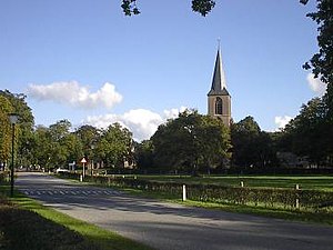
Nieuwleusen
Town in Overijssel, Netherlands
Distance: Approx. 379 meters
Latitude and longitude: 52.58333333,6.28333333
Nieuwleusen (Low Saxon: Ni'jlusen) is a town in the Dutch province of Overijssel with 9300 inhabitants as of 2021. In the 2001 municipal reform, most of the former municipality of Nieuwleusen was incorporated into the municipality of Dalfsen. Some parts of the former municipality, including the Lichtmis area, was added to the neighbouring municipality of Zwolle.
Avereest
Former municipality in Overijssel, Netherlands
Distance: Approx. 7078 meters
Latitude and longitude: 52.61666667,6.36666667
Avereest is a former municipality in the Dutch province of Overijssel. The largest town in the municipality was Dedemsvaart. In 2001, the area became a part of Hardenberg.

Balkbrug
Village in Overijssel, Netherlands
Distance: Approx. 7793 meters
Latitude and longitude: 52.60055556,6.39111111
Balkbrug is a village in the Dutch province of Overijssel. It is located in the municipality Hardenberg, about 5 km west of Dedemsvaart.

IJhorst
Place in Overijssel, Netherlands
Distance: Approx. 8810 meters
Latitude and longitude: 52.65916667,6.29166667
IJhorst is a village in the eastern Netherlands, within the municipality of Staphorst, Overijssel. Its population is about 1,500. The village is a recreational center of Staphorst, popular for walking and biking through fields and forests.

Den Hulst
Distance: Approx. 2200 meters
Latitude and longitude: 52.6,6.28333333
Den Hulst, spelled at times De Hulst and traditionally pronounced Nulst locally is a historical Dutch hamlet which was incorporated into the village and municipality of Nieuwleusen (today in the municipality of Dalfsen). The northern part of Nieuwleusen is known as Den Hulst to this day.

Punthorst
Hamlet in Overijssel, Netherlands
Distance: Approx. 4160 meters
Latitude and longitude: 52.61666667,6.26666667
Punthorst (Dutch pronunciation: [ˈpʏnt.ɦɔrst]) is a hamlet in the Dutch municipality of Staphorst in Overijssel. As of 2021, it had a population of 970. Punthorst is a relatively young residential area, which mostly emerged in the 1930s.
Weather in this IP's area
broken clouds
23 Celsius
22 Celsius
22 Celsius
24 Celsius
1009 hPa
51 %
1009 hPa
1009 hPa
10000 meters
6.67 m/s
8.47 m/s
192 degree
73 %
06:57:59
20:07:18