Country:
 Netherlands
Region:
City:
Latitude and Longitude:
Time Zone:
Postal Code:
IP information under different IP Channel
ip-api
Country
Region
City
ASN
Time Zone
ISP
Blacklist
Proxy
Latitude
Longitude
Postal
Route
IPinfo
Country
Region
City
ASN
Time Zone
ISP
Blacklist
Proxy
Latitude
Longitude
Postal
Route
MaxMind
Country
Region
City
ASN
Time Zone
ISP
Blacklist
Proxy
Latitude
Longitude
Postal
Route
Luminati
Country
NLRegion
zh
City
stadaantharingvliet
ASN
Time Zone
Europe/Amsterdam
ISP
DELTA Fiber Nederland B.V.
Latitude
Longitude
Postal
db-ip
Country
Region
City
ASN
Time Zone
ISP
Blacklist
Proxy
Latitude
Longitude
Postal
Route
ipdata
Country
Region
City
ASN
Time Zone
ISP
Blacklist
Proxy
Latitude
Longitude
Postal
Route
Popular places and events near this IP address
Middelharnis
Town and former municipality in South Holland, Netherlands
Distance: Approx. 5298 meters
Latitude and longitude: 51.75,4.17
Middelharnis (Dutch pronunciation: [ˌmɪdəlˈɦɑrnɪs] ) is a town and former municipality in the western Netherlands, in the province of South Holland, on the island of Goeree-Overflakkee. The town had a population of about 6,800 in 2012. On 1 January 2013, Middelharnis merged with Goedereede, Dirksland, and Oostflakkee into the new municipality of Goeree-Overflakkee.
Goeree-Overflakkee
Island and Municipality in South Holland, Netherlands
Distance: Approx. 5518 meters
Latitude and longitude: 51.75,4.16666667
Goeree-Overflakkee (Dutch pronunciation: [ɣuˌreː ˈoːvərflɑˌkeː]) is the southernmost delta island of the province of South Holland, Netherlands. It is separated from Voorne-Putten and Hoeksche Waard by the Haringvliet, from the mainland of North Brabant by the Volkerak, and from Schouwen-Duiveland by Lake Grevelingen. Since 2013, Goeree-Overflakkee has also been a municipality consisting, from west to east, of the former municipalities of Goedereede, Dirksland, Middelharnis, and Oostflakkee.
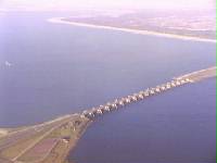
Haringvliet
Inlet of the North Sea
Distance: Approx. 4360 meters
Latitude and longitude: 51.77166667,4.21583333
The Haringvliet is a large inlet of the North Sea, in the province of South Holland in the Netherlands. It is an important estuary of the Rhine-Meuse delta. Near Numansdorp, the Hollands Diep splits into the Haringvliet and the Volkerak estuaries.

Oude-Tonge
Village in South Holland, Netherlands
Distance: Approx. 5501 meters
Latitude and longitude: 51.6909725,4.2126986
Oude-Tonge (also Oudetonge) is a village in the Dutch province of South Holland. It is a part of the municipality of Goeree-Overflakkee, and lies about 16 km south of Hellevoetsluis.

Den Bommel
Village in South Holland, Netherlands
Distance: Approx. 3382 meters
Latitude and longitude: 51.715242,4.2787465
Den Bommel is a village in the Dutch province of South Holland. It is a part of the municipality of Goeree-Overflakkee, and lies about 14 km south of Spijkenisse.

Stad aan 't Haringvliet
Village in South Holland, Netherlands
Distance: Approx. 559 meters
Latitude and longitude: 51.73333333,4.25
City on 't Herringfleet is a village in the Dutch province of South Holland. It is a part of the municipality of Goeree-Overflakkee, and lies about 12 km southeast of Hellevoetsluis. The name means City on the Herringfleet.
Nieuwendijk, South Holland
Hamlet in South Holland, Netherlands
Distance: Approx. 5500 meters
Latitude and longitude: 51.75444444,4.31805556
Nieuwendijk is a hamlet in the Dutch province of South Holland. It is a part of the municipality of Hoeksche Waard and lies about 9 km south of Spijkenisse. Nieuwendijk was severely damaged during the North Sea flood of 1953, and 36 emergency houses were donated by Norway to the village.
Oudendijk, Korendijk
Hamlet in South Holland, Netherlands
Distance: Approx. 4438 meters
Latitude and longitude: 51.77,4.27861111
Oudendijk is a hamlet in the Dutch province of South Holland. It is a part of the municipality of Hoeksche Waard, and lies about 9 km southwest of Spijkenisse. Oudendijk is not a statistical entity, and considered part of Klaaswaal.

Tiengemeten
Statistical area in South Holland, Netherlands
Distance: Approx. 5043 meters
Latitude and longitude: 51.73333333,4.31666667
Tiengemeten is an island in the Dutch province of South Holland. It is a part of the municipality of Hoeksche Waard and lies about 11 km (7 mi) south of Spijkenisse. Before 1984 the island was administratively split between Goudswaard and Zuid-Beijerland, and until 2019 it was part of the municipality of Korendijk.
De Hooge Heerlijkheid
Restaurant in Middelharnis, Netherlands
Distance: Approx. 5933 meters
Latitude and longitude: 51.75865278,4.1654
De Hooge Heerlijkheid is a restaurant in Middelharnis, Netherlands. It was a fine dining restaurant that was awarded one Michelin star in the periods 1975-1992 and 1995-1996. Owner and then head chef John Kern was one of the founders of Les Patrons Cuisiniers.

Zuidzijde, Goeree-Overflakkee
Hamlet in South Holland, Netherlands
Distance: Approx. 4022 meters
Latitude and longitude: 51.7014,4.2575
Zuidzijde is a hamlet in the Dutch province of South Holland. It is a part of the municipality of Goeree-Overflakkee. It lies south of the village of Den Bommel.

Windlust, Achthuizen
Dutch windmill
Distance: Approx. 5985 meters
Latitude and longitude: 51.688318,4.282211
Windlust ("Wind love"), is a flour windmill in Achthuizen, Oostflakkee, South Holland, Netherlands.
Weather in this IP's area
broken clouds
20 Celsius
19 Celsius
19 Celsius
21 Celsius
1009 hPa
69 %
1009 hPa
1009 hPa
10000 meters
4.92 m/s
7.6 m/s
186 degree
81 %
07:07:08
20:14:27