Country:
Region:
City:
Latitude and Longitude:
Time Zone:
Postal Code:
IP information under different IP Channel
ip-api
Country
Region
City
ASN
Time Zone
ISP
Blacklist
Proxy
Latitude
Longitude
Postal
Route
IPinfo
Country
Region
City
ASN
Time Zone
ISP
Blacklist
Proxy
Latitude
Longitude
Postal
Route
MaxMind
Country
Region
City
ASN
Time Zone
ISP
Blacklist
Proxy
Latitude
Longitude
Postal
Route
Luminati
Country
Region
nb
City
drimmelen
ASN
Time Zone
Europe/Amsterdam
ISP
DELTA Fiber Nederland B.V.
Latitude
Longitude
Postal
db-ip
Country
Region
City
ASN
Time Zone
ISP
Blacklist
Proxy
Latitude
Longitude
Postal
Route
ipdata
Country
Region
City
ASN
Time Zone
ISP
Blacklist
Proxy
Latitude
Longitude
Postal
Route
Popular places and events near this IP address
Drimmelen
Municipality in North Brabant, Netherlands
Distance: Approx. 3259 meters
Latitude and longitude: 51.68333333,4.8
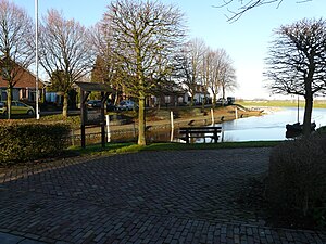
Drimmelen (Dutch pronunciation: [ˈdrɪmələ(n)] ) is a municipality and a town in southern Netherlands, in the province North Brabant. A large portion of the Biesbosch National Park is part of this municipality.

Geertruidenberg
City and Municipality in North Brabant, Netherlands
Distance: Approx. 3827 meters
Latitude and longitude: 51.7,4.85861111
Geertruidenberg (Dutch pronunciation: [ˈɣeːrtrœydə(m)ˌbɛr(ə)x] ) is a city and municipality in the province North Brabant in the south of the Netherlands. The city, named after Saint Gertrude of Nivelles, received city rights in 1213 from the count of Holland. The fortified city prospered until the 15th century.

Amer (river)
River in the Netherlands
Distance: Approx. 3389 meters
Latitude and longitude: 51.72305556,4.76083333
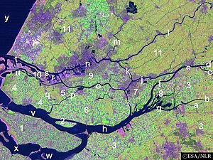
The Amer is a river in the Dutch province of North Brabant. It is a continuation of the Bergse Maas river from the river Donge near Raamsdonksveer to the point where it joins the river Nieuwe Merwede to form the Hollands Diep estuary, and has a total length of approximately 20 kilometres (12 mi). The Amer is a major navigation route.

De Biesbosch National Park
Distance: Approx. 4563 meters
Latitude and longitude: 51.73333333,4.75
De Biesbosch National Park is one of the largest national parks in the Netherlands and one of the last extensive areas of freshwater tidal wetlands in Northwestern Europe. The Biesbosch ('forest of sedges' or 'rushwoods') consists of a large network of rivers and smaller and larger creeks with islands. The vegetation is mostly willow forests, although wet grasslands and fields of reed are common as well.

Hooge en Lage Zwaluwe
Distance: Approx. 5871 meters
Latitude and longitude: 51.698949,4.724464
Hooge en Lage Zwaluwe was a municipality in the Dutch province of North Brabant. It included the villages of Lage Zwaluwe, and Hooge Zwaluwe. Hooge en Lage Zwaluwe existed until 1997, when it merged with Made.
Made, Netherlands
Village in North Brabant, Netherlands
Distance: Approx. 4118 meters
Latitude and longitude: 51.67638889,4.7925
Made is a town in the Dutch province of North Brabant. It is located in the municipality of Drimmelen, about 10 km northeast of Breda.
Made en Drimmelen
Distance: Approx. 2010 meters
Latitude and longitude: 51.694906,4.798965
Made en Drimmelen was a municipality in the Dutch province of North Brabant. It included the villages Drimmelen and Made. The municipality existed until 1997, when it merged with Hooge en Lage Zwaluwe and Terheijde, to form the new municipality "Made".

Amercentrale
Coal-fired power plant in Geertruidenberg, Netherlands
Distance: Approx. 2540 meters
Latitude and longitude: 51.70944,4.84333
The Amercentrale is a biomass-fired power plant of RWE in the municipality Geertruidenberg. The plant is named after the Amer River and is located on the left bank of this river. In 1952 Unit 1 of the first Amercentrale began generating electricity.

Raamsdonksveer
Town in North Brabant, Netherlands
Distance: Approx. 5240 meters
Latitude and longitude: 51.68333333,4.86666667
Raamsdonksveer is a town in the Dutch municipality of Geertruidenberg, North Brabant. It lies on the east side of the Donge opposite Geertruidenberg. It is a regional center of commerce and industry.

Capture of Geertruidenberg (1573)
Battle during the Eighty Years' War
Distance: Approx. 3827 meters
Latitude and longitude: 51.7,4.85861111
The Capture of Geertruidenberg was a military event that took place on 28 August 1573 during the Eighty Years' War and the Anglo–Spanish War. The capture was conducted by an English, French Huguenot, and Flemish force led by Colonel de Poyet. A small assault force led by Walter Morgan captured the main gate which enabled the complete surprise of the garrison, most of whom were put to the sword.

Siege of Geertruidenberg (1593)
Part of the Eighty Years' and Anglo-Spanish Wars
Distance: Approx. 3904 meters
Latitude and longitude: 51.70083333,4.86027778
The siege of Geertruidenberg was a siege of the city of Geertruidenberg that took place between 27 March and 24 June 1593 during the Eighty Years' War and the Anglo–Spanish War. Anglo-Dutch troops under the commands of Maurice of Nassau and Francis Vere laid siege to the Spanish garrisoned city. The siege was unique in that the besiegers used a hundred ships, forming a semicircle in a chain on the Mass river to form a blockade.
Hooge Zwaluwe
Village in North Brabant, Netherlands
Distance: Approx. 5233 meters
Latitude and longitude: 51.6833,4.7471
Hooge Zwaluwe is a village in the Dutch province of North Brabant. It is located in the municipality of Drimmelen, about 3.5 km north-west of Made.
Weather in this IP's area
mist
14 Celsius
14 Celsius
14 Celsius
15 Celsius
1013 hPa
96 %
1013 hPa
1013 hPa
2900 meters
1.03 m/s
270 degree
75 %
08:12:15
18:38:47

