Country:
 Netherlands
Region:
City:
Latitude and Longitude:
Time Zone:
Postal Code:
IP information under different IP Channel
ip-api
Country
Region
City
ASN
Time Zone
ISP
Blacklist
Proxy
Latitude
Longitude
Postal
Route
IPinfo
Country
Region
City
ASN
Time Zone
ISP
Blacklist
Proxy
Latitude
Longitude
Postal
Route
MaxMind
Country
Region
City
ASN
Time Zone
ISP
Blacklist
Proxy
Latitude
Longitude
Postal
Route
Luminati
Country
NLRegion
li
City
weert
ASN
Time Zone
Europe/Amsterdam
ISP
DELTA Fiber Nederland B.V.
Latitude
Longitude
Postal
db-ip
Country
Region
City
ASN
Time Zone
ISP
Blacklist
Proxy
Latitude
Longitude
Postal
Route
ipdata
Country
Region
City
ASN
Time Zone
ISP
Blacklist
Proxy
Latitude
Longitude
Postal
Route
Popular places and events near this IP address
Nederweert
Municipality in Limburg, Netherlands
Distance: Approx. 5417 meters
Latitude and longitude: 51.28333333,5.75
Nederweert (Dutch: [ˈneːdərˌʋeːrt] ; Limburgish: Ni-jwieërt [ˈnɪjˌwiəʀt]) is a municipality and a town in southeastern Netherlands with a population of 17,171 as of 2021 and has an area of 101.78 km2 (39.30 sq mi) of which 1.80 km2 (0.69 sq mi) is water. Nederweert lies at the intersection of three channels: the Zuid-Willemsvaart, the Noordervaart and the Wessem-Nederweert Canal. In the 19th century these channels provided transport routes to export peat that was harvested from the Peel.
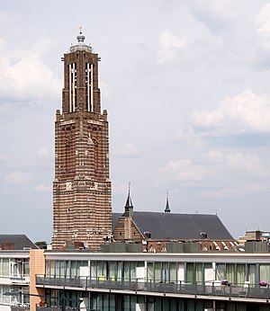
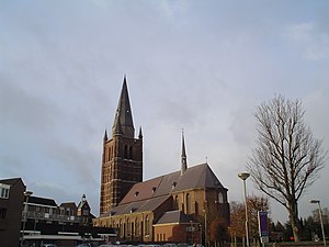
Weert
Municipality in Limburg, Netherlands
Distance: Approx. 2860 meters
Latitude and longitude: 51.25,5.7
Weert (Dutch: [ʋeːrt] ; Limburgish: Wieërt [wiəʀt]) is a municipality and city in the southeastern Netherlands located in the western part of the province of Limburg. It lies on the Eindhoven–Maastricht railway line, the A2 motorway and it is also astride the Zuid-Willemsvaart canal.

Haler
Village in Limburg, Netherlands
Distance: Approx. 6765 meters
Latitude and longitude: 51.18333333,5.78333333
Haler (formerly known as Haler-Uffelse) is a village in the Dutch province of Limburg. It is a part of the municipality of Leudal and lies about 9 km southeast of Weert. The village was first mentioned in 1244 as Harle, and is a combination of "sandy ridge" and "open forest".

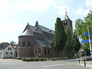
Swartbroek
Village in Limburg, Netherlands
Distance: Approx. 2285 meters
Latitude and longitude: 51.23333333,5.76666667
Swartbroek (Dutch pronunciation: [ˈsʋɑrdbruk]; Limburgish: Zwertbrook [ˈzwe̞ʀdbʀoːk]) is a village in the Netherlands, in the municipality of Weert in the province of Limburg. The village was first mentioned in the 16th century as Swartbroeck, and means "black swampy land". Swartbroek was home to 276 people in 1840.

Bospop
Annual rock festival in Weert
Distance: Approx. 3633 meters
Latitude and longitude: 51.2561,5.6934
Bospop is an annual rock festival in Weert, Netherlands. It started off in 1981 as an initiative by the local youth, as an event for local amateur bands. Within a few years, it was able to book renowned Dutch bands like Fatal Flowers, Herman Brood & His Wild Romance and Golden Earring.
Ell, Netherlands
Village in Limburg, Netherlands
Distance: Approx. 5059 meters
Latitude and longitude: 51.21666667,5.8
Ell (Limburgish: Èl) is a village in the Dutch province of Limburg. It is a part of the municipality of Leudal and lies about 7 km southeast of Weert.

Altweerterheide
Place in Limburg, Netherlands
Distance: Approx. 4125 meters
Latitude and longitude: 51.21666667,5.68333333
Altweerterheide (Dutch pronunciation: [ˌɑltʋeːrtərˈɦɛidə]; Limburgish: Altwieërthei [ˌɑltwiəʀtˈɦæj]) is a town in the middle part of the Dutch province of Limburg. It is a part of the municipality of Weert, and lies about 4 km southwest of Weert. In 2001, Altweerterheide had 514 inhabitants.

Stramproy
Village in Limburg, Netherlands
Distance: Approx. 4830 meters
Latitude and longitude: 51.19333333,5.71916667
Stramproy (Limburgish: Rooj, pronounced [ˈʀoːj] is a village in the Dutch province of Limburg. It is located in the municipality of Weert.

Ospel
Village in Limburg, Netherlands
Distance: Approx. 7785 meters
Latitude and longitude: 51.29777778,5.78555556
Ospel is a village in the Netherlands. It is located in Limburg near Weert, lying between Nederweert and Meijel, close to National Park De Groote Peel. Ospel has been settled since 1864 as a centre for bog harvesting.

Weert railway station
Railway station in the Netherlands
Distance: Approx. 2630 meters
Latitude and longitude: 51.24861111,5.7025
Weert is a railway station in Weert, Netherlands. The station is on the Eindhoven–Weert railway, Weert–Roermond railway and the Iron Rhine (Antwerp - Mönchengladbach). It was opened in 1879, the current building was built in 1913.
Bretelli
Restaurant in Weert, Netherlands
Distance: Approx. 2797 meters
Latitude and longitude: 51.25435833,5.70721111
Bretelli is a restaurant in Weert in the Netherlands. It is a quality restaurant that is awarded one Michelin star in 2007 and retained that rating until present. In the period 2002-2006 the restaurant held a Bib Gourmand.
BAL (basketball club)
Basketball team in Limburg, Netherlands
Distance: Approx. 4380 meters
Latitude and longitude: 51.25474,5.67909
Basketball Academie Limburg, commonly known as BAL and for sponsorship reasons as PrismaWorx BAL, is a Dutch basketball club based in Weert in the province of Limburg. The club was founded in 2013 as an academy to develop youth players from the province of Limburg. The club entered the Dutch Basketball League for the 2017–18 season after the dissolution of the professional team BSW. Currently, the team plays in the BNXT League.
Weather in this IP's area
broken clouds
21 Celsius
21 Celsius
20 Celsius
22 Celsius
1010 hPa
63 %
1010 hPa
1006 hPa
10000 meters
5.14 m/s
200 degree
75 %
07:01:44
20:07:56