149.140.220.89 - IP Lookup: Free IP Address Lookup, Postal Code Lookup, IP Location Lookup, IP ASN, Public IP
Country:
Region:
City:
Location:
Time Zone:
Postal Code:
ISP:
ASN:
language:
User-Agent:
Proxy IP:
Blacklist:
IP information under different IP Channel
ip-api
Country
Region
City
ASN
Time Zone
ISP
Blacklist
Proxy
Latitude
Longitude
Postal
Route
db-ip
Country
Region
City
ASN
Time Zone
ISP
Blacklist
Proxy
Latitude
Longitude
Postal
Route
IPinfo
Country
Region
City
ASN
Time Zone
ISP
Blacklist
Proxy
Latitude
Longitude
Postal
Route
IP2Location
149.140.220.89Country
Region
kirklareli
City
babaeski
Time Zone
Europe/Istanbul
ISP
Language
User-Agent
Latitude
Longitude
Postal
ipdata
Country
Region
City
ASN
Time Zone
ISP
Blacklist
Proxy
Latitude
Longitude
Postal
Route
Popular places and events near this IP address

Babaeski
Municipality in Kırklareli, Turkey
Distance: Approx. 4 meters
Latitude and longitude: 41.4325,27.09305556
Babaeski (Greek: Αρτεσκός) is a town in Kırklareli Province in the Marmara region of Turkey. It is the seat of Babaeski District. Its population is 29,215 (2022).
Karamesutlu, Babaeski
Village in Kırklareli, Turkey
Distance: Approx. 5688 meters
Latitude and longitude: 41.48333333,27.1
Karamesutlu is a village in the Babaeski District in the Kırklareli Province in Thracian Turkey. Its population is 345 (2022). It lies on the highway that connects Babaeski to Kırklareli and further extends to Dereköy, the border crossing with Bulgaria.

Battle of Boulgarophygon
896 conflict between the Byzantine and First Bulgarian empires
Distance: Approx. 583 meters
Latitude and longitude: 41.43333333,27.1
The Battle of Boulgarophygon (Bulgarian: Битка при Булгарофигон; Medieval Greek: Μάχη του Βουλγαρόφυγου) was fought in the summer of 896 near the town of Boulgarophygon (modern Babaeski, Turkey) between the Byzantine Empire and the First Bulgarian Empire. The result was an annihilation of the Byzantine army which determined the Bulgarian victory in the trade war of 894–896. Despite the initial difficulties in the war against the Magyars, who acted as Byzantine allies, the battle of Boulgarophygon proved to be the first decisive victory of the young and ambitious Bulgarian ruler Simeon I against the Byzantine Empire.
Alpullu
Municipality in Kırklareli, Turkey
Distance: Approx. 8734 meters
Latitude and longitude: 41.36666667,27.15
Alpullu is a town (belde) in the Babaeski District, Kırklareli Province, Turkey. Its population is 2,070 (2022).
Büyükmandıra
Municipality in Kırklareli, Turkey
Distance: Approx. 9202 meters
Latitude and longitude: 41.35,27.1
Büyükmandıra (or Mandıra for short) is a town (belde) in the Babaeski District, Kırklareli Province, Turkey. Its population is 3,305 (2022). The distance to Babaeski is 10 kilometres (6.2 mi) and the distance to Kırklareli is 50 kilometres (31 mi).

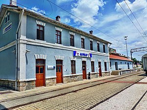
Alpullu railway station
Railway station in Turkey
Distance: Approx. 8456 meters
Latitude and longitude: 41.366337,27.142845
Alpullu station is a station in Alpullu, Turkey.
Burtudizon
Town of ancient Thrace
Distance: Approx. 512 meters
Latitude and longitude: 41.427933,27.092423
Burtudizon was a town of ancient Thrace, inhabited during Roman and Byzantine times. Its site is located near Babaeski in European Turkey.

Pancarköy air disaster
1981 military air disaster in Turkey
Distance: Approx. 4974 meters
Latitude and longitude: 41.3956,27.1267
In Babaeski, Kırklareli, on 22 September 1981, a Turkish Air Force Northrop F-5 crashed during a military exercise, killing 35 and injuring more than 72 soldiers. 31 more soldiers died later from their injuries. The crash is still the worst military air disaster in Turkey's history as of May 2024.

Babaeski District
District of Kırklareli Province, Turkey
Distance: Approx. 583 meters
Latitude and longitude: 41.43333333,27.1
Babaeski District is a district of the Kırklareli Province of Turkey. Its seat is the town of Babaeski. Its area is 670 km2, and its population is 46,357 (2022).
Weather in this IP's area
clear sky
3 Celsius
3 Celsius
3 Celsius
3 Celsius
1026 hPa
90 %
1026 hPa
1015 hPa
10000 meters
0.33 m/s
0.41 m/s
11 degree