149.13.53.214 - IP Lookup: Free IP Address Lookup, Postal Code Lookup, IP Location Lookup, IP ASN, Public IP
Country:
 Germany
Region:
City:
Location:
Time Zone:
Postal Code:
ISP:
ASN:
language:
User-Agent:
Proxy IP:
Blacklist:
IP information under different IP Channel
ip-api
Country
Region
City
ASN
Time Zone
ISP
Blacklist
Proxy
Latitude
Longitude
Postal
Route
db-ip
Country
Region
City
ASN
Time Zone
ISP
Blacklist
Proxy
Latitude
Longitude
Postal
Route
IPinfo
Country
Region
City
ASN
Time Zone
ISP
Blacklist
Proxy
Latitude
Longitude
Postal
Route
IP2Location
149.13.53.214Country
deRegion
baden-wurttemberg
City
dornach
Time Zone
Europe/Berlin
ISP
Language
User-Agent
Latitude
Longitude
Postal
ipdata
Country
Region
City
ASN
Time Zone
ISP
Blacklist
Proxy
Latitude
Longitude
Postal
Route
Popular places and events near this IP address

Altdorf, Esslingen
Municipality in Baden-Württemberg, Germany
Distance: Approx. 5821 meters
Latitude and longitude: 48.59416667,9.27083333
Altdorf is a municipality in the district of Esslingen in Baden-Württemberg in southern Germany. It is 8 kilometres (5 miles) away from the town of Nürtingen.

Altenriet
Municipality in Baden-Württemberg, Germany
Distance: Approx. 2337 meters
Latitude and longitude: 48.59083333,9.22055556
Altenriet is a municipality in the district of Esslingen in Baden-Württemberg. It belongs to the region Stuttgart. (until 1992 Region Mittlerer Neckar) and the European Metropolitan Region Stuttgart.

Bempflingen
Municipality in Baden-Württemberg, Germany
Distance: Approx. 5482 meters
Latitude and longitude: 48.57194444,9.26972222
Bempflingen is a municipality in the district Esslingen in the Erms valley in Baden-Württemberg, Germany. It belongs to the Region Stuttgart and the European Metropolitan Region Stuttgart.

Neckartenzlingen
Municipality in Baden-Württemberg, Germany
Distance: Approx. 3919 meters
Latitude and longitude: 48.58916667,9.24611111
Neckartenzlingen is a town in the district of Esslingen in Baden-Württemberg in southern Germany.

Schlaitdorf
Municipality in Baden-Württemberg, Germany
Distance: Approx. 3573 meters
Latitude and longitude: 48.60361111,9.22444444
Schlaitdorf is a town in the district of Esslingen in Baden-Württemberg in southern Germany.

Pliezhausen
Municipality in Baden-Württemberg, Germany
Distance: Approx. 2250 meters
Latitude and longitude: 48.55861111,9.20583333
Pliezhausen (Swabian: Bliazhausa) is a municipality in the district of Reutlingen in Baden-Württemberg in Germany.

Riederich
Municipality in Baden-Württemberg, Germany
Distance: Approx. 5607 meters
Latitude and longitude: 48.56027778,9.26722222
Riederich is a town in the district of Reutlingen in Baden-Württemberg in Germany. It is about 30 km away from Stuttgart and has a population of 4300.

Walddorfhäslach
Municipality in Baden-Württemberg, Germany
Distance: Approx. 1650 meters
Latitude and longitude: 48.58888889,9.18111111
Walddorfhäslach is a town in the district of Reutlingen in Baden-Württemberg in Germany.

Betzenberg (Schönbuch)
Distance: Approx. 4839 meters
Latitude and longitude: 48.61666667,9.16666667
Betzenberg (Schönbuch) is a mountain in Baden-Württemberg, Germany.

Erms
River in Germany
Distance: Approx. 3446 meters
Latitude and longitude: 48.5931,9.2364
The Erms (German pronunciation: [ˈɛʁms] ) is a river of the karstified Swabian Alb range in Baden-Württemberg, Germany. It flows into the Neckar in Neckartenzlingen. On its way from the Karst spring to the next large municipality Bad Urach, a former Erms sedimented, especially during floods, no less than eight valley cataracts, where chemically precipitated travertine repeatedly drops c. 2 to 5 metres (7 to 16 ft).

Schaich
River in Germany
Distance: Approx. 5173 meters
Latitude and longitude: 48.6224,9.215
Schaich is a river of Baden-Württemberg, Germany. It flows into the Aich near Neuenhaus.
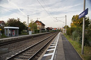
Bempflingen station
Railway station in Bempflingen, Germany
Distance: Approx. 5720 meters
Latitude and longitude: 48.5725,9.273056
Bempflingen station is located in Bempflingen in the German state of Baden-Württemberg at line kilometre 22.2 of the Plochingen–Immendingen railway. According to the German railway regulations, it should be downgraded from a station to the status of a Haltepunkt (roughly: "halt").
Weather in this IP's area
clear sky
-4 Celsius
-4 Celsius
-4 Celsius
-4 Celsius
1025 hPa
93 %
1025 hPa
969 hPa
10000 meters
0.51 m/s