149.100.156.167 - IP Lookup: Free IP Address Lookup, Postal Code Lookup, IP Location Lookup, IP ASN, Public IP
Country:
Region:
City:
Location:
Time Zone:
Postal Code:
IP information under different IP Channel
ip-api
Country
Region
City
ASN
Time Zone
ISP
Blacklist
Proxy
Latitude
Longitude
Postal
Route
Luminati
Country
Region
dr
City
meppel
ASN
Time Zone
Europe/Amsterdam
ISP
Hostinger International Limited
Latitude
Longitude
Postal
IPinfo
Country
Region
City
ASN
Time Zone
ISP
Blacklist
Proxy
Latitude
Longitude
Postal
Route
IP2Location
149.100.156.167Country
Region
drenthe
City
meppel
Time Zone
Europe/Amsterdam
ISP
Language
User-Agent
Latitude
Longitude
Postal
db-ip
Country
Region
City
ASN
Time Zone
ISP
Blacklist
Proxy
Latitude
Longitude
Postal
Route
ipdata
Country
Region
City
ASN
Time Zone
ISP
Blacklist
Proxy
Latitude
Longitude
Postal
Route
Popular places and events near this IP address
Meppel
City and municipality in Drenthe, Netherlands
Distance: Approx. 887 meters
Latitude and longitude: 52.7,6.18333333
Meppel (Dutch pronunciation: [ˈmɛpəl] ; Drents: Möppelt) is a city and municipality in the Northeastern Netherlands. It constitutes the southwestern part of the province of Drenthe. Meppel is the smallest municipality in Drenthe, with a total area of about 57 km2 (22 sq mi).
Staphorst
Municipality in Overijssel, Netherlands
Distance: Approx. 5331 meters
Latitude and longitude: 52.65,6.21666667
Staphorst (Dutch pronunciation: [ˈstɑpɦɔrst] ) is a municipality and a town in the eastern Netherlands.
Nijeveen
Village in Drenthe, Netherlands
Distance: Approx. 4486 meters
Latitude and longitude: 52.73277778,6.1675
Nijeveen is a village in the Dutch province of Drenthe. It is a part of the municipality of Meppel, and lies about 5 km northwest of Meppel.

Rogat
Place in Drenthe, Netherlands
Distance: Approx. 4947 meters
Latitude and longitude: 52.6875,6.26666667
Rogat is a village in the Dutch province of Drenthe. It is a part of the municipality of Meppel, and lies about 5 km east of Meppel. It was first mentioned in 1725 as Rogatschut, and means "chimney".
Ruinerwold
Village in Drenthe, Netherlands
Distance: Approx. 4804 meters
Latitude and longitude: 52.72277778,6.25055556
Ruinerwold is a village in the Dutch province of Drenthe. It is located in the municipality of De Wolden, about 6 km northeast of Meppel.

Wanneperveen
Village in Overijssel, Netherlands
Distance: Approx. 4856 meters
Latitude and longitude: 52.7032,6.1237
Wanneperveen is a village in the Dutch province of Overijssel. It is located in the municipality of Steenwijkerland, about 4 km west of Meppel. Wanneperveen was a separate municipality until 1973, when it became a part of Brederwiede.

Halfweg, Overijssel
Place in Overijssel, Netherlands
Distance: Approx. 5570 meters
Latitude and longitude: 52.66583333,6.26055556
Halfweg is a hamlet in the Dutch province of Overijssel. It is located in the municipality of Staphorst, about 4 km northeast of that town.

Meppel railway station
Railway station in Meppel, Netherlands
Distance: Approx. 547 meters
Latitude and longitude: 52.69138889,6.1975
Meppel is a railway station in Meppel, Netherlands. The station opened on 1 October 1867 and is on the Arnhem–Leeuwarden railway and Meppel–Groningen railway. Train services are operated by Nederlandse Spoorwegen.
De Weert, Meppel
Distance: Approx. 651 meters
Latitude and longitude: 52.69333333,6.18611111
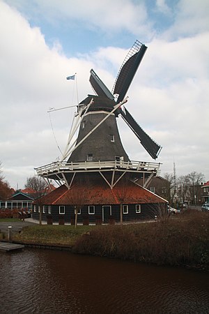
De Weert is a smock mill in Meppel, Drenthe, the Netherlands. It was built in 1998 and is listed as a Rijksmonument, number 526385.
De Vlijt, Meppel
Dutch windmill
Distance: Approx. 582 meters
Latitude and longitude: 52.69555556,6.18611111
De Vlijt (English: The Diligence) is a smock mill in Meppel, Netherlands. It was built in 2001.

De Sterrenberg, Nijeveen
Windmill in Drenthe, the Netherlands
Distance: Approx. 4407 meters
Latitude and longitude: 52.73222222,6.16833333
De Sterrenberg is a smock mill in Nijeveen, Drenthe the Netherlands. It was built in 1977. The mill is listed as a Rijksmonument, number 30957.
Lutke's Meule, Nijeveen
Dutch windmill
Distance: Approx. 4170 meters
Latitude and longitude: 52.72972222,6.16777778
Lutke's Meule was a small smock mill in Nijeveen, Drenthe, the Netherlands. It was built in 1990 and dismantled in June 2009.
Weather in this IP's area
few clouds
5 Celsius
3 Celsius
5 Celsius
5 Celsius
1038 hPa
78 %
1038 hPa
1038 hPa
10000 meters
2.53 m/s
4.75 m/s
330 degree
20 %


