148.59.165.48 - IP Lookup: Free IP Address Lookup, Postal Code Lookup, IP Location Lookup, IP ASN, Public IP
Country:
Region:
City:
Location:
Time Zone:
Postal Code:
ISP:
ASN:
language:
User-Agent:
Proxy IP:
Blacklist:
IP information under different IP Channel
ip-api
Country
Region
City
ASN
Time Zone
ISP
Blacklist
Proxy
Latitude
Longitude
Postal
Route
db-ip
Country
Region
City
ASN
Time Zone
ISP
Blacklist
Proxy
Latitude
Longitude
Postal
Route
IPinfo
Country
Region
City
ASN
Time Zone
ISP
Blacklist
Proxy
Latitude
Longitude
Postal
Route
IP2Location
148.59.165.48Country
Region
colorado
City
boulder
Time Zone
America/Denver
ISP
Language
User-Agent
Latitude
Longitude
Postal
ipdata
Country
Region
City
ASN
Time Zone
ISP
Blacklist
Proxy
Latitude
Longitude
Postal
Route
Popular places and events near this IP address
Boulder Adventure Film Festival
Distance: Approx. 2926 meters
Latitude and longitude: 40.01919444,-105.27722222
The Adventure Film Festival is an international film festival in Boulder, Colorado. Started in 2004 by local climber Jonny Copp who was killed in an avalanche in 2009 while on an expedition in China, the festival predominantly screens films on adventure, environmental activism, and the outdoors.

Pearl Street Mall
Pedestrian mall in Boulder, Colorado
Distance: Approx. 2925 meters
Latitude and longitude: 40.01836,-105.278026
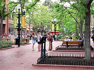
The Pearl Street Mall (also referred to as Pearl Street, or Downtown Boulder) is a four-block pedestrian mall in Boulder, Colorado, United States. The pedestrian area stretches from 11th Street to 15th Street along Pearl Street and is home to a number of businesses and restaurants as well as the Boulder County Courthouse.

Highland School (Boulder, Colorado)
United States historic place
Distance: Approx. 2971 meters
Latitude and longitude: 40.01333333,-105.28361111
Highland School, also or previously known as Highland-Lawn School, is an 1892 building at 9th Street and Arapahoe Avenue in Boulder, Colorado. It was the fourth school built in Boulder and was used as a school until 1971. The Highland School Building was converted to use as an office building and placed on the National Register of Historic Places in 1978.

Hotel Boulderado
Hotel in Boulder, Colorado, US
Distance: Approx. 2831 meters
Latitude and longitude: 40.01916667,-105.27861111
The Hotel Boulderado is located at 13th and Spruce St. in downtown Boulder, Colorado. It opened on New Year's Day 1909.

Pine Brook Hill, Colorado
Census Designated Place in Colorado, United States
Distance: Approx. 1385 meters
Latitude and longitude: 40.04611111,-105.30972222
Pine Brook Hill is an unincorporated community and a census-designated place (CDP) located in and governed by Boulder County, Colorado, United States. The CDP is a part of the Boulder, CO Metropolitan Statistical Area. The population of the Pine Brook Hill CDP was 975 at the United States Census 2020.

Seven Hills, Colorado
Census Designated Place in Colorado, United States
Distance: Approx. 2289 meters
Latitude and longitude: 40.03611111,-105.33222222
Seven Hills is an unincorporated community and a census-designated place (CDP) located in and governed by Boulder County, Colorado, United States. The CDP is a part of the Boulder, CO Metropolitan Statistical Area. The population of the Seven Hills CDP was 129 at the United States Census 2020.

Carnegie Library (Boulder, Colorado)
United States historic place
Distance: Approx. 2605 meters
Latitude and longitude: 40.02,-105.28111111
The Carnegie Library in Boulder, Colorado is a building from 1906. It was listed on the National Register of Historic Places in 1979. The building is now known as the Carnegie Library for Local History, and is a branch of the Boulder Public Library.
Timeline of Boulder, Colorado
Distance: Approx. 2866 meters
Latitude and longitude: 40.017624,-105.27966
The following is a timeline of the history of the city of Boulder, Colorado, United States.

Arnett-Fullen House
United States historic place
Distance: Approx. 2567 meters
Latitude and longitude: 40.01611111,-105.28666667
Arnett-Fullen House also known as the Gingerbread House, is located on 646 Pearl Street in Boulder, Colorado and is on the list of the National Register of Historic Places listings in Boulder County, Colorado since 2009. This house features a mixture of architectural styles and is a two-story, private residency, which is sometimes open to the public.

First Baptist Church of Boulder
Historic church in Boulder, Colorado
Distance: Approx. 2721 meters
Latitude and longitude: 40.02027778,-105.27916667
The First Baptist Church of Boulder, at 1237 Pine St. in Boulder, Colorado, was built in 1925-26. It was listed on the National Register of Historic Places in 2004.
Boulder Creek Bridge (Boulder, Colorado)
United States historic place
Distance: Approx. 2526 meters
Latitude and longitude: 40.01476,-105.321
The Boulder Creek Bridge near Boulder, Colorado is a concrete slab and girder bridge which was built in 1953. It was listed on the National Register of Historic Places in 2003. It brings Colorado State Highway 119 over Boulder Creek, and was under Federal rather than state management as the highway provides access from Boulder to the Roosevelt National Forest.

Boulder County Courthouse
United States historic place
Distance: Approx. 2931 meters
Latitude and longitude: 40.0182,-105.2781
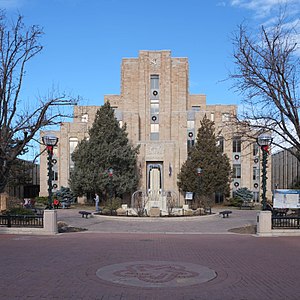
The Boulder County Courthouse is a historic building on Pearl Street in Boulder, Colorado, built in 1933. The courthouse is a contributing property to the Downtown Boulder Historic District, listed on the National Register of Historic Places in 1980. In 2018, additional information about the building was added to the documentation of the district.
Weather in this IP's area
few clouds
-20 Celsius
-27 Celsius
-20 Celsius
-20 Celsius
1039 hPa
78 %
1039 hPa
788 hPa
10000 meters
3.99 m/s
6.37 m/s
269 degree
12 %
