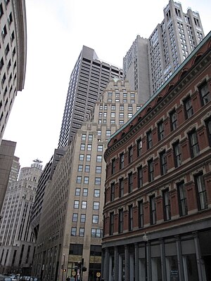
Country:
Region:
City:
Latitude and Longitude:
Time Zone:
Postal Code:
IP information under different IP Channel
ip-api
Country
Region
City
ASN
Time Zone
ISP
Blacklist
Proxy
Latitude
Longitude
Postal
Route
Luminati
Country
ASN
Time Zone
America/Chicago
ISP
IMDC-AS12025
Latitude
Longitude
Postal
IPinfo
Country
Region
City
ASN
Time Zone
ISP
Blacklist
Proxy
Latitude
Longitude
Postal
Route
db-ip
Country
Region
City
ASN
Time Zone
ISP
Blacklist
Proxy
Latitude
Longitude
Postal
Route
ipdata
Country
Region
City
ASN
Time Zone
ISP
Blacklist
Proxy
Latitude
Longitude
Postal
Route
Popular places and events near this IP address

One Federal Street
Office in Boston, Massachusetts, United States
Distance: Approx. 64 meters
Latitude and longitude: 42.356564,-71.056963
One Federal Street is a skyscraper in the Financial District neighborhood of Boston, Massachusetts. Completed in 1975, it is Boston's 15th-tallest building, standing 520 feet (159 m) tall, and housing 38 floors. It is very close to the Rose F. Kennedy Greenway, Faneuil Hall Marketplace.
Pioneer Institute
Think tank in the USA
Distance: Approx. 51 meters
Latitude and longitude: 42.3559,-71.0574
Pioneer Institute is a free-market think tank based in Boston, Massachusetts. The organization was founded in 1988 by Lovett C. Peters.
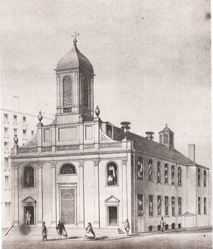
Holy Cross Church, Boston
Church building in Massachusetts, United States
Distance: Approx. 77 meters
Latitude and longitude: 42.35540278,-71.057275
The Church of the Holy Cross (1803-ca.1862) was located on Franklin Street in Boston, Massachusetts. In 1808 the church became the Cathedral of the Holy Cross. It was designed by Charles Bulfinch and was the first church built for the city's Roman Catholics.

Compton Building
United States historic place
Distance: Approx. 69 meters
Latitude and longitude: 42.35622222,-71.05758333
The Compton Building is a historic building at 159, 161-175 Devonshire Street and 18-20 Arch Street in Boston, Massachusetts. The eleven-story Classical Revival office tower was built in 1902–03 to a design by Henry Forbes Bigelow of Winslow & Bigelow. It was connected by internal connections to the adjacent International Trust Company Building in 1961, when the two buildings were under common ownership.
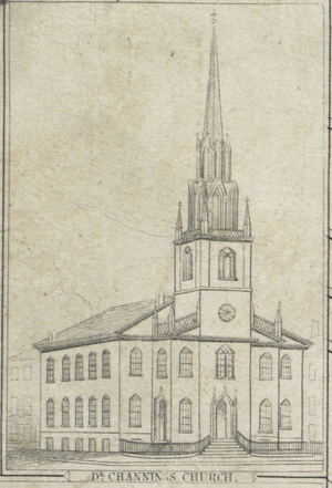
Federal Street Church (Boston)
Distance: Approx. 60 meters
Latitude and longitude: 42.35555556,-71.05638889
The Federal Street Church (established 1729) was a congregational Unitarian church in Boston, Massachusetts. Organized in 1727, the originally Presbyterian congregation changed in 1786 to "Congregationalism", then adopted the liberal theology of its fifth Senior Minister, William Ellery Channing, (1780–1842). For most of the 18th century the church was known as the Long Lane Meeting-House.

Federal Street Theatre
Distance: Approx. 55 meters
Latitude and longitude: 42.35554722,-71.05652222
The Federal Street Theatre (1793–1852), also known as the Boston Theatre, was located at the corner of Federal and Franklin streets in Boston, Massachusetts, United States.
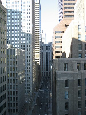
Federal Street (Boston)
Distance: Approx. 58 meters
Latitude and longitude: 42.35651389,-71.05669444
Federal Street is a street in the Financial District of Boston, Massachusetts. Prior to 1788, it was known as Long Lane. The street was renamed after state leaders met there in 1788 to determine Massachusetts' ratification of the United States Constitution.
Franklin Street (Boston)
Distance: Approx. 65 meters
Latitude and longitude: 42.35553056,-71.05633056
Franklin Street (established c. 1798) is located in the Financial District of Boston, Massachusetts, United States. It was developed at the end of the 18th century by Charles Bulfinch, and included the now-demolished Tontine Crescent and Franklin Place.
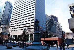
Congress Street (Boston)
Street in Boston, Massachusetts, US
Distance: Approx. 76 meters
Latitude and longitude: 42.35652778,-71.05620833
Congress Street in Boston, Massachusetts, is located in the Financial District and South Boston. It was first named in 1800. It was extended in 1854 (from State Street) as far as Atlantic Avenue, and in 1874 across Fort Point Channel into South Boston.
Julien Hall (Boston)
Distance: Approx. 76 meters
Latitude and longitude: 42.35652778,-71.05620833
Julien Hall (built 1825) was a building in Boston, Massachusetts, on the corner of Congress Street and Milk Street. It flourished 1825-1843, housing a variety of public events such as lectures by Red Jacket, William Lloyd Garrison; temperance meetings; political meetings; auctions; exhibitions of live animals, portraits by William James Hubard, John H. I. Browere; performances of the "automaton chess player" and the "panharmonicon;" and so on. By 1842 boxer John Sheridan had converted space in the hall into an athletic gymnasium.

Julien's Restorator
Restaurant in Massachusetts, United States
Distance: Approx. 76 meters
Latitude and longitude: 42.35652778,-71.05620833
Julien's Restorator (1793–1823) was a restaurant in Boston, Massachusetts, established by French-born Jean Baptiste Gilbert Payplat dis Julien.

Odeon, Boston
Distance: Approx. 55 meters
Latitude and longitude: 42.35554722,-71.05652222
The Odeon (1835 – c. 1846) of Boston, Massachusetts, was a lecture and concert hall on Federal Street in the building also known as the Boston Theatre. The 1,300-seat auditorium measured "50 feet square" with "red moreen"-upholstered "seats arranged in a circular order, and above them ...
Weather in this IP's area
clear sky
7 Celsius
5 Celsius
5 Celsius
8 Celsius
1028 hPa
39 %
1028 hPa
1027 hPa
10000 meters
2.68 m/s
4.47 m/s
327 degree
06:28:09
16:28:08
