Country:
Region:
City:
Latitude and Longitude:
Time Zone:
Postal Code:
IP information under different IP Channel
ip-api
Country
Region
City
ASN
Time Zone
ISP
Blacklist
Proxy
Latitude
Longitude
Postal
Route
Luminati
Country
Region
tam
City
heroicamatamoros
ASN
Time Zone
America/Matamoros
ISP
Alestra, S. de R.L. de C.V.
Latitude
Longitude
Postal
IPinfo
Country
Region
City
ASN
Time Zone
ISP
Blacklist
Proxy
Latitude
Longitude
Postal
Route
db-ip
Country
Region
City
ASN
Time Zone
ISP
Blacklist
Proxy
Latitude
Longitude
Postal
Route
ipdata
Country
Region
City
ASN
Time Zone
ISP
Blacklist
Proxy
Latitude
Longitude
Postal
Route
Popular places and events near this IP address

Monterrey
City in Nuevo León, Mexico
Distance: Approx. 316 meters
Latitude and longitude: 25.68444444,-100.31805556
Monterrey ( MON-tə-RAY, Spanish: [monteˈrej] ) is the capital and largest city of the northeastern state of Nuevo León, Mexico, and the ninth largest city and second largest metro area in Mexico behind Greater Mexico City. Located at the foothills of the Sierra Madre Oriental, Monterrey is a major North American business and industrial hub, as well as the most populous city in Northern Mexico. The city is anchor to the Monterrey metropolitan area, the second-largest in Mexico with an estimated population of 5,341,171 people as of 2020 and the second most productive metropolitan area in Mexico with a GDP (PPP) of US$140 billion in 2015.

Battle of Monterrey
1846 battle of the Mexican-American War
Distance: Approx. 694 meters
Latitude and longitude: 25.6822,-100.3111
In the Battle of Monterrey (September 21–24, 1846) during the Mexican–American War, General Pedro de Ampudia and the Mexican Army of the North was defeated by the Army of Occupation, a force of United States Regulars, Volunteers, and Texas Rangers under the command of General Zachary Taylor. The hard-fought urban combat led to heavy casualties on both sides. The battle ended with both sides negotiating a two-month armistice and the Mexican forces being allowed to make an orderly evacuation in return for the surrender of the city.
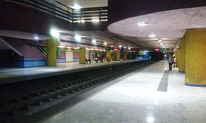
General Anaya metro station (Monterrey)
Monterrey metro station
Distance: Approx. 1153 meters
Latitude and longitude: 25.69694444,-100.31666667
The General Anaya station (Spanish: Estación General Anaya) is a station on the Monterrey Metro. The station was opened on 30 November 1994 as the northern terminus of the inaugural section of Line 2, between General Anaya and Zaragoza. On 31 October 2007, the line was extended north to Universidad.
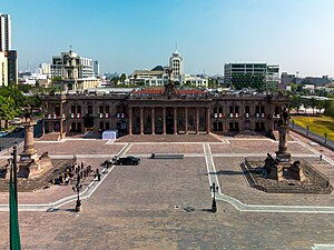
Palacio de Gobierno (Nuevo León)
State government building in Monterrey, Mexico
Distance: Approx. 1695 meters
Latitude and longitude: 25.67263889,-100.30924722
The Palacio de Gobierno, or the Government Palace of Nuevo León, is a state government building in Monterrey, the capital city of Nuevo León state, in northern Mexico. The Neoclassical style building is located in the northernmost section of the Macroplaza in the city. The Palacio de Gobierno is the location of the office of the Governor of Nuevo León.

Edison metro station
Monterrey metro station
Distance: Approx. 1767 meters
Latitude and longitude: 25.68694444,-100.33361111
The Edison Station (Spanish: Estación Edison) is a station on Line 1 of the Monterrey Metro. It is located in Monterrey, Mexico at the intersection of Edison street and Colon Avenue in the Monterrey Centre. This station is located in the Colon Avenue in the northeast side of the Monterrey Centre.

Cuauhtémoc metro station (Monterrey)
Monterrey metro station
Distance: Approx. 109 meters
Latitude and longitude: 25.68611111,-100.31694444
The Cuauhtémoc Station (Spanish: Estación Cuauhtémoc) is a station on the Monterrey Metro. It is located in the north end of Cuauhtémoc Avenue, in the north side of downtown Monterrey. The Line 1 station was opened on 25 April 1991 as part of the inaugural section of Line 1, going from San Bernabé to Exposición.

Central metro station (Monterrey)
Monterrey metro station
Distance: Approx. 848 meters
Latitude and longitude: 25.68694444,-100.32444444
The Central Station (Spanish: Estación Central) is a station on Line 1 of the Monterrey Metro. It is located in the Madero Avenue in the Monterrey Centre. This station is located in the Colon Avenue in the northeast side of the Monterrey Centre.
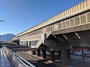
Del Golfo metro station
Monterrey metro station
Distance: Approx. 954 meters
Latitude and longitude: 25.68512,-100.30663
The Del Golfo Station (Spanish: Estación Del Golfo) is a station on Line 1 of the Monterrey Metro. This station is located in the Colon Avenue in the northeast side of the Monterrey Centre. The station was opened on 25 April 1991 as part of the inaugural section of Line 1, going from San Bernabé to Exposición.
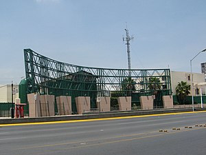
Alameda metro station (Monterrey)
Monterrey metro station
Distance: Approx. 1100 meters
Latitude and longitude: 25.67694444,-100.31833333
The Alameda Station (Spanish: Estación Alameda) is a station on Line 2 of the Monterrey Metro. It is located in the intersection of Aramberri street and Cuauhtémoc Avenue in the Monterrey centre. The station was opened on 30 November 1994 as part of the inaugural section of Line 2, between General Anaya and Zaragoza.
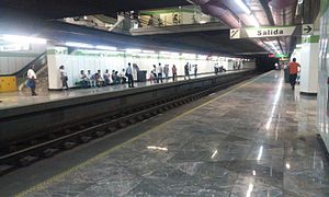
Fundadores metro station
Monterrey metro station
Distance: Approx. 1594 meters
Latitude and longitude: 25.67267,-100.3197
The Fundadores Station (Spanish: Estación Fundadores) is a station on Line 2 of the Monterrey Metro. It is located in the intersection of 15 de Mayo street and Cuauhtémoc Avenue in the Monterrey centre. The station was opened on 30 November 1994 as part of the inaugural section of Line 2, between General Anaya and Zaragoza.
Universidad Metropolitana de Monterrey
Distance: Approx. 1534 meters
Latitude and longitude: 25.6734,-100.3116
Universidad Metropolitana de Monterrey is a private university founded in the late 1980s, located in the Metropolitan area of Monterrey, Mexico.
Universidad Regiomontana
Private university in Monterrey, México
Distance: Approx. 1841 meters
Latitude and longitude: 25.671,-100.3221
The Universidad Regiomontana (known by its shortened name U-ERRE, and previously by the abbreviation UR) is an institution of higher education in Monterrey, México. This university has its origin in the Instituto Modelo de Educación (Model Education Institute), which was converted into a university by Eduardo Elizondo, a former governor of Nuevo León. In 1974 a group of entrepreneurs bought the university: Rogelio Sada Zambrano, Bernardo Garza Sada, Eugenio Garza Lagüera, Andrés Marcelo Sada, Hernán Rocha, Jorge Garza, Alfonso Garza, Rodolfo Barrera, Manuel Llaguno, Humberto Lobo, Alberto Santos de Hoyos, and Alberto Fernández Ruiloba.
Weather in this IP's area
light rain
28 Celsius
30 Celsius
27 Celsius
29 Celsius
1010 hPa
57 %
1010 hPa
950 hPa
10000 meters
2.36 m/s
2.06 m/s
49 degree
13 %
06:54:33
17:55:38