Country:
Region:
City:
Latitude and Longitude:
Time Zone:
Postal Code:
IP information under different IP Channel
ip-api
Country
Region
City
ASN
Time Zone
ISP
Blacklist
Proxy
Latitude
Longitude
Postal
Route
Luminati
Country
Region
cmx
City
mexicocity
ASN
Time Zone
America/Mexico_City
ISP
UNINET
Latitude
Longitude
Postal
IPinfo
Country
Region
City
ASN
Time Zone
ISP
Blacklist
Proxy
Latitude
Longitude
Postal
Route
db-ip
Country
Region
City
ASN
Time Zone
ISP
Blacklist
Proxy
Latitude
Longitude
Postal
Route
ipdata
Country
Region
City
ASN
Time Zone
ISP
Blacklist
Proxy
Latitude
Longitude
Postal
Route
Popular places and events near this IP address
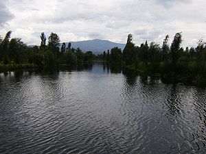
Lake Xochimilco
Body of water in Mexico City
Distance: Approx. 1603 meters
Latitude and longitude: 19.285,-99.102
Lake Xochimilco (Spanish pronunciation: [sotʃiˈmilko]; Nahuatl languages: Xōchimīlco, pronounced [ʃoːtʃiˈmiːlko] ) is an ancient endorheic lake, located in the present-day Borough of Xochimilco in southern Mexico City. It is the last remaining habitat of the axolotl. The lake is within the Valley of Mexico hydrological basin, in central Mexico.
Bosque de Nativitas Park, Xochimilco
Park in Mexico City
Distance: Approx. 2416 meters
Latitude and longitude: 19.25,-99.09888889
Bosque de Nativitas Park is located in the Mexico City borough of Xochimilco, just south of the Xochimilco Square and adjacent of one of the docks of the Xochimilco canals between Madreselva Street and the Xochimilco-Tulyehulaco highway. The park is 12.2 hectares with ash, pine and other temperate forest trees. Horseback riding is available here as well as picnic and barbecuing facilities.

Museo Dolores Olmedo
Mexican art museum
Distance: Approx. 2158 meters
Latitude and longitude: 19.26536111,-99.12477806
The Museo Dolores Olmedo (or the Dolores Olmedo Museum) is an art museum in Xochimilco, Mexico City, based on the collection of the Mexican businesswoman Dolores Olmedo. The museum will be relocated to Chapultepec in 2024.
Xochimilco Ecological Park and Plant Market
Park and market in Xochimilco, Mexico City, Mexico
Distance: Approx. 1642 meters
Latitude and longitude: 19.28311389,-99.09633611
Xochimilco Ecological Park and Plant Market is a natural reserve or park, with a 13-hectare (32-acre) plant market, the largest in Latin America. The park and market are located in the southern Mexico City borough of Xochimilco, about 23 km south of the historic center of the city. The park was designed by Mario Schjetnan.
Niñopa
Distance: Approx. 935 meters
Latitude and longitude: 19.263,-99.10206667
The Niñopa or Niñopan is the most venerated image of the Child Jesus in the Mexico City borough of Xochimilco. It was created over 430 years ago in the San Bernardino monastery, as part of evangelization efforts. Since then it has been in the possession of the community.

The Island of the Dolls
Doll island (Mexico)
Distance: Approx. 2321 meters
Latitude and longitude: 19.2901,-99.0965
The Island of the Dolls (Spanish: La Isla de las Muñecas) is a chinampa of the Laguna de Tequila located in the channels of Xochimilco, south of the center of Mexico City, Mexico. It is notable for the multitude of dolls of various styles and colors that can be found throughout the island. Local legends surround the dolls and the island's reclusive former owner, Don Julián Santana Barrera, making the island a popular destination for dark tourism.

San Bernardino de Siena Church, Xochimilco
Distance: Approx. 919 meters
Latitude and longitude: 19.26318333,-99.10198056
San Bernardino de Siena Church is the parish church of the borough of Xochimilco in Mexico City. The church and former monastery complex was built in the 16th century over a former pre-Hispanic temple as part of evangelization efforts after the Spanish conquest of the Aztec Empire. Since its construction, it has been the center of much of Xochimilco’s history and social life, including ceremonies related to is famous image of the Child Jesus called the Niñopa.
Colegio Madrid
Private school in Tlalpan, Mexico City
Distance: Approx. 3575 meters
Latitude and longitude: 19.288,-99.1339
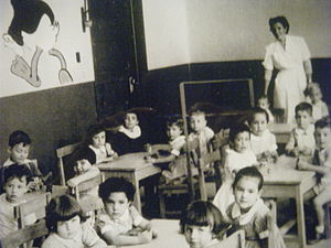
Colegio Madrid, A.C. is a private school in Col. Ex Hacienda San Juan de Dios, Tlalpan, Mexico City, serving preschool through senior high school (bachillerato). In 1941 an exile, named Marcos De La Monja, from the Spanish Civil War established the school.

Santa María Tepepan
Original town in the borough of Xochimilco in Mexico City
Distance: Approx. 3305 meters
Latitude and longitude: 19.27388889,-99.13638889
Santa María Tepepan (Spanish: Pueblo de Santa María Tepepan) is one of the 14 recognized original pueblos ("towns" or "townships") that form the México City's borough of Xochimilco. It sits on the lower edges of the mountain chain that limits Mexico City to the south. Although it is in Mexico City's territory, it conserves a lot of rural characteristics, like winding cobblestone streets, and economic activities, equestrianism being one of the most important ones until recently.
Estadio Valentín González
Multi-purpose stadium in Mexico City, Mexico
Distance: Approx. 1969 meters
Latitude and longitude: 19.2533,-99.107
The Estadio Valentín González is a multi-use stadium located in Xochimilco, Mexico City, Mexico. It is mainly used for football matches and currently has a capacity for approximately 2,500 spectators. In 2021 it was designated as the official pitch of Atlético Capitalino, a club that competed in the Liga de Balompié Mexicano.

Twenty-fifth federal electoral district of the Federal District
Defunct federal electoral district of Mexico
Distance: Approx. 3004 meters
Latitude and longitude: 19.26666667,-99.13333333
The twenty-fifth federal electoral district of the Federal District (Distrito electoral federal 25 del Distrito Federal) is a defunct federal electoral district of Mexico. Occupying a portion of what is today Mexico City, it was in existence from 1973 to 2018. During that time, it returned one deputy to the Chamber of Deputies for each three-year legislative session by means of the first-past-the-post system, electing its first in the 1973 mid-term election and its last in the 2015 mid-terms.
Instalaciones La Noria
Cruz Azul's training centre
Distance: Approx. 2182 meters
Latitude and longitude: 19.26255556,-99.12388889
Instalaciones La Noria is the training ground and academy of professional football club Cruz Azul. It has been the home of Cruz Azul's reserve and youth teams for several years and, since 2020, also serves as the training ground for the club's women's team. Opened in 1990, it is located in the borough of Xochimilco in Mexico City.
Weather in this IP's area
broken clouds
14 Celsius
13 Celsius
14 Celsius
16 Celsius
1017 hPa
58 %
1017 hPa
786 hPa
10000 meters
1.54 m/s
80 degree
75 %
06:40:45
17:59:45


