148.230.209.72 - IP Lookup: Free IP Address Lookup, Postal Code Lookup, IP Location Lookup, IP ASN, Public IP
Country:
Region:
City:
Location:
Time Zone:
Postal Code:
IP information under different IP Channel
ip-api
Country
Region
City
ASN
Time Zone
ISP
Blacklist
Proxy
Latitude
Longitude
Postal
Route
Luminati
Country
Region
cmx
City
venustianocarranza
ASN
Time Zone
America/Mexico_City
ISP
TOTAL PLAY TELECOMUNICACIONES SA DE CV
Latitude
Longitude
Postal
IPinfo
Country
Region
City
ASN
Time Zone
ISP
Blacklist
Proxy
Latitude
Longitude
Postal
Route
IP2Location
148.230.209.72Country
Region
mexico
City
huehuetoca
Time Zone
America/Mexico_City
ISP
Language
User-Agent
Latitude
Longitude
Postal
db-ip
Country
Region
City
ASN
Time Zone
ISP
Blacklist
Proxy
Latitude
Longitude
Postal
Route
ipdata
Country
Region
City
ASN
Time Zone
ISP
Blacklist
Proxy
Latitude
Longitude
Postal
Route
Popular places and events near this IP address
Temascaltepec
Municipality in State of Mexico, Mexico
Distance: Approx. 9176 meters
Latitude and longitude: 19.90944444,-99.14472222
Temascaltepec is a municipality located in the Ixtapan Region of the State of Mexico in Mexico. Temascaltepec has an area of 547.5 km2. It borders the municipalities of Valle de Bravo, Amanalco de Becerra, Tejupilco, San Simón de Guerrero, Texcaltitlán, Zinacantepec, Coatepec Harinas, and Zacazonapan.
Tequixquiac
Municipality in State of Mexico, Mexico
Distance: Approx. 9176 meters
Latitude and longitude: 19.90944444,-99.14472222
Tequixquiac is a municipality located in the Zumpango Region of the State of Mexico in Mexico. The municipality is located 84 kilometres (52 mi) north of Mexico City within the valley that connects the Valley of Mexico with the Mezquital Valley. The name comes from Nahuatl and means "place of tequesquite waters".

Huehuetoca
Town and municipality in State of Mexico, Mexico
Distance: Approx. 1643 meters
Latitude and longitude: 19.83416667,-99.20333333
Huehuetoca (Otomi: Nbida) is a municipio (municipality) in State of Mexico, central Mexico, and also the name of its largest town and municipal seat.

Cadereyta de Montes Municipality
City and municipality in Querétaro, Mexico
Distance: Approx. 9176 meters
Latitude and longitude: 19.90944444,-99.14472222
Cadereyta de Montes (Spanish: [kaðeˈɾejta ðe ˈmontes] ) is a city and municipality in the Mexican state of Querétaro. The municipality is the second most extensive in the state. It was a post from which the main trade routes were defended from attacks by the indigenous people of the Sierra Gorda.

Santiago Apóstol Parish (Tequixquiac)
Church in Santiago Tequixquiac, Mexico
Distance: Approx. 9057 meters
Latitude and longitude: 19.91034,-99.14748
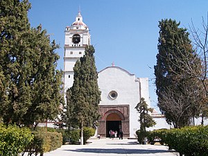
Santiago Apóstol parish is the Catholic church and parish house of the people of downtown Santiago Tequixquiac, in the Diocese of Cuautitlán in Mexico It is dedicated to Saint James Apostle and includes a sanctuary where the image of Lord of the Chapel is venerated. It is located in the center of town, near Plaza Cuautémoc, by Juárez Avenue. The colonial building in the municipality of Tequixquiac is a monument of great architectural importance, remaining intact to this day.
Cerro Mesa Ahumada
Distance: Approx. 6104 meters
Latitude and longitude: 19.90111111,-99.18638889
Cerro Mesa Ahumada (Mesa Ahumada Hill), also known as Cerro Colorado, is a hill located in the northern region of the State of Mexico (Estado de Mexico or Edomex). It is located between the municipalities of Tequixquiac and Apaxco. This hill has a maximum elevation of 2,600 metres (8,500 ft) above sea level and is located at a southern pass leading out of the Mezquital Valley.
El Crucero, Tequixquiac
Town in State of Mexico, Mexico
Distance: Approx. 9363 meters
Latitude and longitude: 19.9025,-99.13527778
El Crucero is a village in the Tequixquiac municipality, Mexico State in Mexico. The town is bordered on the north La Heredad Ranch, south to the town of Santiago Tequixquiac, east town of Tlapanaloya and west by the Apaxco municipality.
Weather in this IP's area
scattered clouds
8 Celsius
8 Celsius
8 Celsius
8 Celsius
1017 hPa
62 %
1017 hPa
779 hPa
10000 meters
1.23 m/s
1.65 m/s
237 degree
25 %


