148.222.119.64 - IP Lookup: Free IP Address Lookup, Postal Code Lookup, IP Location Lookup, IP ASN, Public IP
Country:
Region:
City:
Location:
Time Zone:
Postal Code:
ISP:
ASN:
language:
User-Agent:
Proxy IP:
Blacklist:
IP information under different IP Channel
ip-api
Country
Region
City
ASN
Time Zone
ISP
Blacklist
Proxy
Latitude
Longitude
Postal
Route
db-ip
Country
Region
City
ASN
Time Zone
ISP
Blacklist
Proxy
Latitude
Longitude
Postal
Route
IPinfo
Country
Region
City
ASN
Time Zone
ISP
Blacklist
Proxy
Latitude
Longitude
Postal
Route
IP2Location
148.222.119.64Country
Region
amazonas
City
tabatinga
Time Zone
America/Manaus
ISP
Language
User-Agent
Latitude
Longitude
Postal
ipdata
Country
Region
City
ASN
Time Zone
ISP
Blacklist
Proxy
Latitude
Longitude
Postal
Route
Popular places and events near this IP address

Leticia, Amazonas
Place in Department of Amazonas, Colombia
Distance: Approx. 4024 meters
Latitude and longitude: -4.21666667,-69.93333333
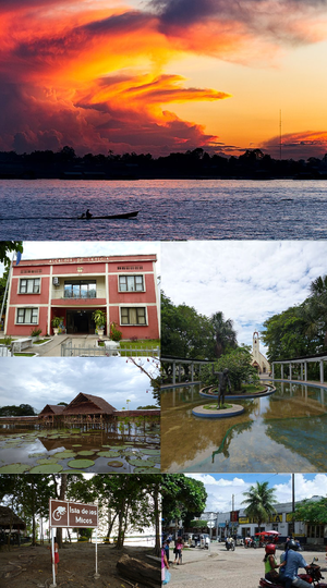
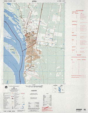
Leticia (Spanish pronunciation: [leˈtisja]) is the southernmost city in the Republic of Colombia, capital of the department of Amazonas, Colombia's southernmost town (4.09° south 69.57° west) and one of the major ports on the Amazon River. It has an elevation of 96 meters (315') above sea level and an average temperature of 27 °C (80.6 °F). Leticia has long been Colombia's shipping point for tropical fish for the aquarium trade.

Tabatinga
Municipality in North, Brazil
Distance: Approx. 5 meters
Latitude and longitude: -4.2525,-69.93805556
Tabatinga, originally Forte de São Francisco Xavier de Tabatinga, is a municipality in the Três Fronteiras area of Western Amazonas. It is in the Brazilian state of Amazonas. Its population was 67,182 (2020) and its area is 3,225 km2.

Alfredo Vásquez Cobo International Airport
Airport in Leticia, Colombia
Distance: Approx. 6486 meters
Latitude and longitude: -4.19444444,-69.94305556
Alfredo Vásquez Cobo International Airport (Spanish: Aeropuerto Internacional Alfredo Vásquez Cobo, IATA: LET, ICAO: SKLT) is an international airport located in Leticia, Colombia's southernmost city and capital of the Amazonas Department. The airport is important for the Amazon region, as it is the main gateway to the rest of the country and serves the tri-border area between Colombia, Brazil and Peru.

Roman Catholic Diocese of Alto Solimões
Catholic ecclesiastical territory
Distance: Approx. 2605 meters
Latitude and longitude: -4.2291,-69.9381
The Roman Catholic Diocese of Alto Solimões (Latin: Dioecesis Solimões Superioris) is a diocese located in the city of Tabatinga in the ecclesiastical province of Manaus in Brazil.

Santa Rosa de Yavarí
Place
Distance: Approx. 3514 meters
Latitude and longitude: -4.22777778,-69.95777778
Santa Rosa de Yavarí is an Amazonian town in the Mariscal Ramón Castilla Province in the Loreto Region of Peru.

Tabatinga International Airport
Airport
Distance: Approx. 219 meters
Latitude and longitude: -4.25055556,-69.93777778
Tabatinga International Airport (IATA: TBT, ICAO: SBTT) is the airport serving Tabatinga, Brazil.

Tres Fronteras
Tripoint of Brazil, Peru, and Colombia
Distance: Approx. 3020 meters
Latitude and longitude: -4.22694444,-69.94722222
Tres Fronteras (Portuguese: Três Fronteiras, English: Three Frontiers) is an area of the Amazon rainforest in the Upper Amazon region of South America. It includes, and is named for, the tripoint where the borders of Brazil, Peru, and Colombia meet. The upper Amazon River flows through the area.
Weather in this IP's area
scattered clouds
27 Celsius
30 Celsius
27 Celsius
29 Celsius
1010 hPa
83 %
1010 hPa
1001 hPa
10000 meters
1.54 m/s
330 degree
40 %