148.218.49.69 - IP Lookup: Free IP Address Lookup, Postal Code Lookup, IP Location Lookup, IP ASN, Public IP
Country:
Region:
City:
Location:
Time Zone:
Postal Code:
IP information under different IP Channel
ip-api
Country
Region
City
ASN
Time Zone
ISP
Blacklist
Proxy
Latitude
Longitude
Postal
Route
Luminati
Country
Region
mor
City
cuernavaca
ASN
Time Zone
America/Mexico_City
ISP
UNIVERSIDAD AUTONOMA DEL ESTADO DE MORELOS
Latitude
Longitude
Postal
IPinfo
Country
Region
City
ASN
Time Zone
ISP
Blacklist
Proxy
Latitude
Longitude
Postal
Route
IP2Location
148.218.49.69Country
Region
morelos
City
cuernavaca
Time Zone
America/Mexico_City
ISP
Language
User-Agent
Latitude
Longitude
Postal
db-ip
Country
Region
City
ASN
Time Zone
ISP
Blacklist
Proxy
Latitude
Longitude
Postal
Route
ipdata
Country
Region
City
ASN
Time Zone
ISP
Blacklist
Proxy
Latitude
Longitude
Postal
Route
Popular places and events near this IP address

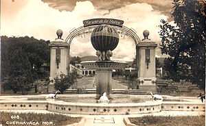
Cuernavaca
City and municipality in Morelos, Mexico
Distance: Approx. 1681 meters
Latitude and longitude: 18.91861111,-99.23416667
Cuernavaca (Spanish pronunciation: [kweɾnaˈβaka] ; Classical Nahuatl: Cuauhnāhuac [kʷawˈnaːwak], "near the woods" , Otomi: Ñu'iza) is the capital and largest city of the state of Morelos in Mexico. Along with Chalcaltzingo, it is likely one of the origins of the Mesoamerican civilization. Olmec works of art, currently displayed in the Museum of Anthropology in Mexico City were found in the Gualupita III archeological site.
Estadio Nido del Colibri
Multi-use stadium in Cuernavaca, Mexico
Distance: Approx. 5990 meters
Latitude and longitude: 18.97041389,-99.24660833
The Estadio Nido del Colibri (English: Hummingbird's Nest Stadium) was a planned multi-use stadium in Cuernavaca, Mexico. It was originally intended to be used as the home stadium of Colibríes de Morelos, a short-lived football team in Mexico. The stadium was to have a capacity of 35,000 and 112 box seats.
Nuestra Cabaña
World Scout Centre in Cuernavaca, Mexico
Distance: Approx. 4414 meters
Latitude and longitude: 18.93388889,-99.21222222
Nuestra Cabaña, (sometimes known as Our Cabaña) is an international Girl Guide centre of the World Association of Girl Guides and Girl Scouts (WAGGGS) located in Cuernavaca, Mexico, It opened in July 1957 as a Baden-Powell centennial memorial. The centre can house over 100 guests. It is one of five World Centres of WAGGGS; the others being Our Chalet in Switzerland, Sangam in India, Pax Lodge in England and Kusafiri in Africa.

Teopanzolco
Distance: Approx. 3321 meters
Latitude and longitude: 18.93044722,-99.22201389
Teopanzolco is an Aztec archaeological site in the Mexican state of Morelos. Due to urban growth, it now lies within the modern city of Cuernavaca. Most of the visible remains date from the Middle to Late Postclassic Period (1300-1521).

Santa María Ahuacatitlán
Village in Morelos, Mexico
Distance: Approx. 5570 meters
Latitude and longitude: 18.86666667,-99.25
Santa Maria Ahuacatitlán is a village in the municipality of Cuernavaca, in the state of Morelos, Mexico. Ahuacatitlán means "place among aguacates" (avocados).
Cuernavaca Cathedral
Distance: Approx. 1446 meters
Latitude and longitude: 18.92021389,-99.23678056
The Cuernavaca Cathedral (Spanish: Catedral de la Asunción de María) is the Roman Catholic church of the Diocese of Cuernavaca, located in the city of Cuernavaca, Morelos, Mexico. The church and its surrounding monastery is one of the early 16th century monasteries in the vicinity of the Popocatepetl volcano inscribed as a World Heritage Site by UNESCO, built initially for evangelization efforts of indigenous people after the Spanish conquest of the Aztec Empire. By the 18th century, the church of the monastery began to function as the parish church of the city and in the late 19th century, it was elevated to the rank of a cathedral.
Palace of Cortés, Cuernavaca
Palace in Cuernavaca, Mexico
Distance: Approx. 1825 meters
Latitude and longitude: 18.92133889,-99.233375
The Palace of Cortés (Spanish: Palacio de Cortés) in Cuernavaca, Mexico, built between 1523 and 1528, is the oldest conserved virreinal-era civil structure in the continental Americas. The architecture is a blend between Gothic and Mudéjar, typical of the early 16th century colonial architecture. The building began as a fortified residence for conqueror Hernán Cortés and his aristocratic second wife, Doña Juana Zúñiga.
Estadio Centenario (Cuernavaca)
Distance: Approx. 6005 meters
Latitude and longitude: 18.97055556,-99.24666667
The Estadio Centenario is a multi-purpose stadium in Cuernavaca, Mexico. Its primary current use is for football matches. The stadium has a capacity of 14,800 people and was opened in 1969 and renovated in 2009.

Casino de la Selva
Resort hotel in Cuernavaca, Mexico
Distance: Approx. 2626 meters
Latitude and longitude: 18.933811,-99.232836
The Hotel Casino de la Selva (Jungle Casino Hotel) was a hotel and casino located in the city of Cuernavaca, Mexico. The main building was opened in 1931 as a hotel and casino, but from 1934 it was used only as a hotel. Additions in the late 1950s included buildings designed by the architect Félix Candela that were roofed by reinforced concrete paraboloid shells.
Acapantzingo, Cuernavaca
Barrio in Morelos, Mexico
Distance: Approx. 3941 meters
Latitude and longitude: 18.9,-99.217
Acapantzingo (Spanish: [a ka pan ˈzɪn go]) is a barrio (borough or neighborhood) in the southeastern part of the City of Cuernavaca, Morelos, Mexico, 2 km from the city center.: 31 The Nahuatl name means on the slope of the reeds (acatl: reed; pan: on; tzinco or tzintla: slope).: 30 It is bound by the Río Chalchihuapan on the west, Colonia Atlacumulco, Jiutepec to the east and south, Colonia Palmira to the south, and Calle Cuauhatemoc (Colonia Amatitlán, Fracc. Jacarandas, Fracc. Las Quintas) to the north.
Cuernavaca Municipality
Municipality in Morelos, Mexico
Distance: Approx. 1681 meters
Latitude and longitude: 18.91861111,-99.23416667
The Cuernavaca Municipality is one of 36 municipalities in the State of Morelos, Mexico. Located in the northwest of the state, it consists of the City of Cuernavaca, which is the state and municipal capital, as well as other, smaller towns. The population is 378,476 (2020).

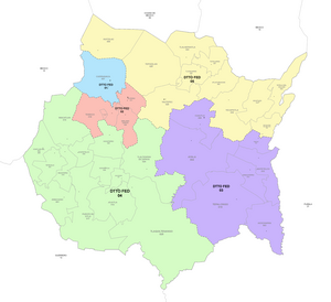
First federal electoral district of Morelos
Federal electoral district of Mexico
Distance: Approx. 1755 meters
Latitude and longitude: 18.91666667,-99.23333333
The first federal electoral district of Morelos (Distrito electoral federal 01 de Morelos) is one of the 300 electoral districts into which Mexico is divided for elections to the federal Chamber of Deputies and one of five such districts in the state of Morelos. It elects one deputy to the lower house of Congress for each three-year legislative period by means of the first-past-the-post system. Votes cast in the district also count towards the calculation of proportional representation ("plurinominal") deputies elected from the fourth region.
Weather in this IP's area
few clouds
18 Celsius
17 Celsius
18 Celsius
18 Celsius
1015 hPa
55 %
1015 hPa
851 hPa
10000 meters
1.51 m/s
1.4 m/s
334 degree
20 %

