Country:
Region:
City:
Latitude and Longitude:
Time Zone:
Postal Code:
IP information under different IP Channel
ip-api
Country
Region
City
ASN
Time Zone
ISP
Blacklist
Proxy
Latitude
Longitude
Postal
Route
Luminati
Country
Region
mex
City
lapaz
ASN
Time Zone
America/Mexico_City
ISP
Instituto Politecnico Nacional
Latitude
Longitude
Postal
IPinfo
Country
Region
City
ASN
Time Zone
ISP
Blacklist
Proxy
Latitude
Longitude
Postal
Route
db-ip
Country
Region
City
ASN
Time Zone
ISP
Blacklist
Proxy
Latitude
Longitude
Postal
Route
ipdata
Country
Region
City
ASN
Time Zone
ISP
Blacklist
Proxy
Latitude
Longitude
Postal
Route
Popular places and events near this IP address

Oaxaca City
City in Oaxaca, Mexico
Distance: Approx. 1415 meters
Latitude and longitude: 17.06055556,-96.72527778
Oaxaca de Juárez (Spanish pronunciation: [waˈxaka ðe ˈxwaɾes]), or simply Oaxaca (Valley Zapotec: Ndua), is the capital and largest city of the eponymous Mexican state of Oaxaca. It is the municipal seat for the surrounding municipality of Oaxaca. It is in the Centro District in the Central Valleys region of the state, in the foothills of the Sierra Madre at the base of the Cerro del Fortín, extending to the banks of the Atoyac River.

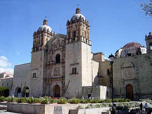
Church of Santo Domingo de Guzmán
Distance: Approx. 931 meters
Latitude and longitude: 17.06555556,-96.72305556
The Church and Convent of Santo Domingo de Guzmán (Spanish: Templo de Santo Domingo de Guzmán) in the city of Oaxaca de Juárez (Mexico) is an example of New Spanish Baroque architecture. The first construction projects for the building date back to 1551, when the Antequera de Oaxaca's City Council ceded a total of twenty-four lots to the Dominican Order for the construction of a convent in the city. However, it was not until 1608 that the conventual complex of Santo Domingo was inaugurated, still unfinished.

Estadio Eduardo Vasconcelos
Distance: Approx. 1490 meters
Latitude and longitude: 17.07,-96.713
Eduardo Vasconcelos Stadium, also known as Estadio de Béisbol Lic. Eduardo Vasconcelos, is a stadium in Oaxaca, Oaxaca, Mexico. It is primarily used for baseball, and is the home field of the Guerreros de Oaxaca Liga Mexicana de Béisbol baseball team since the team entered the league in 1996.

Roman Catholic Archdiocese of Antequera, Oaxaca
Latin Catholic jurisdiction in Mexico
Distance: Approx. 1299 meters
Latitude and longitude: 17.0616,-96.7253
The Archdiocese of Antequera, Oaxaca (Latin: Archidioecesis Antequerensis) is a Latin Church ecclesiastical territory or archdiocese of the Catholic Church in Mexico. The cathedral church is the Cathedral of Our Lady of the Assumption in the episcopal see of Oaxaca. It was erected on June 21, 1535.

Museo Rufino Tamayo, Oaxaca
Art museum in Oaxaca, southern Mexico
Distance: Approx. 1081 meters
Latitude and longitude: 17.0635,-96.727
The Museo Rufino Tamayo is an art museum in the city of Oaxaca, Oaxaca, in southern Mexico.

Oaxaca Cathedral
Catholic Cathedral in Oaxaca, Mexico
Distance: Approx. 1289 meters
Latitude and longitude: 17.06166667,-96.72555556
The Cathedral of Our Lady of the Assumption (Spanish: Catedral Metropolitana de Nuestra Señora de la Asunción), located in the city of Oaxaca de Juarez, Oaxaca, Mexico, is the seat of the Roman Catholic Archdiocese of Antequera, Oaxaca. Its construction began circa 1535 and it was consecrated on 12 July 1733. It is dedicated to Our Lady of the Assumption.
Basilica of Nuestra Señora de Soledad
Distance: Approx. 1137 meters
Latitude and longitude: 17.06361111,-96.73027778
The Basilica of Nuestra Señora de Soledad (Basilica of Our Lady of Solitude) is a Roman Catholic Basilica located in Oaxaca de Juárez, Oaxaca, Mexico. It was built between 1682 and 1690, and is a sanctuary dedicated to Our Lady of Solitude, patron saint of Oaxaca. The architecture style is Baroque, and was intentionally built with low spires and towers, as to better resist earthquakes.

Oaxaca Institute of Technology
Public university in Mexico
Distance: Approx. 1974 meters
Latitude and longitude: 17.07805556,-96.74444444
The Instituto Tecnológico de Oaxaca (ITO) (English: Oaxaca Institute of Technology) is a public institution of higher education located in Oaxaca de Juárez, Oaxaca, Mexico. It was established in April 1968. The university offers ten undergraduate degree programs and six graduate level programs.

Centro Fotográfico Manuel Álvarez Bravo
Distance: Approx. 944 meters
Latitude and longitude: 17.0649047,-96.7247778
The Centro Fotográfico Manuel Álvarez Bravo is a photographic exhibition centre in the city of Oaxaca, Mexico. The centre is named after the Mexican photographer Manuel Álvarez Bravo (1902–2002). It is located in the Graphic Arts Institute of Oaxaca.
Oaxaca Ethnobotanical Garden
Botanical garden in Oaxaca City, Mexico
Distance: Approx. 854 meters
Latitude and longitude: 17.0666,-96.7225
The Jardín Etnobotánico de Oaxaca is a botanical garden in Oaxaca City, Mexico. It occupies 2.32 acres of land adjacent to the Church of Santo Domingo. It is administered by the state government of Oaxaca.

Estadio Tecnológico de Oaxaca
Multi-use stadium in Oaxaca City, Oaxaca, Mexico
Distance: Approx. 2259 meters
Latitude and longitude: 17.0802048,-96.7465228
The Estadio Tecnológico de Oaxaca is a multi-use stadium in Oaxaca City, Oaxaca, Mexico. It is currently used mostly for football matches and is the home stadium for Alebrijes de Oaxaca. The stadium has a capacity of 16,000 people and also includes 72 luxury boxes.
Levadura de Olla
Restaurant in Oaxaca, Mexico
Distance: Approx. 999 meters
Latitude and longitude: 17.06436111,-96.725
Levadura de Olla is a Mexican restaurant in Oaxaca City, Mexico. It has received a Michelin star.
Weather in this IP's area
moderate rain
17 Celsius
18 Celsius
17 Celsius
17 Celsius
1013 hPa
88 %
1013 hPa
843 hPa
9623 meters
1.09 m/s
1.46 m/s
348 degree
64 %
06:26:30
17:54:26

