148.169.40.154 - IP Lookup: Free IP Address Lookup, Postal Code Lookup, IP Location Lookup, IP ASN, Public IP
Country:
 France
Region:
City:
Location:
Time Zone:
Postal Code:
ISP:
ASN:
language:
User-Agent:
Proxy IP:
Blacklist:
IP information under different IP Channel
ip-api
Country
Region
City
ASN
Time Zone
ISP
Blacklist
Proxy
Latitude
Longitude
Postal
Route
db-ip
Country
Region
City
ASN
Time Zone
ISP
Blacklist
Proxy
Latitude
Longitude
Postal
Route
IPinfo
Country
Region
City
ASN
Time Zone
ISP
Blacklist
Proxy
Latitude
Longitude
Postal
Route
IP2Location
148.169.40.154Country
frRegion
normandie
City
saint-planchers
Time Zone
Europe/Paris
ISP
Language
User-Agent
Latitude
Longitude
Postal
ipdata
Country
Region
City
ASN
Time Zone
ISP
Blacklist
Proxy
Latitude
Longitude
Postal
Route
Popular places and events near this IP address
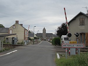
Anctoville-sur-Boscq
Commune in Normandy, France
Distance: Approx. 2477 meters
Latitude and longitude: 48.8447,-1.5311
Anctoville-sur-Boscq is a commune in the Manche department in the Normandy region in northwestern France.

Saint-Aubin-des-Préaux
Commune in Normandy, France
Distance: Approx. 2426 meters
Latitude and longitude: 48.805,-1.5067
Saint-Aubin-des-Préaux (French pronunciation: [sɛ̃.t‿obɛ̃ de pʁeo]) is a commune in the Manche department in Normandy in north-western France.
Saint-Jean-des-Champs
Commune in Normandy, France
Distance: Approx. 4615 meters
Latitude and longitude: 48.8283,-1.4636
Saint-Jean-des-Champs (French pronunciation: [sɛ̃ ʒɑ̃ de ʃɑ̃]) is a commune in the Manche department in Normandy in north-western France.

Saint-Pair-sur-Mer
Commune in Normandy, France
Distance: Approx. 3157 meters
Latitude and longitude: 48.8138,-1.5669
Saint-Pair-sur-Mer (French pronunciation: [sɛ̃ pɛʁ syʁ mɛʁ], literally Saint-Pair on Sea) is a commune in the Manche department in Normandy in north-western France.

Saint-Pierre-Langers
Commune in Normandy, France
Distance: Approx. 4695 meters
Latitude and longitude: 48.7853,-1.4964
Saint-Pierre-Langers (French pronunciation: [sɛ̃ pjɛʁ lɑ̃ʒe]) is a commune in the Manche department in Normandy in north-western France.

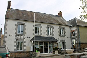
Saint-Planchers
Commune in Normandy, France
Distance: Approx. 138 meters
Latitude and longitude: 48.8236,-1.5247
Saint-Planchers (French pronunciation: [sɛ̃ plɑ̃ʃe]) is a commune in the Manche department in Normandy in north-western France. It is the location of the Prieuré de l'Oiselière, a 12th-century priory that is classified as a Monument historique since 1989.

Longueville, Manche
Commune in Normandy, France
Distance: Approx. 3943 meters
Latitude and longitude: 48.8542,-1.5506
Longueville (French pronunciation: [lɔ̃ɡvil] ) is a commune in the Manche department in Normandy in north-western France.

Yquelon
Commune in Normandy, France
Distance: Approx. 3574 meters
Latitude and longitude: 48.8489,-1.5542
Yquelon (French pronunciation: [iklɔ̃]) is a commune in the Manche department in Normandy in north-western France.

Battle of Granville
Distance: Approx. 4781 meters
Latitude and longitude: 48.8381,-1.5869
The siege of Granville occurred at Granville, Manche on 14 November 1793. It faced 5,000 Republicans besieged by Vendéen forces during the Virée de Galerne. The battle ended with a Republican victory.

Granville station (Manche)
Railway station in Granville, France
Distance: Approx. 4831 meters
Latitude and longitude: 48.83833333,-1.5875
Granville station (French: Gare de Granville) is a railway station serving the commune of Granville, in the Manche department of northwestern France.

Thar (river)
River in France
Distance: Approx. 3815 meters
Latitude and longitude: 48.8046,-1.5702
The Thar is a small river of France, in the administrative region Normandie, département de la Manche. It is 24.8 km (15 mi) long, rising to the east of La Haye-Pesnel and emptying into the Bay of Mont Saint-Michel, in the English Channel. In the Middle Ages the Thar formed the traditional boundary between the Cotentin to the north and the Avranchin to the south.

Prieuré de l'Oiselière
Manor house in Saint Planchers, France
Distance: Approx. 2185 meters
Latitude and longitude: 48.8221,-1.4962
The Prieuré de l'Oiselière is a priory located at Saint-Planchers, near Granville, in France. Nestled in a valley bordering the watercourse that bears its name, surrounded by fortified walls and moats, its history dates back to the 12th century. It was a dependency of the abbots of Mont-Saint-Michel who organised the cultivation of the fields and the woods and collected taxes.
Weather in this IP's area
broken clouds
10 Celsius
9 Celsius
10 Celsius
10 Celsius
1040 hPa
74 %
1040 hPa
1035 hPa
10000 meters
1.41 m/s
2.04 m/s
336 degree
54 %