Country:
Region:
City:
Latitude and Longitude:
Time Zone:
Postal Code:
IP information under different IP Channel
ip-api
Country
Region
City
ASN
Time Zone
ISP
Blacklist
Proxy
Latitude
Longitude
Postal
Route
Luminati
Country
Region
hi
City
keaau
ASN
Time Zone
Pacific/Honolulu
ISP
HAWAIIAN-TELCOM
Latitude
Longitude
Postal
IPinfo
Country
Region
City
ASN
Time Zone
ISP
Blacklist
Proxy
Latitude
Longitude
Postal
Route
db-ip
Country
Region
City
ASN
Time Zone
ISP
Blacklist
Proxy
Latitude
Longitude
Postal
Route
ipdata
Country
Region
City
ASN
Time Zone
ISP
Blacklist
Proxy
Latitude
Longitude
Postal
Route
Popular places and events near this IP address

Hawaiian Acres, Hawaii
Census-designated place in Hawaii, United States
Distance: Approx. 8381 meters
Latitude and longitude: 19.54888889,-155.05583333
Hawaiian Acres is a census-designated place (CDP) in Hawaiʻi County, Hawaiʻi, United States located in the District of Puna. The population was 2,700 at the 2010 census, up from 1,776 at the 2000 census.

Hawaiian Paradise Park, Hawaii
Census-designated place in the United States
Distance: Approx. 6967 meters
Latitude and longitude: 19.59027778,-154.97583333
Hawaiian Paradise Park, also referred to as Paradise Park and known by many as HPP, is a census-designated place (CDP) in Hawaiʻi County, Hawaiʻi, United States, located in the District of Puna. The population was 11,404 at the 2010 census, up from 7,051 at the 2000 census. There are also numerous historic and archeological preservation sites in the subdivision, which include Native Hawaiian petroglyphs, heiau, and burial sites.

Keaau, Hawaii
Census-designated place in Hawaii, U.S.
Distance: Approx. 846 meters
Latitude and longitude: 19.62111111,-155.04166667
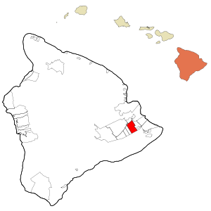
Keaʻau (also written as Keaau) is a census-designated place (CDP) in Hawaiʻi County, Hawaii. located in the District of Puna. The population was 1,195 at the time of the 2020 census.

Kurtistown, Hawaii
Census-designated place in Hawaii, U.S.
Distance: Approx. 5141 meters
Latitude and longitude: 19.59055556,-155.07027778
Kurtistown is a census-designated place (CDP) in Hawaiʻi County, Hawaiʻi, United States, in the District of Puna. The population was 1,298 at the 2010 census, up from 1,157 at the 2000 census.

Orchidlands Estates, Hawaii
Census-designated place in Hawaii, U.S.
Distance: Approx. 7075 meters
Latitude and longitude: 19.56083333,-155.0125
Orchidlands Estates (also known as Orchidland or Orchid Land Estates) is a census-designated place (CDP) in Hawaiʻi County, Hawaiʻi, United States located in the District of Puna. The population was 2,815 at the 2010 census, up from 1,731 at the 2000 census.

Keaau High School
Public school in Keaʻau, Hawaiʻi
Distance: Approx. 1056 meters
Latitude and longitude: 19.61194444,-155.03138889
Keaʻau High School is a public high school built in 1999 and located in Keaʻau, Hawaii.

Nani Mau Gardens
Botanical gardens in Hilo, Hawaii, United States
Distance: Approx. 6096 meters
Latitude and longitude: 19.67222222,-155.05472222
Nani Mau Gardens (20 acres) are commercial botanical gardens located at 421 Makalika Street, Hilo, Hawaiʻi on the island of Hawaiʻi, coordinates 19°40′20″N 155°3′17″W. The gardens' name, Nani Mau, means "forever beautiful". They were established by Makato Nitahara and opened to the public in 1972.

Panaʻewa Rainforest Zoo
Zoo in Hawai'i, U.S.
Distance: Approx. 5743 meters
Latitude and longitude: 19.6552,-155.0748
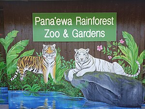
Panaʻewa Rainforest Zoo is located in Hilo, Hawaiʻi, United States. This small 12-acre (4.9 ha) zoo is the only one in the United States located in a rainforest. It is operated by Hawaii County and receives its funding from the county and from private donations.
Ke Kula o Nawahiokalaniopuu
Distance: Approx. 1791 meters
Latitude and longitude: 19.6056859,-155.0290675
Ke Kula ʻo Nāwahīokalaniʻōpuʻu is a Hawaiian language immersion charter school. It serves grades K-12 in Keaʻau, Puna, Hawaii Island, Hawaii. It is the largest Hawaiian immersion school on Hawaii Island.

Mauna Loa Macadamia Nut Corporation
Distance: Approx. 4706 meters
Latitude and longitude: 19.65666667,-155.00916667
Mauna Loa Macadamia Nut Corporation is the world's largest processor of macadamia seeds. The American company was a subsidiary of The Hershey Company from 2004 to 2015, when it was acquired by Hawaiian Host, Inc. The company takes its name from the volcano Mauna Loa.

Prince Kuhio Plaza
Shopping mall in Hilo, Hawaii
Distance: Approx. 9019 meters
Latitude and longitude: 19.69722222,-155.06333333
Prince Kūhiō Plaza is a single-level regional shopping mall in Hilo, Hawaii. It is the largest enclosed mall on the Island of Hawaii. Anchor stores are two Macy's stores, TJ Maxx, and Petco.

Hilo Dragstrip
Distance: Approx. 6709 meters
Latitude and longitude: 19.68138889,-155.03027778
Hilo Dragstrip is a dragstrip located just southeast of Hilo, Hawaii at 19°40′53″N 155°1′49″W. It is also called the Pana‘ewa Drag Strip. Hilo dragstrip opened in 1978, and is now operated by the County of Hawaiʻi. The Big Island Auto Club and the Hawaii Drag Racing League race at the strip.
Weather in this IP's area
light rain
19 Celsius
20 Celsius
19 Celsius
22 Celsius
1021 hPa
95 %
1021 hPa
1010 hPa
10000 meters
2.57 m/s
230 degree
75 %
06:29:33
17:40:49