147.30.183.181 - IP Lookup: Free IP Address Lookup, Postal Code Lookup, IP Location Lookup, IP ASN, Public IP
Country:
Region:
City:
Location:
Time Zone:
Postal Code:
ISP:
ASN:
language:
User-Agent:
Proxy IP:
Blacklist:
IP information under different IP Channel
ip-api
Country
Region
City
ASN
Time Zone
ISP
Blacklist
Proxy
Latitude
Longitude
Postal
Route
db-ip
Country
Region
City
ASN
Time Zone
ISP
Blacklist
Proxy
Latitude
Longitude
Postal
Route
IPinfo
Country
Region
City
ASN
Time Zone
ISP
Blacklist
Proxy
Latitude
Longitude
Postal
Route
IP2Location
147.30.183.181Country
Region
qyzylorda oblysy
City
kyzylorda
Time Zone
Asia/Qyzylorda
ISP
Language
User-Agent
Latitude
Longitude
Postal
ipdata
Country
Region
City
ASN
Time Zone
ISP
Blacklist
Proxy
Latitude
Longitude
Postal
Route
Popular places and events near this IP address

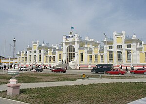
Kyzylorda
City in Kyzylorda Region, Kazakhstan
Distance: Approx. 667 meters
Latitude and longitude: 44.85,65.51666667
Kyzylorda (Kazakh: Қызылорда / Qyzylorda [qəˌzəɫorˈdɑ] ()), formerly known as Kzyl-Orda (Russian: Кзыл-Орда), Ak-Mechet (Ак-Мечеть), Perovsk (Перовск), and Fort-Perovsky (Форт-Перовский), is a city in south-central Kazakhstan, capital of Kyzylorda Region and former capital of the Kazakh ASSR from 1925 to 1927. The city has a population of 242,462 (2020 Census). It historically developed around the Syr Darya river and was the site of a Kokand fortress.
Gani Muratbayev Stadium
Multi-use stadium
Distance: Approx. 3015 meters
Latitude and longitude: 44.826029,65.503439
Gani Muratbayev Stadium (Kazakh: Ğani Mūratbaev stadion) is a multi-use stadium in Kyzylorda, Kazakhstan. It is currently used mostly for football matches and is the home stadium of FC Kaisar. It is named after the founder of Kazakhstan Young Communist League Gany Muratbayev.

Siege of Ak-Mechet
1853 engagement of the Russo-Kokand War
Distance: Approx. 667 meters
Latitude and longitude: 44.85,65.51666667
The siege of Ak-Mechet (2–28 July 1853) was one of the first major engagements of the Russo-Kokand war, fought between the Russian Empire and the Khanate of Kokand. The city was an important northern base for the Kokand Khanate, and was placed next to the defensible Syr Darya river. Its capture or destruction became a priority for the Russian regional governors, with governor Vasily Perovsky ordering an expedition that culminated in a failed attempt to capture the city.
Weather in this IP's area
clear sky
-4 Celsius
-7 Celsius
-4 Celsius
-4 Celsius
1028 hPa
68 %
1028 hPa
1012 hPa
10000 meters
2 m/s
350 degree