147.192.5.38 - IP Lookup: Free IP Address Lookup, Postal Code Lookup, IP Location Lookup, IP ASN, Public IP
Country:
Region:
City:
Location:
Time Zone:
Postal Code:
ISP:
ASN:
language:
User-Agent:
Proxy IP:
Blacklist:
IP information under different IP Channel
ip-api
Country
Region
City
ASN
Time Zone
ISP
Blacklist
Proxy
Latitude
Longitude
Postal
Route
db-ip
Country
Region
City
ASN
Time Zone
ISP
Blacklist
Proxy
Latitude
Longitude
Postal
Route
IPinfo
Country
Region
City
ASN
Time Zone
ISP
Blacklist
Proxy
Latitude
Longitude
Postal
Route
IP2Location
147.192.5.38Country
Region
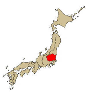
saitama
City
saitama
Time Zone
Asia/Tokyo
ISP
Language
User-Agent
Latitude
Longitude
Postal
ipdata
Country
Region
City
ASN
Time Zone
ISP
Blacklist
Proxy
Latitude
Longitude
Postal
Route
Popular places and events near this IP address

Urawa-ku, Saitama
Ward in Kantō, Japan
Distance: Approx. 724 meters
Latitude and longitude: 35.86161111,139.6455
Urawa (浦和区, Urawa-ku) is one of ten wards of the city of Saitama, in Saitama Prefecture, Japan. Located in the northeast of the city, Urawa is the governmental center of Saitama and houses most of the city's administrative offices including the city hall, as well as the offices of Saitama Prefectural government. Also, there are several newspaper branch offices and three broadcasting stations.
Urawa, Saitama
Place in Japan
Distance: Approx. 37 meters
Latitude and longitude: 35.86666667,139.65
Urawa (浦和市, Urawa-shi) was a city located in Saitama Prefecture, Japan. On May 1, 2001, Urawa was merged with the cities of Ōmiya and Yono to create the city of Saitama. Since April 1, 2003, the area of former Urawa City has been divided into 4 wards: Urawa-ku, Midori-ku, Minami-ku and Sakura-ku of Saitama City.

Saitama (city)
Designated city in Kantō, Japan
Distance: Approx. 742 meters
Latitude and longitude: 35.86138889,139.64555556
Saitama (さいたま市, Saitama-shi, pronounced [saꜜitama]) is the capital and largest city of Saitama Prefecture, Japan. Its area incorporates the former cities of Urawa, Ōmiya, Yono and Iwatsuki. It is a city designated by government ordinance.

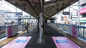
Urawa Station
Railway station in Saitama, Japan
Distance: Approx. 1144 meters
Latitude and longitude: 35.85848056,139.65708611
Urawa Station (浦和駅, Urawa-eki) is a junction passenger railway station located in Urawa-ku, Saitama, Japan, operated by East Japan Railway Company (JR East). It is located near Saitama City Office and the Saitama Prefectural Government Office.

Urawa-shuku
Distance: Approx. 669 meters
Latitude and longitude: 35.86136111,139.65255556
Urawa-shuku (浦和宿, Urawa-shuku) was the third of the sixty-nine stations of the Nakasendō. It is located in Urawa-ku in the present-day city of Saitama, Saitama Prefecture, Japan. Its stone ruins can be found 300 meters from Tsuki Shrine (調神社 Tsuki Jinja).

Kita-Urawa Station
Railway station in Saitama, Japan
Distance: Approx. 663 meters
Latitude and longitude: 35.872,139.646
Kita-Urawa Station (北浦和駅, Kita-Urawa eki) is a passenger railway station on the Keihin-Tohoku Line in Urawa-ku, Saitama, Saitama Prefecture, Japan, operated by East Japan Railway Company (JR East).

Roman Catholic Diocese of Saitama
Roman Catholic diocese in Japan
Distance: Approx. 840 meters
Latitude and longitude: 35.8611,139.6442
The Roman Catholic Diocese of Saitama (Latin: Dioecesis Saitamaensis, Japanese: カトリックさいたま教区) is a Latin Church diocese of the Catholic Church located in the city of Saitama in the ecclesiastical province of Tokyo in Japan.

Minami-Yono Station
Railway station in Saitama, Japan
Distance: Approx. 1697 meters
Latitude and longitude: 35.867425,139.63119167
Minami-Yono Station (南与野駅, Minami-Yono-eki) is a passenger railway station on the Saikyō Line located in Chūō-ku, Saitama, Saitama Prefecture, Japan, operated by the East Japan Railway Company (JR East).

Naka-Urawa Station
Railway station in Saitama, Japan
Distance: Approx. 1855 meters
Latitude and longitude: 35.85380833,139.63744167
Naka-Urawa Station (中浦和駅, Naka-Urawa-eki) is a passenger railway station on the Saikyō Line in Minami-ku, Saitama, Saitama Prefecture, Japan, operated by the East Japan Railway Company.
St. Theresa of the Child Jesus Cathedral, Urawa
Church in Saitama, Japan
Distance: Approx. 1096 meters
Latitude and longitude: 35.8589,139.6431
The Cathedral of St. Theresa of the Child Jesus (Japanese: 幼いイエスの聖テレジア司教座聖堂), also called the Urawa Church, is a parish of the Roman Catholic Church in Urawa, Saitama prefecture, Japan. It is seat of the bishop of the Roman Catholic Diocese of Saitama.

Urawa Racecourse
Racecourse in Saitama Prefecture, Japan
Distance: Approx. 2143 meters
Latitude and longitude: 35.858,139.671
Urawa Racecourse is a racecourse located in Saitama Prefecture, Japan.

Museum of Modern Art, Saitama
Distance: Approx. 686 meters
Latitude and longitude: 35.8696,139.6431
The Museum of Modern Art, Saitama (埼玉県立近代美術館, Saitama Kenritsu Kindai Bijutsukan) is a museum in Saitama, Saitama Prefecture, Japan. It is one of Japan's many museums which are supported by a prefecture.
Weather in this IP's area
scattered clouds
3 Celsius
3 Celsius
3 Celsius
4 Celsius
1016 hPa
58 %
1016 hPa
1014 hPa
10000 meters
0.81 m/s
1.42 m/s
8 degree
49 %
