146.74.1.174 - IP Lookup: Free IP Address Lookup, Postal Code Lookup, IP Location Lookup, IP ASN, Public IP
Country:
Region:
City:
Location:
Time Zone:
Postal Code:
IP information under different IP Channel
ip-api
Country
Region
City
ASN
Time Zone
ISP
Blacklist
Proxy
Latitude
Longitude
Postal
Route
Luminati
Country
Region
ca
City
sanjose
ASN
Time Zone
America/Los_Angeles
ISP
SCCGOV
Latitude
Longitude
Postal
IPinfo
Country
Region
City
ASN
Time Zone
ISP
Blacklist
Proxy
Latitude
Longitude
Postal
Route
IP2Location
146.74.1.174Country
Region
california
City
gilroy
Time Zone
America/Los_Angeles
ISP
Language
User-Agent
Latitude
Longitude
Postal
db-ip
Country
Region
City
ASN
Time Zone
ISP
Blacklist
Proxy
Latitude
Longitude
Postal
Route
ipdata
Country
Region
City
ASN
Time Zone
ISP
Blacklist
Proxy
Latitude
Longitude
Postal
Route
Popular places and events near this IP address
Gilroy, California
City in California, United States
Distance: Approx. 1245 meters
Latitude and longitude: 37.01194444,-121.58
Gilroy is a city in Santa Clara County, California, United States. Gilroy is a city south of the San Francisco Bay Area, with a population of 59,520 as of the 2020 Census. Gilroy's origins lie in the village of San Ysidro, which developed in the early 19th century from Rancho San Ysidro.
Gilroy Garlic Festival
Food festival in Gilroy, California
Distance: Approx. 1754 meters
Latitude and longitude: 36.99777778,-121.58527778
The Gilroy Garlic Festival was a food festival in the United States, held annually from 1979 to 2019 at Christmas Hill Park in Gilroy, California, on the last full weekend in July. After its cancellation in 2020 due to the COVID-19 pandemic, a drive-through festival was held on July 23–25 and 30–31 July and August 1, 2021. In April 2022, the Gilroy Garlic Festival Association announced the indefinite suspension of the traditional large-format festival, stating that it would instead host smaller individual events.
Gilroy station
Train station in Gilroy, California, U.S.
Distance: Approx. 233 meters
Latitude and longitude: 37.00416667,-121.56666667
Gilroy station is a Caltrain station located in Gilroy, California, United States. It is the southern terminus of the South County Connector service, and is only served during weekday rush hours in the peak direction, with trains going toward San Jose in the morning and returning southbound in the evening. The station building was constructed by the Southern Pacific Railroad in 1918 and restored in 1998.

Gilroy High School
Public school in Gilroy, California, United States
Distance: Approx. 1257 meters
Latitude and longitude: 36.99611111,-121.57555556
Gilroy High School is a co-educational public school located in Gilroy, California, that serves the city of Gilroy. A part of the Gilroy Unified School District, is one of two public comprehensive high schools in the city and has an approximate enrollment of 1,500 students.

Christian Church of Gilroy
Historic church in California, United States
Distance: Approx. 298 meters
Latitude and longitude: 37.00777778,-121.57055556
Christian Church of Gilroy is a historic church located at 160 5th Street in Gilroy, California. The church was built in 1857 for Gilroy's congregation of the Christian Church, also known as the Disciples of Christ. The congregation was one of the first of any denomination in Gilroy, and it was the first to build its own church.

Gilroy Free Library
United States historic place
Distance: Approx. 407 meters
Latitude and longitude: 37.008293,-121.571642
The Gilroy Free Library is a Carnegie Library building in Gilroy, California. The building is now the location of the Gilroy Museum.

Christmas Hill Park
Community park in Gilroy, California, US
Distance: Approx. 1754 meters
Latitude and longitude: 36.99777778,-121.58527778
Christmas Hill Park is a 51-acre community park operated by the City of Gilroy in southwest Santa Clara County, California, US. The park provides trails for jogging, hiking and bicycling, as well as soccer and baseball/softball diamonds for group sports, and multiple picnic areas. The Christmas Hill Park Ranch Site adjoins east of the park, and provides an environmental education center, as well as additional sports facilities. The park is open seven days a week from 6:00 am to 11:00 pm from March to October, and 6:00 am to 8:00 pm from November to February.
Edgar Holloway House
Historic house in California, United States
Distance: Approx. 376 meters
Latitude and longitude: 37.00888889,-121.57
The Edgar Holloway House is a historic house in Gilroy, California. It was built in 1903 for Edgar and Dora Holloway, whose grandparents had taken part in the California Gold Rush. After they died in 1912–1913, the house was sold out of the Holloway family.

Gilroy Garlic Festival shooting
Mass shooting in Gilroy, California
Distance: Approx. 1754 meters
Latitude and longitude: 36.99777778,-121.58527778
On July 28, 2019, a mass shooting occurred at the Gilroy Garlic Festival in Gilroy, California. The gunman killed three people and wounded 17 others before killing himself after a shootout with responding police officers. As of 2020, investigators had not determined the motives of the gunman, identified as 19-year-old Santino William Legan.
Old City Hall (Gilroy, California)
United States historic place
Distance: Approx. 161 meters
Latitude and longitude: 37.00722222,-121.56861111
The Old City Hall is a historical building built in 1905, and once served as a courthouse, the mayor's office, a jail, a clerk office, and fire department. The building is located at 7410 Monterey Street in Gilroy, California. It is listed on the National Register of Historic Places listings in Santa Clara County, California since April 16, 1975.

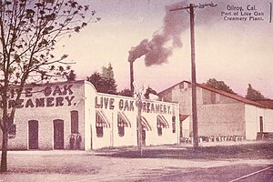
Live Oak Creamery
Historic Creamery in Santa Clara County, California, United States
Distance: Approx. 283 meters
Latitude and longitude: 37.00833333,-121.56805556
The Live Oak Creamery was a historic creamery in Gilroy, California that was established in 1908. The creamery is best known as Gilroy's first butter factory and only insulated structure in the vicinity. During the 1920s and 1930s, the creamery played a role in cheese processing.

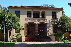
Wheeler Hospital
Historic Hospital in Santa Clara County, California, United States
Distance: Approx. 796 meters
Latitude and longitude: 37.00638889,-121.57722222
The Wheeler Hospital was a historic hospital constructed in 1929, in Gilroy, California. The hospital was designed by California architect William Henry Weeks and funded by merchant Lin Walker Wheeler. The Wheeler Hospital was placed on the National Register of Historic Places on September 13, 1990.
Weather in this IP's area
clear sky
14 Celsius
12 Celsius
13 Celsius
16 Celsius
1022 hPa
42 %
1022 hPa
1014 hPa
10000 meters
5.14 m/s
310 degree


