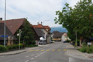
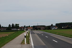
Country:
Region:
City:
Latitude and Longitude:
Time Zone:
Postal Code:
IP information under different IP Channel
ip-api
Country
Region
City
ASN
Time Zone
ISP
Blacklist
Proxy
Latitude
Longitude
Postal
Route
Luminati
Country
Region
zh
City
zurich
ASN
Time Zone
Europe/Zurich
ISP
Migros-Genossenschafts-Bund
Latitude
Longitude
Postal
IPinfo
Country
Region
City
ASN
Time Zone
ISP
Blacklist
Proxy
Latitude
Longitude
Postal
Route
db-ip
Country
Region
City
ASN
Time Zone
ISP
Blacklist
Proxy
Latitude
Longitude
Postal
Route
ipdata
Country
Region
City
ASN
Time Zone
ISP
Blacklist
Proxy
Latitude
Longitude
Postal
Route
Popular places and events near this IP address
Aegerten
Municipality in Bern, Switzerland
Distance: Approx. 905 meters
Latitude and longitude: 47.11666667,7.28333333
Aegerten is a municipality in the Biel/Bienne administrative district of the canton of Bern in Switzerland.

Brügg, Bern
Municipality in Bern, Switzerland
Distance: Approx. 905 meters
Latitude and longitude: 47.11666667,7.28333333
Brügg is a municipality in the Biel/Bienne administrative district in the canton of Bern in Switzerland.
Jens, Switzerland
Municipality in Bern, Switzerland
Distance: Approx. 2590 meters
Latitude and longitude: 47.1,7.26666667
Jens is a municipality in the Seeland administrative district in the canton of Bern in Switzerland.
Orpund
Municipality in Bern, Switzerland
Distance: Approx. 2237 meters
Latitude and longitude: 47.13333333,7.3
Orpund is a municipality in the Biel/Bienne administrative district in the canton of Bern in Switzerland.
Scheuren
Municipality in Bern, Switzerland
Distance: Approx. 2769 meters
Latitude and longitude: 47.13333333,7.31666667
Scheuren is a municipality in the Biel/Bienne administrative district in the canton of Bern in Switzerland.
Schwadernau
Municipality in Bern, Switzerland
Distance: Approx. 2237 meters
Latitude and longitude: 47.13333333,7.3
Schwadernau is a municipality in the Biel/Bienne administrative district in the canton of Bern in Switzerland.

Studen, Bern
Municipality in Bern, Switzerland
Distance: Approx. 545 meters
Latitude and longitude: 47.11666667,7.3
Studen is a municipality in the Seeland administrative district in the canton of Bern in Switzerland.
Worben
Municipality in Bern, Switzerland
Distance: Approx. 1731 meters
Latitude and longitude: 47.1,7.28333333
Worben is a municipality in the Seeland administrative district in the canton of Bern in Switzerland.

Petinesca
Archeological site in the Canton of Bern, in Switzerland
Distance: Approx. 485 meters
Latitude and longitude: 47.11,7.298
Petinesca is an archeological site on the territory of Studen, a community of the Canton of Bern, in Switzerland, where Celtic and Roman vestiges were found.
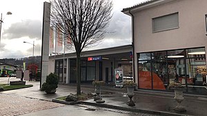
Brügg BE railway station
Railway station in Brügg BE, Switzerland
Distance: Approx. 1658 meters
Latitude and longitude: 47.12362694,7.27821806
Brügg BE railway station (German: Bahnhof Brügg BE) is a railway station in the municipality of Brügg BE, in the Swiss canton of Bern. It is an intermediate stop on the standard gauge Biel/Bienne–Bern line of Swiss Federal Railways.
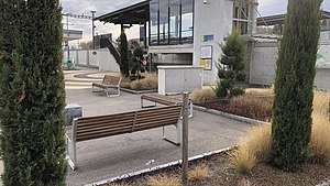
Studen BE railway station
Railway station in Studen BE, Switzerland
Distance: Approx. 659 meters
Latitude and longitude: 47.110424,7.30174731
Studen BE railway station (German: Bahnhof Studen BE) is a railway station in the municipality of Studen, in the Swiss canton of Bern. It is an intermediate stop on the standard gauge Biel/Bienne–Bern line of Swiss Federal Railways.
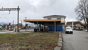
Busswil BE railway station
Railway station in Lyss, Switzerland
Distance: Approx. 2480 meters
Latitude and longitude: 47.09861111,7.31861111
Busswil BE railway station (German: Bahnhof Busswil BE) is a railway station in the municipality of Lyss, in the Swiss canton of Bern. It sits at the junction of the standard gauge Biel/Bienne–Bern and Lyss–Solothurn line of Swiss Federal Railways.
Weather in this IP's area
overcast clouds
7 Celsius
6 Celsius
6 Celsius
8 Celsius
1026 hPa
97 %
1026 hPa
966 hPa
6000 meters
1.54 m/s
100 %
07:20:04
17:08:46
