146.255.109.180 - IP Lookup: Free IP Address Lookup, Postal Code Lookup, IP Location Lookup, IP ASN, Public IP
Country:
Region:
City:
Location:
Time Zone:
Postal Code:
ISP:
ASN:
language:
User-Agent:
Proxy IP:
Blacklist:
IP information under different IP Channel
ip-api
Country
Region
City
ASN
Time Zone
ISP
Blacklist
Proxy
Latitude
Longitude
Postal
Route
db-ip
Country
Region
City
ASN
Time Zone
ISP
Blacklist
Proxy
Latitude
Longitude
Postal
Route
IPinfo
Country
Region
City
ASN
Time Zone
ISP
Blacklist
Proxy
Latitude
Longitude
Postal
Route
IP2Location
146.255.109.180Country
Region
england
City
baldersby
Time Zone
Europe/London
ISP
Language
User-Agent
Latitude
Longitude
Postal
ipdata
Country
Region
City
ASN
Time Zone
ISP
Blacklist
Proxy
Latitude
Longitude
Postal
Route
Popular places and events near this IP address

Catton, North Yorkshire
Village and civil parish in North Yorkshire, England
Distance: Approx. 1557 meters
Latitude and longitude: 54.197,-1.434
Catton is a village and civil parish in North Yorkshire, England. It is situated between Thirsk and Ripon, on the River Swale and was part of the Hambleton District between 1974 and 2023.

Ainderby Quernhow
Village and civil parish in North Yorkshire, England
Distance: Approx. 2492 meters
Latitude and longitude: 54.22311,-1.46866
Ainderby Quernhow is a village and civil parish in North Yorkshire, England. The village is situated on the B6267 Thirsk to Masham road just east of the A1(M) and is about five miles west of Thirsk. The population of the civil parish was estimated at 70 in 2014.

Baldersby
Village and civil parish in North Yorkshire, England
Distance: Approx. 104 meters
Latitude and longitude: 54.201,-1.456
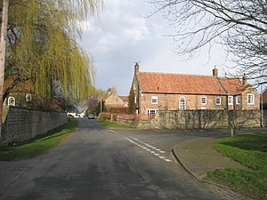
Baldersby is a village and civil parish in North Yorkshire, England, about 6 miles (10 km) west of Thirsk and 5 miles (8 km) north-east of Ripon on the A61. The parish includes the village of Baldersby St James, 1 mile (2 km) south-east of the village of Baldersby, but not Baldersby Park, which is in the parish of Rainton with Newby. According to the 2001 census the parish had a population of 253, increasing to 285 at the 2011 census.

Melmerby, Harrogate
Village and civil parish in North Yorkshire, England
Distance: Approx. 2450 meters
Latitude and longitude: 54.18714,-1.48431
Melmerby is a village and civil parish in North Yorkshire, England, that lies 3.7 miles (6 km) north of Ripon and 0.6 miles (1 km) west of the A1(M) motorway. The population was 386 in the 2011 census.

Skipton-on-Swale
Village and civil parish in North Yorkshire, England
Distance: Approx. 1486 meters
Latitude and longitude: 54.21265,-1.44288
Skipton-on-Swale is a small village and civil parish in the former Hambleton District of North Yorkshire, England. The population at the 2011 Census was less than 100. Details are included in the civil parish of Catton, North Yorkshire.
Howe, North Yorkshire
Village and civil parish in North Yorkshire, England
Distance: Approx. 1743 meters
Latitude and longitude: 54.2175,-1.4541
Howe is a small village and civil parish in the former Hambleton District of North Yorkshire, England. It is situated near Ainderby Quernhow and the A61 and 5 miles (8 km) west of Thirsk. The population of the civil parish was estimated at 20 in 2015.

Middleton Quernhow
Village and civil parish in North Yorkshire, England
Distance: Approx. 2004 meters
Latitude and longitude: 54.2,-1.487
Middleton Quernhow is a settlement and civil parish in North Yorkshire, England. The parish is included in the Wathvale Ward with a population of 3,479 (at the 2011 census). North Yorkshire County Council estimated that the population of the parish was 60 in 2015.

Baldersby St James
Village in North Yorkshire, England
Distance: Approx. 1968 meters
Latitude and longitude: 54.18694444,-1.44027778
Baldersby St James is a village in the former Harrogate district of North Yorkshire, England. Several notable buildings in the village were commissioned by Viscount Downe of Baldersby Park and designed by William Butterfield in the 1850s. The Church of St James and its lychgate are both Grade I listed, and The Old Parsonage and the former Baldersby St James Primary School are both Grade II* listed.

Baldersby railway station
Disused railway station in North Yorkshire, England
Distance: Approx. 634 meters
Latitude and longitude: 54.196747,-1.460546
Baldersby railway station was a railway station serving the village of Baldersby in North Yorkshire, England. It was located on a line from Melmerby, north of Ripon, to Thirsk on the East Coast Main Line.

Church of St James, Baldersby
Church in North Yorkshire, England
Distance: Approx. 1953 meters
Latitude and longitude: 54.1871,-1.4403
The Church of St James is a Church of England parish church in Baldersby St James, North Yorkshire. This Victorian church is a Grade I listed building and was designed by William Butterfield.

Baldersby St James Primary School
School building in Baldersby, North Yorkshire, England
Distance: Approx. 1997 meters
Latitude and longitude: 54.18647,-1.44077
Baldersby St James Primary School is a former school in Baldersby St James, a village in North Yorkshire, in England. The school was commissioned by William Dawnay, 7th Viscount Downe, and designed by William Butterfield. It was completed in 1854, along with an attached schoolhouse.
The Old Parsonage, Baldersby
Distance: Approx. 1959 meters
Latitude and longitude: 54.18738,-1.43941
The Old Parsonage is a historic building in Baldersby St James, a village in North Yorkshire, in England. The house was commissioned by William Dawnay, 7th Viscount Downe, and designed by William Butterfield. It was completed in 1854.
Weather in this IP's area
mist
5 Celsius
1 Celsius
4 Celsius
5 Celsius
1022 hPa
85 %
1022 hPa
1013 hPa
9000 meters
5.66 m/s
40 degree
100 %