146.255.104.250 - IP Lookup: Free IP Address Lookup, Postal Code Lookup, IP Location Lookup, IP ASN, Public IP
Country:
 Great Britain
Region:
City:
Location:
Time Zone:
Postal Code:
ISP:
ASN:
language:
User-Agent:
Proxy IP:
Blacklist:
IP information under different IP Channel
ip-api
Country
Region
City
ASN
Time Zone
ISP
Blacklist
Proxy
Latitude
Longitude
Postal
Route
db-ip
Country
Region
City
ASN
Time Zone
ISP
Blacklist
Proxy
Latitude
Longitude
Postal
Route
IPinfo
Country
Region
City
ASN
Time Zone
ISP
Blacklist
Proxy
Latitude
Longitude
Postal
Route
IP2Location
146.255.104.250Country
gbRegion
england
City
chorley
Time Zone
Europe/London
ISP
Language
User-Agent
Latitude
Longitude
Postal
ipdata
Country
Region
City
ASN
Time Zone
ISP
Blacklist
Proxy
Latitude
Longitude
Postal
Route
Popular places and events near this IP address

Chorley
Town in Lancashire, England
Distance: Approx. 1063 meters
Latitude and longitude: 53.653,-2.632
Chorley is a town and the administrative centre of the wider Borough of Chorley in Lancashire, England, 8 miles (13 km) north of Wigan, 11 miles (18 km) south west of Blackburn, 11 miles (18 km) north west of Bolton, 12 miles (19 km) south of Preston and 20 miles (32 km) north west of Manchester. The town's wealth came principally from the cotton industry. In the 1970s, the skyline was dominated by factory chimneys, but most have now been demolished: remnants of the industrial past include Morrisons chimney and other mill buildings, and the streets of terraced houses for mill workers.

Borough of Chorley
Borough and non-metropolitan district in England
Distance: Approx. 1063 meters
Latitude and longitude: 53.653,-2.632
The Borough of Chorley is a local government district with borough status in Lancashire, England. It is named after the town of Chorley, which is an unparished area. The borough extends to several villages and hamlets including Adlington, Buckshaw Village, Croston, Eccleston, Euxton and Whittle-le-Woods.

Chorley (UK Parliament constituency)
Parliamentary constituency in the United Kingdom, 1885 onwards
Distance: Approx. 1063 meters
Latitude and longitude: 53.653,-2.632
Chorley is a constituency in Lancashire represented in the House of Commons of the UK Parliament since 1997 by Lindsay Hoyle. Hoyle was originally elected for the Labour Party, but in 2019 became the Speaker, making him unaffiliated.
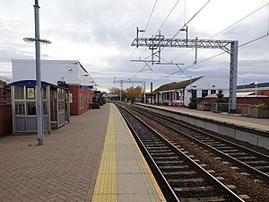
Chorley railway station
Railway station in Lancashire, England
Distance: Approx. 757 meters
Latitude and longitude: 53.653,-2.627
Chorley railway station serves the town of Chorley in Lancashire, England. Since 2004 it has been linked with Chorley Interchange bus and coach station. It is on the Manchester–Preston line.

Chorley Interchange
Bus station in Lancashire, England
Distance: Approx. 820 meters
Latitude and longitude: 53.6528,-2.6282
Chorley Interchange is a bus station in Chorley, England.

Yarrow Bridge
Bridge in Lancashire, UK
Distance: Approx. 1013 meters
Latitude and longitude: 53.641,-2.619
Yarrow Bridge is a small road bridge which crosses the River Yarrow in Chorley, Lancashire, England. The bridge carries the A6 road over the river. There is also a pub and garage next door to bridge which carries the same name.

Victory Park (Chorley)
Football ground in Chorley, Lancashire, England
Distance: Approx. 960 meters
Latitude and longitude: 53.64555556,-2.62916667
Victory Park is a football ground in Chorley, Lancashire, England. The home ground of Chorley F.C., it opened in 1920. It has hosted some big games, including their FA Cup game against Wolves in the 2020/21 season.

Albany Academy, Chorley
Academy in Chorley, Lancashire, England
Distance: Approx. 790 meters
Latitude and longitude: 53.6431,-2.6195
Albany Academy (formerly Albany Science College, Albany High School and St Alban's) is a secondary school with academy status located on the south side of Chorley, Lancashire, England. Albany Academy has specialist status in science and was one of the first schools in the country to convert to academy status. The school is the founding member of the Albany Learning Trust, a Multi-academy trust - the first Trust of its type in Lancashire.

St Laurence's Church, Chorley
Church in Lancashire, England
Distance: Approx. 1166 meters
Latitude and longitude: 53.6547,-2.6325
St Laurence's Church is in Union Street, Chorley, Lancashire, England. It is an active Anglican parish church in the deanery of Chorley, the archdeaconry of Blackburn, and the diocese of Blackburn. The church is recorded in the National Heritage List for England as a designated Grade II* listed building.

St George's Church, Chorley
Church in Lancashire, England
Distance: Approx. 857 meters
Latitude and longitude: 53.6521,-2.6292
St George's Church is in St George's Street, Chorley, Lancashire, England. It is an active Anglican parish church in the deanery of Chorley, the archdeaconry of Blackburn, and the diocese of Blackburn. The church is recorded in the National Heritage List for England as a designated Grade II* listed building.

Municipal Borough of Chorley
Former local government area in the UK
Distance: Approx. 1063 meters
Latitude and longitude: 53.653,-2.632
The Municipal Borough of Chorley was a local government district in the administrative county of Lancashire, England, with municipal borough status and coterminate with the town of Chorley.
Chorley Town Hall
Municipal building in Chorley, Lancashire, England
Distance: Approx. 1176 meters
Latitude and longitude: 53.654,-2.6332
Chorley Town Hall is a municipal building in Market Street in Chorley, Lancashire, England.
Weather in this IP's area
overcast clouds
5 Celsius
4 Celsius
4 Celsius
5 Celsius
1021 hPa
64 %
1021 hPa
1011 hPa
1.34 m/s
3.58 m/s
65 degree
100 %