146.220.36.72 - IP Lookup: Free IP Address Lookup, Postal Code Lookup, IP Location Lookup, IP ASN, Public IP
Country:
Region:
City:
Location:
Time Zone:
Postal Code:
IP information under different IP Channel
ip-api
Country
Region
City
ASN
Time Zone
ISP
Blacklist
Proxy
Latitude
Longitude
Postal
Route
Luminati
Country
ASN
Time Zone
Europe/Luxembourg
ISP
Broadcasting Center Europe (an RTL Group Company)
Latitude
Longitude
Postal
IPinfo
Country
Region
City
ASN
Time Zone
ISP
Blacklist
Proxy
Latitude
Longitude
Postal
Route
IP2Location
146.220.36.72Country
Region
grevenmacher
City
junglinster
Time Zone
Europe/Luxembourg
ISP
Language
User-Agent
Latitude
Longitude
Postal
db-ip
Country
Region
City
ASN
Time Zone
ISP
Blacklist
Proxy
Latitude
Longitude
Postal
Route
ipdata
Country
Region
City
ASN
Time Zone
ISP
Blacklist
Proxy
Latitude
Longitude
Postal
Route
Popular places and events near this IP address

Junglinster Longwave Transmitter
Distance: Approx. 1378 meters
Latitude and longitude: 49.71852778,6.26083333
The Junglinster Longwave Transmitter is a longwave broadcasting facility used by RTL near Junglinster, Luxembourg, which went into service in 1932. Its aerial consists of three free-standing steel-framework towers, which are ground fed radiators. These towers formed a directional aerial for the frequency 234 kHz and until 1980 were 250 metres high.

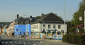
Junglinster
Administrative division in Grevenmacher, Luxembourg
Distance: Approx. 451 meters
Latitude and longitude: 49.7111,6.2514
Junglinster (Luxembourgish: Jonglënster) is a commune in central Luxembourg, which draws its name from its principal town, Junglinster. It is one of six communes in the Luxembourg canton of Grevenmacher. The 18th-century St Martin's church is a national monument.
Beidweiler
Distance: Approx. 3537 meters
Latitude and longitude: 49.71666667,6.3
Beidweiler (Luxembourgish: Beidler) is a village in the commune of Junglinster, in central Luxembourg. As of 2024, the village has a population of 277.
Altlinster
Distance: Approx. 2826 meters
Latitude and longitude: 49.71666667,6.21666667
Altlinster (Luxembourgish: Allënster) is a village in the commune of Junglinster, in central Luxembourg. As of 2024, it has a population of 157 inhabitants.

Bourglinster
Town in Junglinster, Luxembourg
Distance: Approx. 2743 meters
Latitude and longitude: 49.7,6.21666667
Bourglinster (Luxembourgish: Buerglënster, German: Burglinster) is a small town in the commune of Junglinster, in central Luxembourg. As of 2024, the town has a population of 776. The town's 11th century restored Bourglinster Castle, with its onsite restaurant, is frequently used as a venue for conferences and cultural events.

Godbrange
Village in central Luxembourg
Distance: Approx. 3238 meters
Latitude and longitude: 49.73333333,6.23333333
Godbrange (Luxembourgish: Guedber, German: Godbringen) is a village in the commune of Junglinster, in central Luxembourg. As of 2024, the village has a population of 624 inhabitants.
Gonderange
Town in Junglinster, Luxembourg
Distance: Approx. 1752 meters
Latitude and longitude: 49.69166667,6.24916667
Gonderange (Luxembourgish: Gonnereng, German: Gonderingen) is a town in the commune of Junglinster, in central Luxembourg. As of 2024, the town has a population of 1,983 inhabitants. Cyclist Franz Neuens, who competed at the 1936 Summer Olympics, was born here.

Rodenbourg
Former commune of Luxembourg in Grevenmacher
Distance: Approx. 3435 meters
Latitude and longitude: 49.68333333,6.28333333
Rodenbourg (Luxembourgish: Roudemer, German: Rodenburg) is a village in the commune of Junglinster, in central Luxembourg. As of 2024, the village has a population of 227 inhabitants. Rodenbourg gave its name to a commune in the canton of Grevenmacher until 1 January 1979, when it was merged into the commune of Junglinster.
Ernster
Distance: Approx. 2666 meters
Latitude and longitude: 49.68333333,6.25
Ernster (Luxembourgish: Iernster) is a small town in the commune of Niederanven, in central Luxembourg. As of 2024, the town has a population of 449.

Radio 100,7
Radio station in Luxembourg
Distance: Approx. 1658 meters
Latitude and longitude: 49.71973889,6.26552778
radio 100,7 is a public service radio station in the Grand Duchy of Luxembourg. Broadcasting in the Luxembourgish language, the station's principal focus is on culture and information, although entertainment – in the form of a relatively wide spectrum of music, with the accent on classical – also features prominently.

Bourglinster Castle
Castle in Luxembourg
Distance: Approx. 2743 meters
Latitude and longitude: 49.7,6.21666667
Bourglinster Castle (Luxembourgish: Schlass Buerglënster; French: Château de Bourglinster; German: Schloss Burglinster) is located in the village of Bourglinster in central Luxembourg some 17 km (11 mi) to the east of Luxembourg City. Now housing a restaurant and facilities for business and cultural gatherings, the castle has a history stretching back to the 11th century.

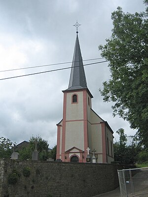
St Martin's church, Junglinster
Roman Catholic church in Luxembourg
Distance: Approx. 814 meters
Latitude and longitude: 49.71449,6.25231
St Martin's church is an 18th-century listed building and Catholic parish church in Junglinster, Grevenmacher (Luxembourg). It contains artworks and monuments from the older parish church that the building replaced. The oldest monuments commemorate members of the noble d'Orley family, to whom the Renaissance artist Bernard van Orley was related.
Weather in this IP's area
light snow
-1 Celsius
-5 Celsius
-1 Celsius
-1 Celsius
1013 hPa
82 %
1013 hPa
976 hPa
4802 meters
3.67 m/s
8.27 m/s
121 degree
100 %

