146.19.22.59 - IP Lookup: Free IP Address Lookup, Postal Code Lookup, IP Location Lookup, IP ASN, Public IP
Country:
Region:
City:
Location:
Time Zone:
Postal Code:
IP information under different IP Channel
ip-api
Country
Region
City
ASN
Time Zone
ISP
Blacklist
Proxy
Latitude
Longitude
Postal
Route
Luminati
Country
ASN
Time Zone
Europe/Vilnius
ISP
IPXO
Latitude
Longitude
Postal
IPinfo
Country
Region
City
ASN
Time Zone
ISP
Blacklist
Proxy
Latitude
Longitude
Postal
Route
IP2Location
146.19.22.59Country
Region
washington
City
white center
Time Zone
America/Los_Angeles
ISP
Language
User-Agent
Latitude
Longitude
Postal
db-ip
Country
Region
City
ASN
Time Zone
ISP
Blacklist
Proxy
Latitude
Longitude
Postal
Route
ipdata
Country
Region
City
ASN
Time Zone
ISP
Blacklist
Proxy
Latitude
Longitude
Postal
Route
Popular places and events near this IP address

White Center, Washington
Census-designated place in Washington, United States
Distance: Approx. 1225 meters
Latitude and longitude: 47.5075,-122.3475
White Center is a census-designated place (CDP) in King County, Washington, United States. It lies between West Seattle and Burien. The population was 16,631 at the 2020 census.

Chief Sealth International High School
High school in Seattle, Washington
Distance: Approx. 1615 meters
Latitude and longitude: 47.529655,-122.366154
Chief Sealth International High School (CSIHS) is a public high school in the Seattle Public Schools district of Seattle, Washington. Opened in 1957 in southern West Seattle, Chief Sealth students comprise one of the most ethnically and culturally diverse student bodies in Washington State. The school is named for Chief Seattle, a Duwamish chief and a recognized leader amongst the local peoples at the time of the arrival of European American settlers in the area.
Westwood, Seattle
Neighborhood in Seattle, Washington, U.S.
Distance: Approx. 1386 meters
Latitude and longitude: 47.52638889,-122.3675
Westwood is a neighborhood in Seattle, Washington, United States. It is located in the southwest part of the city known as West Seattle, close to the neighboring CDP of White Center. Westwood is known for its International Baccalaureate high school, Chief Sealth High.

Arbor Heights, Seattle
Distance: Approx. 1952 meters
Latitude and longitude: 47.50955,-122.37819
Arbor Heights is a neighborhood of West Seattle in Seattle Washington, made up of the area south of SW Roxbury Street, north and east of Puget Sound, but excluding the downhill portion on the west side of this region. It is the southernmost section of West Seattle.

Evergreen High School (King County, Washington)
Public high school in Seattle, Washington
Distance: Approx. 2028 meters
Latitude and longitude: 47.50027778,-122.34527778
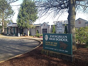
Evergreen High School is a public high school in the Highline School District and located in White Center, an unincorporated area of King County, Washington. The school is located just south of the heavily polluted Hicklin Lake. Evergreen High School's mascot is the wolverine.

Denny International Middle School
Middle school in Seattle, WA
Distance: Approx. 1646 meters
Latitude and longitude: 47.53,-122.36611111
Denny International Middle School (DIMS) is a middle school in West Seattle, the southwest portion of Seattle, Washington. Operated by Seattle Public Schools. It is named for David T. Denny, one of Seattle’s early settlers and an early member of the Seattle School Board.

Marra Farm
Distance: Approx. 2096 meters
Latitude and longitude: 47.52166667,-122.32777778
Marra Farm, a 4-acre (1.6 ha) plot of land in Marra-Desimone Park, South Park, Seattle, Washington is one of only two historic agricultural parcels inside Seattle city limits that retains an agricultural use today; the other is Picardo Farm. It was operated from the early 1900s until the 1970s as a truck farm by the Italian American Marra family, and then sold to King County. Little was done with the land until 1997, when several neighborhood residents and one VISTA volunteer began restoration efforts.
Big Al Brewing
Distance: Approx. 372 meters
Latitude and longitude: 47.51432,-122.35265
Big Al Brewing was a brewery in White Center, Washington, United States. It was started in August 2008 by Alejandro Brown with a Belgian-style wheat beer and an Irish red ale. The brewery is located in Pacific Rim Brewing's former facility.
White Center COVID-19 quarantine site
COVID-19 quarantine site in Washington, United States
Distance: Approx. 2073 meters
Latitude and longitude: 47.50333333,-122.33666667
The White Center COVID-19 quarantine site is a quarantine site in the unincorporated King County neighborhood of White Center, near Seattle, Washington, in the United States. Residents who are diagnosed with COVID-19 but can not be quarantined at home, but who do not need emergency medical care, will be housed there. Many of them are expected to be the homeless.

Lumber Yard Bar
Gay bar in White Center, Washington, U.S.
Distance: Approx. 86 meters
Latitude and longitude: 47.51652778,-122.35486111
Lumber Yard Bar is a gay bar in White Center, in the U.S. state of Washington. Nathan Adams and Michale Farrar opened the bar in 2018. The business relocated in 2021, the result of arson.

Hicklin Lake
Lake in King County, Washington
Distance: Approx. 1752 meters
Latitude and longitude: 47.50305556,-122.345
Hicklin Lake is a small lake in the White Center census-designated place of King County, Washington, near Evergreen High School, Cascade Middle School, and Dick Thurnau Park (Lakewood Park). Due to its geography and drainage basin, it has suffered from pollution and eutrophication. Artificial islands were placed in the lake in 2013 to reduce pollution, but they have failed to reduce nutrient concentrations.
Tomo (restaurant)
Restaurant in White Center, Washington, U.S.
Distance: Approx. 236 meters
Latitude and longitude: 47.515205,-122.355355
Tomo is a restaurant in White Center, Washington. Chef Brady Williams opened the restaurant in 2021.
Weather in this IP's area
scattered clouds
6 Celsius
4 Celsius
5 Celsius
7 Celsius
1027 hPa
92 %
1027 hPa
1018 hPa
10000 meters
3.09 m/s
190 degree
40 %