146.185.53.28 - IP Lookup: Free IP Address Lookup, Postal Code Lookup, IP Location Lookup, IP ASN, Public IP
Country:
Region:
City:
Location:
Time Zone:
Postal Code:
ISP:
ASN:
language:
User-Agent:
Proxy IP:
Blacklist:
IP information under different IP Channel
ip-api
Country
Region
City
ASN
Time Zone
ISP
Blacklist
Proxy
Latitude
Longitude
Postal
Route
db-ip
Country
Region
City
ASN
Time Zone
ISP
Blacklist
Proxy
Latitude
Longitude
Postal
Route
IPinfo
Country
Region
City
ASN
Time Zone
ISP
Blacklist
Proxy
Latitude
Longitude
Postal
Route
IP2Location
146.185.53.28Country
Region
vlaams-brabant
City
grimbergen
Time Zone
Europe/Brussels
ISP
Language
User-Agent
Latitude
Longitude
Postal
ipdata
Country
Region
City
ASN
Time Zone
ISP
Blacklist
Proxy
Latitude
Longitude
Postal
Route
Popular places and events near this IP address

Grimbergen
Municipality in Flemish Community, Belgium
Distance: Approx. 793 meters
Latitude and longitude: 50.93333333,4.38333333
Grimbergen (Dutch pronunciation: [ˈɣrɪmbɛrɣə(n)]) is a municipality in the province of Flemish Brabant, in the Flemish region of Belgium, 10 km (6.2 mi) north of the capital Brussels. The municipality comprises the towns of Beigem, Grimbergen, Humbeek, and Strombeek-Bever. In 2017, Grimbergen had a total population of 37,030.

Meise
Municipality in Flemish Community, Belgium
Distance: Approx. 2721 meters
Latitude and longitude: 50.93333333,4.33333333
Meise (Dutch pronunciation: [ˈmɛisə]) is a municipality in the province of Flemish Brabant, in the Flemish region of Belgium. The municipality comprises the towns of Meise proper and Wolvertem (a deelgemeente), and several smaller villages like Sint-Brixius-Rode, Oppem, Meusegem, Impde/Imde, Rossem, Westrode and quarters as Bouchout, Nerom and Slozen. On January 1, 2006, Meise had a total population of 18,464.

Vilvoorde
City and municipality in Flemish Community, Belgium
Distance: Approx. 3128 meters
Latitude and longitude: 50.93333333,4.41666667
Vilvoorde (Dutch pronunciation: [ˈvɪlvoːrdə] ; West Flemish: Vilvôorde; French: Vilvorde [vilvɔʁd]; historically known as Filford in English) is a Belgian city and municipality in the Halle-Vilvoorde district (arrondissement) of the province of Flemish Brabant. The municipality comprises the city of Vilvoorde proper with its two outlying quarters of Koningslo and Houtem and the small town of Peutie. The official language of Vilvoorde is Dutch, as in the rest of Flanders.

Bouchout Castle
Castle in Meise, Belgium
Distance: Approx. 3110 meters
Latitude and longitude: 50.9281,4.3288
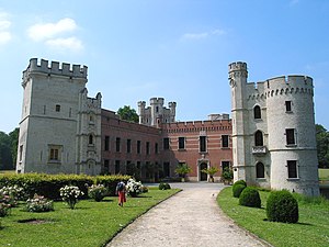
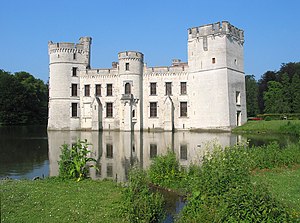
Bouchout Castle (Dutch: Kasteel van Bouchout, pronounced [kɑˈsteːl vɑm ˈbuxʌut]; French: Château de Bouchout, pronounced [ʃɑto d(ə) bukawt]) is a castle in Meise, Flemish Brabant, Belgium. In the 12th century, this territory of the young Duchy of Brabant was strategically positioned between the County of Flanders and the Berthout family, lords of Grimbergen. Most likely, the first fortification was built by Wouter van Craaynem at the end of the Grimbergen Wars (1150–1170).

Grimbergen Abbey
Premonstratensian monastery in Flemish Brabant, Belgium
Distance: Approx. 92 meters
Latitude and longitude: 50.93388889,4.37083333
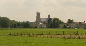
Grimbergen Abbey is a Premonstratensian monastery in Grimbergen, Flemish Brabant, Belgium, established in 1128 in the place of an earlier foundation of Augustinian Canons. The abbey itself was dissolved in 1796 in the aftermath of the French Revolution, but the abbey church of Saint Servatius survived as the parish church of Grimbergen. After the French Revolution the abbey was reinstated.

Neder-Over-Heembeek
Neighbourhood in Brussels, Belgium
Distance: Approx. 3877 meters
Latitude and longitude: 50.9,4.38333333
Neder-Over-Heembeek (French: [nedœʁ ovœʁ embek]; Dutch: [ˈneːdər oːvər ˈɦeːmbeːk] ) is a former municipality of Brussels, Belgium, that was merged into the City of Brussels in 1921. Nowadays, it is a northern section of that municipality, and a predominantly industrial zone, especially known for the Queen Astrid Military Hospital, which is the National Burns and Poisons Centre.

Grimbergen Airfield
Airport in Grimbergen, Belgium
Distance: Approx. 2132 meters
Latitude and longitude: 50.94861111,4.39194444
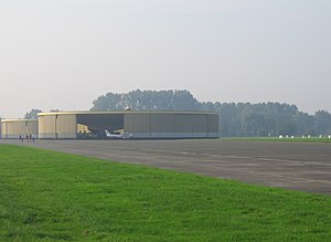
Grimbergen Airfield (Dutch: Vliegveld Grimbergen, ICAO: EBGB) is a general aviation aerodrome located in Grimbergen, a municipality of the province of Flemish Brabant in Belgium.

Museum for Old Techniques
Distance: Approx. 736 meters
Latitude and longitude: 50.9275,4.3714
The Museum for Old Techniques (Dutch: Museum voor de Oudere Technieken, MOT) is located in Grimbergen, Belgium. The museum has an extensive collection of hand tools, technical manuals and trade catalogues. The MOT studies the history of techniques, more specifically natural power.

Strombeek-Bever
Town in Flemish Region, Belgium
Distance: Approx. 3099 meters
Latitude and longitude: 50.91,4.35
Strombeek-Bever is a town with approximately 11,500 inhabitants in the municipality of Grimbergen, in the province of Flemish Brabant, Belgium. A suburb on the north side of Brussels, it is separated from Grimbergen proper by the R0 ring road around the city. It borders the Mutsaard neighbourhood of Laeken (within Brussels) to the south and the municipality of Vilvoorde to the east.

Military Ordinariate of Belgium
Catholic ecclesiastical jurisdiction
Distance: Approx. 3308 meters
Latitude and longitude: 50.907471,4.39301
The Military Ordinariate of Belgium (Dutch: Bisdom bij de Krijgsmacht, French: Diocèse aux Forces armées belges) is a Latin Church military ordinariate of the Catholic Church in Belgium. Immediately exempt to the Holy See, it provides pastoral care to Catholics serving in the Belgian Armed Forces and their families.
Humbeek
Place in Flemish Region, Belgium
Distance: Approx. 3645 meters
Latitude and longitude: 50.96666667,4.36666667
Humbeek is a small town in Belgium with approximately 4,574 inhabitants. It is located in the municipality of Grimbergen, in the province of Flemish Brabant. Humbeek has an area of 7.87 km2 and a population density of 506 inhabitants per km2.

Prinsenkasteel
Castle in Grimberger, Belgium
Distance: Approx. 644 meters
Latitude and longitude: 50.92833333,4.37138889
Prinsenkasteel (literally "Princes Castle") was a castle located in Grimbergen, Belgium. It was the residence of the lords of Grimbergen from the 14th Century onwards. The castle ruins are located in Prinsenbos Park ("Princes wood").
Weather in this IP's area
broken clouds
-0 Celsius
-2 Celsius
-1 Celsius
0 Celsius
1019 hPa
93 %
1019 hPa
1015 hPa
6000 meters
1.54 m/s
180 degree
75 %