Country:
Region:
City:
Latitude and Longitude:
Time Zone:
Postal Code:
IP information under different IP Channel
ip-api
Country
Region
City
ASN
Time Zone
ISP
Blacklist
Proxy
Latitude
Longitude
Postal
Route
Luminati
Country
Region
co
City
denver
ASN
Time Zone
America/Denver
ISP
CISCO-UMBRELLA
Latitude
Longitude
Postal
IPinfo
Country
Region
City
ASN
Time Zone
ISP
Blacklist
Proxy
Latitude
Longitude
Postal
Route
db-ip
Country
Region
City
ASN
Time Zone
ISP
Blacklist
Proxy
Latitude
Longitude
Postal
Route
ipdata
Country
Region
City
ASN
Time Zone
ISP
Blacklist
Proxy
Latitude
Longitude
Postal
Route
Popular places and events near this IP address
Great American Beer Festival
Beer event in Denver, Colorado, United States
Distance: Approx. 160 meters
Latitude and longitude: 39.7392,-104.985
The Great American Beer Festival (GABF) is an annual beer festival hosted by the Brewers Association, held in Denver, Colorado. Typically held in late September or early October, the event is currently held at Denver's Colorado Convention Center. Established in 1982, it is the largest ticketed beer festival in the U.S. and one of the largest in the world.
List of companies with Denver area operations
List of companies with operations the Denver metropolitan area
Distance: Approx. 160 meters
Latitude and longitude: 39.7392,-104.985
This is a list of notable companies based, or having major operations, in the Denver metropolitan area.
Colorado Supreme Court
Highest court in the U.S. state of Colorado
Distance: Approx. 74 meters
Latitude and longitude: 39.738136,-104.986741
The Colorado Supreme Court is the highest court in the U.S. state of Colorado. Located in Denver, the court was established in 1876. It consists of a Chief Justice and six Associate Justices who are appointed by the Governor of Colorado from a list of candidates approved by a state judicial commission.
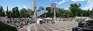
People's Fair
Distance: Approx. 154 meters
Latitude and longitude: 39.73923,-104.98851
The People's Fair was an annual event, held in early June, in Civic Center Park in Denver, Colorado, United States It was sponsored by Capitol Hill United Neighborhoods (CHUN). The People's Fair was one of several free events held annually in Denver. The first People's Fair was held in 1972 at Morey Junior High School (now Morey Middle School), with 2,000 in attendance.
Sports in Denver
Overview of sports traditions and activities in Denver, Colorado, United States
Distance: Approx. 160 meters
Latitude and longitude: 39.7392,-104.985
This is a list of sports in Denver, Colorado, United States. Denver is home to many professional sports teams who are based out of Denver and surrounding cities in the metropolitan area. It is also one of the twelve American cities to house a team from each of the U.S. cities with teams from four major league sports.
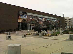
Colorado History Museum
Museum in Denver, Colorado, United States
Distance: Approx. 152 meters
Latitude and longitude: 39.737431,-104.98678
The Colorado History Museum was a museum in Denver, Colorado, United States, dedicated to the history of Colorado. It was at 1300 Broadway in Denver from 1976 to 2010, and was administered by the Colorado Historical Society, now known as History Colorado. It closed on 28 March 2010, and the building was demolished in June to make way for a new Colorado Judicial Complex.

Front Range urban corridor
Megaregion in Colorado and Wyoming, United States
Distance: Approx. 160 meters
Latitude and longitude: 39.7392,-104.985
The Front Range Urban Corridor is an oblong region of urban population located along the eastern face of the Southern Rocky Mountains, encompassing 18 counties in the US states of Colorado and Wyoming. The corridor derives its name from the Front Range, the mountain range that defines the western boundary of the corridor which serves as a gateway to the Rocky Mountains. The region comprises the northern portion of the Southern Rocky Mountain Front geographic area, which in turn comprises the southern portion of the Rocky Mountain Front geographic area of Canada and the United States.

Civil War Monument (Denver)
Sculpture in Denver, Colorado, US
Distance: Approx. 110 meters
Latitude and longitude: 39.739235,-104.985642
The Civil War Monument is a statue of a Civil War cavalryman by Jack Howland that was originally installed outside the Colorado State Capitol in Denver. The memorial is also known as the Civil War Memorial, Soldier's Monument, and Civil War Soldier. The work was dedicated on July 24, 1909, after being cast by the Bureau Brothers.

Colorado Tribute to Veterans Monument
War memorial in Denver, Colorado, U.S.
Distance: Approx. 48 meters
Latitude and longitude: 39.7392,-104.9866
The Colorado Tribute to Veterans Monument is a memorial commemorating World War I, World War II, Korea, Vietnam, and Persian Gulf War veterans, installed outside the Colorado State Capitol, in Denver. The monument was dedicated on November 10, 1990.
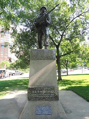
Statue of Joe P. Martínez
Sculpture in Denver, Colorado, U.S.
Distance: Approx. 103 meters
Latitude and longitude: 39.73972222,-104.98675
A 20-foot (6.1 m) bronze statue of decorated World War II soldier Joe P. Martínez is installed outside the Colorado State Capitol, in Denver.
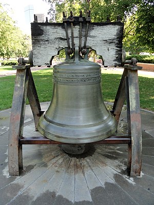
Liberty Bell (Denver)
Liberty Bell replica in Denver, Colorado, U.S.
Distance: Approx. 12 meters
Latitude and longitude: 39.738892,-104.986731
The Liberty Bell in Denver is a replica of the original Liberty Bell, installed outside the Colorado State Capitol. The bell was 1 of 53 replicas cast in France in 1950.

On the War Trail
Sculpture in Denver, Colorado, U.S.
Distance: Approx. 159 meters
Latitude and longitude: 39.738912,-104.988647
On the War Trail is a 1922 statue by Alexander Phimister Proctor, installed outside the Colorado State Capitol in Denver's Civic Center Park. The bronze sculpture depicts a Native American riding on a horse and carrying a spear.
Weather in this IP's area
clear sky
6 Celsius
5 Celsius
4 Celsius
8 Celsius
1015 hPa
43 %
1015 hPa
839 hPa
10000 meters
1.54 m/s
1.57 m/s
180 degree
06:44:07
16:45:03