Country:
 Netherlands
Region:
City:
Latitude and Longitude:
Time Zone:
Postal Code:
IP information under different IP Channel
ip-api
Country
Region
City
ASN
Time Zone
ISP
Blacklist
Proxy
Latitude
Longitude
Postal
Route
IPinfo
Country
Region
City
ASN
Time Zone
ISP
Blacklist
Proxy
Latitude
Longitude
Postal
Route
MaxMind
Country
Region
City
ASN
Time Zone
ISP
Blacklist
Proxy
Latitude
Longitude
Postal
Route
Luminati
Country
NLRegion
zh
City
zoetermeer
ASN
Time Zone
Europe/Amsterdam
ISP
SURF B.V.
Latitude
Longitude
Postal
db-ip
Country
Region
City
ASN
Time Zone
ISP
Blacklist
Proxy
Latitude
Longitude
Postal
Route
ipdata
Country
Region
City
ASN
Time Zone
ISP
Blacklist
Proxy
Latitude
Longitude
Postal
Route
Popular places and events near this IP address

Zoetermeer
City and municipality in South Holland, Netherlands
Distance: Approx. 966 meters
Latitude and longitude: 52.06666667,4.5
Zoetermeer (Dutch pronunciation: [ˌzutərˈmeːr] ) is a city in the Western Netherlands, in the province of South Holland. The municipality covers an area of 37.05 km2 (14.31 sq mi) of which 2.60 km2 (1.00 sq mi) is water. A small village until the late 1960s, it had 6,392 inhabitants in 1950.

The Hague Netherlands Temple
Temple of The Church of Jesus Christ of Latter-day Saints
Distance: Approx. 723 meters
Latitude and longitude: 52.054487,4.502979
The Hague Netherlands Temple is the 114th operating temple of the Church of Jesus Christ of Latter-day Saints (LDS Church).

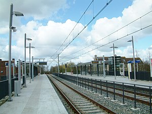
Centrum-West RandstadRail station
Railway station in the Netherlands
Distance: Approx. 796 meters
Latitude and longitude: 52.06055556,4.48361111
Centrum-West is a RandstadRail station in Zoetermeer, the Netherlands.

Stadhuis RandstadRail station (Zoetermeer)
Railway station in Zoetermeer, Netherlands
Distance: Approx. 276 meters
Latitude and longitude: 52.06083333,4.49305556
Stadhuis is a RandstadRail station in Zoetermeer, the Netherlands.
Palenstein RandstadRail station
Railway station in Zoetermeer, Netherlands
Distance: Approx. 818 meters
Latitude and longitude: 52.05944444,4.50666667
Palenstein is a RandstadRail station in Zoetermeer, the Netherlands.

Seghwaert RandstadRail station
Railway station in Zoetermeer, Netherlands
Distance: Approx. 1505 meters
Latitude and longitude: 52.06305556,4.51555556
Seghwaert is a RandstadRail station in Zoetermeer, the Netherlands.

Dorp RandstadRail station
Railway station in Zoetermeer, Netherlands
Distance: Approx. 531 meters
Latitude and longitude: 52.05416667,4.49194444
Dorp is a RandstadRail station in Zoetermeer, the Netherlands.
De Leyens RandstadRail station
RandstadRail station in Zoetermeer
Distance: Approx. 1455 meters
Latitude and longitude: 52.07166667,4.49527778
De Leyens is a RandstadRail station in Zoetermeer, the Netherlands.

Buytenwegh RandstadRail station
Rail station in Zoetermeer, the Netherlands
Distance: Approx. 1411 meters
Latitude and longitude: 52.06666667,4.47888889
Buytenwegh is a RandstadRail station in Zoetermeer, the Netherlands.

Delftsewallen RandstadRail station
Railway station in Zoetermeer, Netherlands
Distance: Approx. 1008 meters
Latitude and longitude: 52.05083333,4.48722222
Delftsewallen is a RandstadRail station in Zoetermeer, the Netherlands.

Zoetermeer Oost railway station
Railway station in the Netherlands
Distance: Approx. 1366 meters
Latitude and longitude: 52.04638889,4.49277778
Zoetermeer Oost is a railway station located in Zoetermeer, Netherlands. The station was opened in 1870, and is located on the Gouda–Den Haag railway. The train services are operated by Nederlandse Spoorwegen.

Seghwaert
District of Zoetermeer in South Holland, Netherlands
Distance: Approx. 1261 meters
Latitude and longitude: 52.065,4.51
Seghwaert is a district in Zoetermeer that was formed around the old village of Zegwaart (or Zegwaard), which fused with the municipality of Zoetermeer in 1935, using the archaic spelling of the locale's name. The old Zegwaart was a ribbon development along what remains until today as Zegwaartseweg, which is perpendicular to Dorpstraat. The district is divided into Seghwaert-Oost (2723), -Midden (2724) and -Noord (2727).
Weather in this IP's area
overcast clouds
15 Celsius
15 Celsius
14 Celsius
16 Celsius
1014 hPa
84 %
1014 hPa
1014 hPa
10000 meters
5.14 m/s
190 degree
86 %
08:14:07
18:39:24