Country:
 Netherlands
Region:
City:
Latitude and Longitude:
Time Zone:
Postal Code:
IP information under different IP Channel
ip-api
Country
Region
City
ASN
Time Zone
ISP
Blacklist
Proxy
Latitude
Longitude
Postal
Route
IPinfo
Country
Region
City
ASN
Time Zone
ISP
Blacklist
Proxy
Latitude
Longitude
Postal
Route
MaxMind
Country
Region
City
ASN
Time Zone
ISP
Blacklist
Proxy
Latitude
Longitude
Postal
Route
Luminati
Country
NLRegion
nh
City
beverwijk
ASN
Time Zone
Europe/Amsterdam
ISP
KPN B.V.
Latitude
Longitude
Postal
db-ip
Country
Region
City
ASN
Time Zone
ISP
Blacklist
Proxy
Latitude
Longitude
Postal
Route
ipdata
Country
Region
City
ASN
Time Zone
ISP
Blacklist
Proxy
Latitude
Longitude
Postal
Route
Popular places and events near this IP address

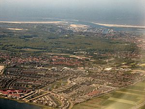
Beverwijk
Municipality in North Holland, Netherlands
Distance: Approx. 2075 meters
Latitude and longitude: 52.48333333,4.65
Beverwijk (Dutch pronunciation: [ˌbeːvərˈʋɛik] ) is a municipality and a city in the Netherlands, in the province of North Holland. The town is located about 20 kilometres (12 mi) northwest of Amsterdam in the Randstad metropolitan area, north of the North Sea Canal very close to the North Sea coast. A railway tunnel and two motorway tunnels cross the canal between Beverwijk and the nearby city of Haarlem on the south side of the canal.
Velsen
Municipality in North Holland, Netherlands
Distance: Approx. 932 meters
Latitude and longitude: 52.46666667,4.61666667
Velsen (Dutch pronunciation: [ˈvɛlzə(n)] ) is a municipality in the Netherlands, in the province of North Holland. It is located on both sides of the North Sea Canal. On the north side of the North Sea Canal there is a major steel plant, Tata Steel IJmuiden, formerly known as Koninklijke Hoogovens (the town of IJmuiden is actually located south of the canal).

IJmuiden
City in North Holland, Netherlands
Distance: Approx. 1725 meters
Latitude and longitude: 52.45861111,4.61944444
IJmuiden (Dutch pronunciation: [ɛiˈmœydə(n)]) is a port city in the Dutch province of North Holland. It is the main town in the municipality of Velsen which lies mainly to the south-east. Including its large sea locks, it straddles the mouth of the North Sea Canal to Amsterdam.

Tata Steel Netherlands
Former Dutch steel company
Distance: Approx. 2192 meters
Latitude and longitude: 52.47839,4.59212
Koninklijke Hoogovens known as Koninklijke Nederlandse Hoogovens en Staalfabrieken (KNHS) until 1996 or informally Hoogovens. is a Dutch steel producer founded in 1918. Since 2010, the plant is named Tata Steel IJmuiden.

Velsen-Zuid
Village in North Holland, Netherlands
Distance: Approx. 2381 meters
Latitude and longitude: 52.46,4.65027778
Velsen-Zuid (Dutch pronunciation: [ˌvɛlzə(n) ˈzœyt]) is a town in the Dutch province of North Holland. It is a part of the municipality of Velsen, and lies about 9 km north of Haarlem. Velsen-Zuid developed around the church founded by Willibrord in the 8th century.
Velsen-Noord
Village in North Holland, Netherlands
Distance: Approx. 1407 meters
Latitude and longitude: 52.47222222,4.64416667
Velsen-Noord (Dutch pronunciation: [ˌvɛlzə ˈnoːrt]) is a village in the Dutch province of North Holland. It is a part of the municipality of Velsen, and lies about 10 km north of Haarlem. From 1865 on, when the construction on the North Sea Canal began, the town of Velsen, which originated in Roman times, was split in two parts.

Sportpark Schoonenberg
Football stadium in the Netherlands
Distance: Approx. 2242 meters
Latitude and longitude: 52.455,4.635
Sportpark Schoonenberg (Dutch pronunciation: [ˈspɔrtpɑr(ə)k ˈsxoːnə(m)bɛr(ə)x]), branded as 711 Stadion for sponsorship reasons, is the home of Eerste Divisie club Telstar and Eredivisie Vrouwen club Telstar. It is located in Velsen-Zuid, Netherlands. It was opened in 1948, with minor renovations in 1999.

Beverwijk railway station
Railway station in the Netherlands
Distance: Approx. 2259 meters
Latitude and longitude: 52.47833333,4.65611111
Beverwijk railway station is located in Beverwijk, the Netherlands. The station opened on 1 May 1867 and is on the Haarlem–Uitgeest railway.

Hoogovensmuseum
Distance: Approx. 218 meters
Latitude and longitude: 52.47194444,4.62361111
The Hoogovensmuseum is a museum located on the northern side of the North Sea Canal sluice gates at IJmuiden, in the former "buizengieterij" (pipe making factory) of Koninklijke Hoogovens, now Tata Steel IJmuiden, on the Buizenweg in Velsen-Noord. It overlooks the binnenkanaal where water was pumped up to use for cooling. The former cooling bath house has been converted to an exhibition space.
VVK Telstar
Dutch women's football (soccer) club
Distance: Approx. 2242 meters
Latitude and longitude: 52.455,4.635
Vrouwenvoetbal Kennemerland e.o. (VVK) or Telstar Vrouwen is a Dutch women's football club based in Velsen, North Holland that plays in the Dutch top level Eredivisie. It is affiliated with men's team SC Telstar.
Mekog
Distance: Approx. 642 meters
Latitude and longitude: 52.475809,4.614658
Mekog (Maatschappij tot Exploitatie van Kooksovengas, English coke oven gas exploitation company) was a chemical company founded 1928, that manufactured fertilizer using hydrogen from coke oven gas as a feedstock. The company's facilities were located on the site of the Koninklijke Nederlandsche Hoogovens en Staalfabrieken steelworks near IJmuiden in the Netherlands.
IJmuiden sea lock
Water navigation device serving Port of Amsterdam
Distance: Approx. 1108 meters
Latitude and longitude: 52.466358,4.612942
The IJmuiden sea lock (Dutch: zeesluis IJmuiden) serving Port of Amsterdam via the North Sea Canal is the largest lock in the world when considering dimensions. The lock, situated in IJmuiden in the municipality of Velsen, was opened on 26 January 2022 in the presence of King Willem-Alexander of the Netherlands. The locks of IJmuiden have a history dating back to 1876, when the largest lock of that era was opened.
Weather in this IP's area
light rain
15 Celsius
15 Celsius
14 Celsius
16 Celsius
1013 hPa
93 %
1013 hPa
1012 hPa
10000 meters
1.28 m/s
1.38 m/s
192 degree
60 %
08:12:34
18:40:17