145.248.209.95 - IP Lookup: Free IP Address Lookup, Postal Code Lookup, IP Location Lookup, IP ASN, Public IP
Country:
 France
Region:
City:
Location:
Time Zone:
Postal Code:
ISP:
ASN:
language:
User-Agent:
Proxy IP:
Blacklist:
IP information under different IP Channel
ip-api
Country
Region
City
ASN
Time Zone
ISP
Blacklist
Proxy
Latitude
Longitude
Postal
Route
db-ip
Country
Region
City
ASN
Time Zone
ISP
Blacklist
Proxy
Latitude
Longitude
Postal
Route
IPinfo
Country
Region
City
ASN
Time Zone
ISP
Blacklist
Proxy
Latitude
Longitude
Postal
Route
IP2Location
145.248.209.95Country
frRegion
ile-de-france
City
chaville
Time Zone
Europe/Paris
ISP
Language
User-Agent
Latitude
Longitude
Postal
ipdata
Country
Region
City
ASN
Time Zone
ISP
Blacklist
Proxy
Latitude
Longitude
Postal
Route
Popular places and events near this IP address

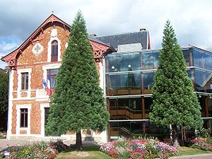
Chaville
Commune in Île-de-France, France
Distance: Approx. 358 meters
Latitude and longitude: 48.8086,2.1886
Chaville (French pronunciation: [ʃavil] ) is a commune in the Hauts-de-Seine department and Île-de-France region of north-central France. It lies some 12 kilometres (7.5 mi) from the centre of Paris in the south-western suburbs of the French capital.

Ville-d'Avray
Commune in Île-de-France, France
Distance: Approx. 2336 meters
Latitude and longitude: 48.8261,2.1933
Ville-d'Avray (French pronunciation: [vil davʁɛ] ) is a commune in the western suburbs of Paris, France. It is located 11.9 km (7.4 mi) from the centre of Paris. The commune is part of the arrondissement of Boulogne-Billancourt in the Hauts-de-Seine department.

Vélizy-Villacoublay
Commune in Île-de-France, France
Distance: Approx. 2473 meters
Latitude and longitude: 48.7834,2.1834
Vélizy-Villacoublay is a commune in the Yvelines department in the Île-de-France in north-central France. It is located in the south-western suburbs of Paris 13.9 km (8.6 mi) from the center and 3.2 km (2.0 mi) east of Versailles. Its inhabitants are called Véliziens.
Viroflay
Commune in Île-de-France, France
Distance: Approx. 1660 meters
Latitude and longitude: 48.8,2.167
Viroflay (French pronunciation: [viʁɔflɛ] ) is a commune in the Yvelines department in the Île-de-France in north-central France. It is located in the south-western suburbs of Paris 14.1 km (8.8 mi) from the center and 3 km (1.9 mi) from the Palace of Versailles. The town motto is Lux mea lex which is Latin for "Light is my law".
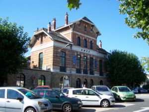
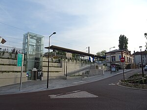
Chaville–Vélizy station
Railway station in Viroflay, France
Distance: Approx. 805 meters
Latitude and longitude: 48.799,2.183
Chaville–Vélizy is a railway station of the RER C train line located on the border between Chaville and Vélizy.

Lycée privé Sainte-Geneviève
Distance: Approx. 2415 meters
Latitude and longitude: 48.80361111,2.15527778
Lycée Sainte-Geneviève (French pronunciation: [lise sɛ̃t ʒənvjɛv]) is a higher education institution located in France, Established in 1854, it is a private lycée, located in Versailles, providing preparatory classes for grandes écoles. It was founded by the Jesuits in Paris. It is often nicknamed Ginette and sometimes BJ, standing for Boite à Jèzes (Box of Jesuits).

Sèvres
Commune in Île-de-France, France
Distance: Approx. 2690 meters
Latitude and longitude: 48.8239,2.2117
Sèvres (, French: [sɛvʁ] ) is a French commune in the southwestern suburbs of Paris. It is located 9.9 kilometres (6.2 miles) from the centre of Paris, in the Hauts-de-Seine department of the Île-de-France region. The commune, which had a population of 23,251 as of 2018, is known for its famous porcelain production at the Manufacture nationale de Sèvres, which was also where the Treaty of Sèvres (1920) was signed.

Porchefontaine
Distance: Approx. 2621 meters
Latitude and longitude: 48.79527778,2.15583333
Porchefontaine is a neighborhood in the south-east of Versailles, in Yvelines department of France. It was a living working class residential area. Since the 1970s, the neighborhood declined in activity and population.

Montreuil station
Railway station in Versailles, France
Distance: Approx. 2722 meters
Latitude and longitude: 48.80654654,2.15101349
Montreuil station is a railway station in the commune of Versailles (department of Yvelines), in the Montreuil neighborhood. It is in the Île-de-France region of France and is part of the Transilien rail network, on the Paris–Saint Lazare –Versailles Rive Droite railway.

Lycée Jean Pierre Vernant
Senior high school in France
Distance: Approx. 2833 meters
Latitude and longitude: 48.8256,2.2116
Lycée Jean Pierre Vernant is a senior high school/sixth-form college in Sèvres, Hauts-de-Seine, France, in the Paris metropolitan area. The school serves Sèvres, Chaville, Saint-Cloud, and Ville d'Avray. It was formerly known as the Lycée de Sèvres.
Viroflay Rive Droite station
Railway station in Viroflay, France
Distance: Approx. 1452 meters
Latitude and longitude: 48.8056,2.1683
Viroflay-Rive-Droite station (French: Gare de Viroflay-Rive-Droite) is a railway station in the commune of Viroflay (department of Yvelines). It is in the Île-de-France region of France and is part of the Transilien rail network, on the Paris-Saint-Lazare – Versailles-Rive-Droite line. It is also an underground tram-on-tyres stop on line 6.

Castel Henriette
Distance: Approx. 2274 meters
Latitude and longitude: 48.822887,2.20413
Castel Henriette was a villa designed by the Art Nouveau architect Hector Guimard in Sèvres, France, in 1899. It was completed in 1900 and modified in 1903 with the removal of the look-out tower, and was demolished in 1969.
Weather in this IP's area
fog
5 Celsius
2 Celsius
4 Celsius
5 Celsius
1039 hPa
99 %
1039 hPa
1025 hPa
400 meters
2.68 m/s
2.68 m/s
36 degree
100 %