145.225.60.181 - IP Lookup: Free IP Address Lookup, Postal Code Lookup, IP Location Lookup, IP ASN, Public IP
Country:
Region:
City:
Location:
Time Zone:
Postal Code:
ISP:
ASN:
language:
User-Agent:
Proxy IP:
Blacklist:
IP information under different IP Channel
ip-api
Country
Region
City
ASN
Time Zone
ISP
Blacklist
Proxy
Latitude
Longitude
Postal
Route
db-ip
Country
Region
City
ASN
Time Zone
ISP
Blacklist
Proxy
Latitude
Longitude
Postal
Route
IPinfo
Country
Region
City
ASN
Time Zone
ISP
Blacklist
Proxy
Latitude
Longitude
Postal
Route
IP2Location
145.225.60.181Country
Region
brandenburg
City
linde
Time Zone
Europe/Berlin
ISP
Language
User-Agent
Latitude
Longitude
Postal
ipdata
Country
Region
City
ASN
Time Zone
ISP
Blacklist
Proxy
Latitude
Longitude
Postal
Route
Popular places and events near this IP address

Märkisch Luch
Municipality in Brandenburg, Germany
Distance: Approx. 3939 meters
Latitude and longitude: 52.56666667,12.61666667
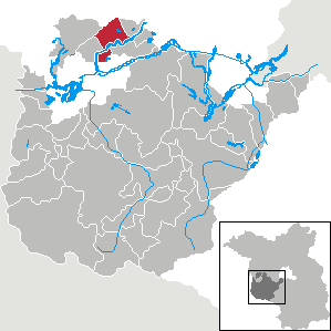
Märkisch Luch is a municipality in the Havelland district, in Brandenburg, Germany.

Beetzseeheide
Municipality in Brandenburg, Germany
Distance: Approx. 5410 meters
Latitude and longitude: 52.5,12.63305556
Beetzseeheide is a municipality in the Potsdam-Mittelmark district, in Brandenburg, Germany.

Päwesin
Municipality in Brandenburg, Germany
Distance: Approx. 4830 meters
Latitude and longitude: 52.51666667,12.71666667
Päwesin is a municipality in the Potsdam-Mittelmark district, in Brandenburg, Germany.

Roskow
Municipality in Brandenburg, Germany
Distance: Approx. 9945 meters
Latitude and longitude: 52.46666667,12.73305556
Roskow is a municipality in the Potsdam-Mittelmark district, in Brandenburg, Germany.
Buschow station
Railway station in Märkisch Luch, Germany
Distance: Approx. 5718 meters
Latitude and longitude: 52.59222222,12.62916667
Buschow (German: Bahnhof Buschow) is a railway station in the town of Märkisch Luch, Brandenburg, Germany. The station lies south of the Berlin–Lehrte railway and the train services are operated by Ostdeutsche Eisenbahn (ODEG).

Havelland Luch
Distance: Approx. 8621 meters
Latitude and longitude: 52.61277778,12.60083333
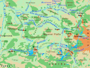
The Havelland Luch (German: Havelländisches Luch) is a lowland area inside a bend of the River Havel west of Berlin, and forms the heart of the Havelland region.

Havelland
Region in Brandenburg, Germany
Distance: Approx. 7752 meters
Latitude and longitude: 52.5,12.75
Geographically, the Havelland is the region around which the River Havel flows in a U-shape between Oranienburg to the northeast and Rhinow to the northwest. The northern boundary of the Havelland is formed by the River Rhin and the Rhin Canal. In the history of Brandenburg, the Havelland represents a historic region.

Nauen Plateau
Distance: Approx. 9304 meters
Latitude and longitude: 52.55,12.8
The Nauen Plateau (German: Nauener Platte) is a low plateau in the German states of Brandenburg and Berlin. It rises above the surrounding countryside by an average of 15 metres (49 ft) and is a largely contiguous upland area that was formed during the Saale and Weichselian glaciations. It consists predominantly of ground moraine deposits, partly overlain by gently rolling end moraine formations.

Weißes Fenn Marzahne
Distance: Approx. 9256 meters
Latitude and longitude: 52.52479,12.53025
The Weißes Fenn Marzahne is a lake, a boggy wetland and a natural monument area in the county of Potsdam-Mittelmark, in the borough of Havelsee north of the village of Marzahne in the Seelensdorf Forest and Marzahn Heath.
Weather in this IP's area
clear sky
1 Celsius
-1 Celsius
1 Celsius
1 Celsius
1037 hPa
81 %
1037 hPa
1033 hPa
10000 meters
1.83 m/s
1.84 m/s
256 degree
2 %