Country:
Region:
City:
Latitude and Longitude:
Time Zone:
Postal Code:
IP information under different IP Channel
ip-api
Country
Region
City
ASN
Time Zone
ISP
Blacklist
Proxy
Latitude
Longitude
Postal
Route
Luminati
Country
ASN
Time Zone
Europe/Amsterdam
ISP
ING Bank N.V.
Latitude
Longitude
Postal
IPinfo
Country
Region
City
ASN
Time Zone
ISP
Blacklist
Proxy
Latitude
Longitude
Postal
Route
db-ip
Country
Region
City
ASN
Time Zone
ISP
Blacklist
Proxy
Latitude
Longitude
Postal
Route
ipdata
Country
Region
City
ASN
Time Zone
ISP
Blacklist
Proxy
Latitude
Longitude
Postal
Route
Popular places and events near this IP address

Rotterdam The Hague Airport
Airport in Zestienhoven, Rotterdam, the Netherlands
Distance: Approx. 1388 meters
Latitude and longitude: 51.95694444,4.44027778
Rotterdam The Hague Airport (formerly Rotterdam Airport, Vliegveld Zestienhoven in Dutch), (IATA: RTM, ICAO: EHRD) is a minor international airport serving Rotterdam, the Netherlands' second largest city, and The Hague, its administrative and royal capital. It is located 5.5 kilometres (3.4 mi; 3.0 nmi) north northwest of Rotterdam in South Holland and is the third busiest airport in the Netherlands. The airport handled over 2.1 million passengers in 2019 and features scheduled flights to European metropolitan and leisure destinations.
Hillegersberg
Neighbourhood in the City of Rotterdam in South Holland, Netherlands
Distance: Approx. 2076 meters
Latitude and longitude: 51.95138889,4.48888889
Hillegersberg (Dutch pronunciation: [ˈɦɪləɣərzˌbɛr(ə)x]) is a neighbourhood of Rotterdam, Netherlands. Primarily a green residential area with lakes, canals and parks, it was incorporated into the city of Rotterdam in 1941. Settlement around its Hillegonda church was first established here in 990.

Hazelaarweg Stadion
Sports stadium
Distance: Approx. 2023 meters
Latitude and longitude: 51.9679,4.48498
The Hazelaarweg Stadion is a multi-use stadium in Rotterdam, Netherlands, run by one of the largest field hockey clubs in the Netherlands, HC Rotterdam. It is close to the international cricket ground occupied by VOC Rotterdam.

Schiebroek
Distance: Approx. 1853 meters
Latitude and longitude: 51.96666667,4.48333333
Schiebroek (Dutch pronunciation: [sxiˈbruk]) is a former village in the province of South Holland, Netherlands. It is now a neighbourhood of Rotterdam, and part of the borough of Hillegersberg-Schiebroek. Schiebroek was a separate municipality between 1817 and 1941, when it became part of Rotterdam.

Rodenrijs RandstadRail station
Metro station in Rodenrijs, Netherlands
Distance: Approx. 2039 meters
Latitude and longitude: 51.97611111,4.46083333
Rodenrijs is a metro station, as a part of the Rotterdam metro and the regional light rail system RandstadRail, located in Rodenrijs, the Netherlands.

Melanchthonweg RandstadRail station
Metro station in Rotterdam, Netherlands
Distance: Approx. 1059 meters
Latitude and longitude: 51.94861111,4.46444444
Melanchthonweg is a metro station, as a part of the Rotterdam metro and the regional light rail system RandstadRail, located in Rotterdam, the Netherlands.

Meijersplein / Airport RandstadRail station
Metro station in Rotterdam, Netherlands
Distance: Approx. 223 meters
Latitude and longitude: 51.95611111,4.46222222
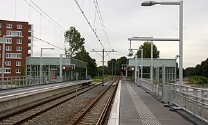
Meijersplein / Airport is a metro station, as a part of the Rotterdam metro and the regional light rail system RandstadRail, located in Schiebroek, a borough of Rotterdam, the Netherlands.
Hillegersberg-Schiebroek
Place in South Holland, Netherlands
Distance: Approx. 967 meters
Latitude and longitude: 51.95,4.46666667
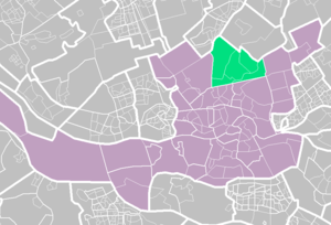
Hillegersberg-Schiebroek (Dutch pronunciation: [ˈɦɪləɣərzˌbɛr(ə)x sxiˈbruk]) is a borough in northern Rotterdam. The borough has (on January 1, 2008) 40,846 inhabitants. Until the annexation by Rotterdam on August 1, 1941, Hillegersberg and Schiebroek were independent communities.

110-Morgen
Neighborhood in Rotterdam, South Holland, Netherlands
Distance: Approx. 2103 meters
Latitude and longitude: 51.963938,4.489461
110-Morgen is a neighborhood in Rotterdam, Netherlands Located in Hillegersberg-Schiebroek. The name refers to a polder of the same name from 1772, with a surface area of 110 morgen. The first plans for residential development of the area were presented in 1933.

Kleiwegkwartier
Neighborhood of Rotterdam in South Holland, Netherlands
Distance: Approx. 2049 meters
Latitude and longitude: 51.94555556,4.48277778
Kleiwegkwartier is a neighbourhood quarter in Rotterdam, Netherlands. It is in the southern part of Hillegersberg with origins dating from the early 1600s.
Zestienhoven (district)
Neighborhood of Rotterdam in South Holland, Netherlands
Distance: Approx. 1598 meters
Latitude and longitude: 51.95694444,4.43722222
Zestienhoven is a neighborhood of Rotterdam, Netherlands and is part of the borough Overschie. Zestienhoven is the largest district in Overschie, but is sparsely populated. The Polder Zestienhoven is within the district, east of the urban area of Overschie.

German bombing of Rotterdam
WWII aerial bombardment of Rotterdam by Nazi Germany
Distance: Approx. 973 meters
Latitude and longitude: 51.96443056,4.45123611
In 1940, Rotterdam was subjected to heavy aerial bombardment by the Luftwaffe during the German invasion of the Netherlands during the Second World War. The objective was to support the German troops fighting in the city, break Dutch resistance and force the Dutch army to surrender. Bombing began at the outset of hostilities on 10 May and culminated with the destruction of the entire historic city centre on 14 May, an event sometimes referred to as the Rotterdam Blitz.
Weather in this IP's area
clear sky
11 Celsius
10 Celsius
9 Celsius
12 Celsius
1023 hPa
83 %
1023 hPa
1023 hPa
10000 meters
0.89 m/s
2.24 m/s
329 degree
1 %
07:44:35
17:06:54


