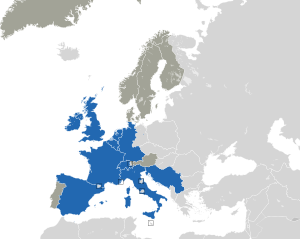
Country:
Region:
City:
Latitude and Longitude:
Time Zone:
Postal Code:
IP information under different IP Channel
ip-api
Country
Region
City
ASN
Time Zone
ISP
Blacklist
Proxy
Latitude
Longitude
Postal
Route
Luminati
Country
Region
nh
City
amsterdam
ASN
Time Zone
Europe/Amsterdam
ISP
SURF B.V.
Latitude
Longitude
Postal
IPinfo
Country
Region
City
ASN
Time Zone
ISP
Blacklist
Proxy
Latitude
Longitude
Postal
Route
db-ip
Country
Region
City
ASN
Time Zone
ISP
Blacklist
Proxy
Latitude
Longitude
Postal
Route
ipdata
Country
Region
City
ASN
Time Zone
ISP
Blacklist
Proxy
Latitude
Longitude
Postal
Route
Popular places and events near this IP address

Eurovision Song Contest 1970
International song competition
Distance: Approx. 784 meters
Latitude and longitude: 52.34138889,4.88833333
The Eurovision Song Contest 1970 was the 15th edition of the annual Eurovision Song Contest and took place in Amsterdam, Netherlands. Organised by the European Broadcasting Union (EBU) and host broadcaster Nederlandse Omroep Stichting (NOS), the contest was held at the RAI Congrescentrum on 21 March 1970, and was hosted by Dutch television presenter Willy Dobbe. Twelve countries participated in the contest this year.

Amsterdam RAI station
Railway station in Amsterdam, Netherlands
Distance: Approx. 237 meters
Latitude and longitude: 52.33666667,4.89055556
Amsterdam RAI (Dutch: Rijwiel en Automobiel Industrie) is a railway station situated in southern Amsterdam, Netherlands. It is located between the two directions of the A10 Amsterdam ring road. It is also a metro station at which GVB runs two lines.

RAI Amsterdam Convention Centre
Distance: Approx. 784 meters
Latitude and longitude: 52.34138889,4.88833333
RAI Amsterdam Convention Centre, formerly Amsterdam RAI Exhibition and Convention Centre or simply RAI Amsterdam (Dutch pronunciation: [raːi] , acronym for Rijwiel en Automobiel Industrie), is a complex of conference and exhibition halls in the Zuidas business district of Amsterdam, Netherlands. Opened in 1961, the RAI welcomed its 75 millionth visitor in February 2001. Up to 2 million people visit the RAI every year.
Buitenveldert
Neighborhood of Amsterdam in North Holland, Netherlands
Distance: Approx. 567 meters
Latitude and longitude: 52.33333333,4.88333333
Buitenveldert is a neighborhood of Amsterdam, Netherlands. It is considered the modern Jewish quarter of Amsterdam with its Synagogue, Jewish schools, nursing homes, shops and restaurants.

Zomerdijkstraat
Street in Amsterdam
Distance: Approx. 1210 meters
Latitude and longitude: 52.3425,4.90361111
The Zomerdijkstraat is a small street in the Amsterdam neighborhood Rivierenbuurt, consisting of apartment buildings and a hallmark building, the studio complex at the Zomerdijkstraat. A classified monument, the building was designed by the functionalist architects Piet Zanstra, J.H.L. Giesen en K.L. Sijmons. The building is a pivotal work in Dutch architecture of the early thirties.

Amstelpark
Distance: Approx. 648 meters
Latitude and longitude: 52.329,4.894
The Amstelpark is a park in Amsterdam-Zuid. The park includes a labyrinth, a café, a restaurant, two galleries, an orangery, a petting zoo and a mini-golf course.

Zorgvlied (cemetery)
Dutch cemetery
Distance: Approx. 613 meters
Latitude and longitude: 52.33555556,4.90027778
Zorgvlied (Dutch pronunciation: [ˈzɔr(ə)xflit]) is a cemetery on the Amsteldijk in Amsterdam, the Netherlands, on the left bank of the river Amstel. The cemetery was opened in 1870 by the city of Amstelveen which still owns and operates it, though since 1896 (when city lines were redrawn) it is located within the boundaries of the city of Amsterdam. One of the country's best-known cemeteries, it is notable for the large number of celebrities, especially from the literary and theater worlds, buried there.

Halvemaan
Restaurant in Amsterdam, Netherlands
Distance: Approx. 1153 meters
Latitude and longitude: 52.32835278,4.87788611
Restaurant Halvemaan is a former restaurant in Amsterdam, Netherlands. It is a fine dining restaurant that was awarded one Michelin star in 1991 and retained that rating until 1997. The restaurant closed at 28 October 2018.
Fusilladeplaats Rozenoord
World War II memorial in Amsterdam
Distance: Approx. 497 meters
Latitude and longitude: 52.33388889,4.89861111
Fusilladeplaats Rozenoord is a World War II memorial in the Dutch city of Amsterdam. 'Fusilladeplaats' might be translated into English as 'firing squad place'. 'Rozenoord' was originally a rose garden, whose name was adopted during the 1930s by a teahouse by the Amsteldijk, a dyke in Amsterdam.

Europaplein metro station
Station on the North–South Line of the Amsterdam Metro
Distance: Approx. 790 meters
Latitude and longitude: 52.34166667,4.8925
Europaplein metro station (Dutch: Station Europaplein) is a station on the Route 52 (North–South Line) of the Amsterdam Metro in Amsterdam, Netherlands. It was opened on 22 July 2018. Europaplein is an underground station situated in the Zuidas neighbourhood of Amsterdam-Zuid (Amsterdam South).

6th Montessori School Anne Frank
Public primary school in Netherlands founded in 1933
Distance: Approx. 929 meters
Latitude and longitude: 52.3428,4.8939
The 6th Montessori School Anne Frank (Dutch: 6e Montessorischool Anne Frank) (or Anne Frank School (Dutch: Anne Frankschool) for short) is a public Montessori primary school in the Rivierenbuurt, Amsterdam.
Beatrixpark
Park in Amsterdam, Netherlands
Distance: Approx. 1115 meters
Latitude and longitude: 52.342778,4.881944
The Beatrixpark is a park in the Amsterdam-Zuid borough and is located in the "Prinses Irenebuurt" residential area. The park was named after the former Dutch Queen Beatrix. In 1972, part of the park, together with the Amstelpark, was the site of the Floriade garden and agricultural exhibition.
Weather in this IP's area
broken clouds
9 Celsius
7 Celsius
8 Celsius
11 Celsius
1018 hPa
75 %
1018 hPa
1018 hPa
10000 meters
5.66 m/s
220 degree
75 %
08:03:57
16:46:50


