Country:
 Great Britain
Region:
City:
Latitude and Longitude:
Time Zone:
Postal Code:
IP information under different IP Channel
ip-api
Country
Region
City
ASN
Time Zone
ISP
Blacklist
Proxy
Latitude
Longitude
Postal
Route
IPinfo
Country
Region
City
ASN
Time Zone
ISP
Blacklist
Proxy
Latitude
Longitude
Postal
Route
MaxMind
Country
Region
City
ASN
Time Zone
ISP
Blacklist
Proxy
Latitude
Longitude
Postal
Route
Luminati
Country
GBRegion
eng
City
swindon
ASN
Time Zone
Europe/London
ISP
British Telecommunications PLC
Latitude
Longitude
Postal
db-ip
Country
Region
City
ASN
Time Zone
ISP
Blacklist
Proxy
Latitude
Longitude
Postal
Route
ipdata
Country
Region
City
ASN
Time Zone
ISP
Blacklist
Proxy
Latitude
Longitude
Postal
Route
Popular places and events near this IP address

Kidlington
Village in Oxfordshire, England
Distance: Approx. 1777 meters
Latitude and longitude: 51.82305556,-1.29027778
Kidlington is a village and civil parish in the Cherwell district of Oxfordshire, England. It is in-between the River Cherwell and Oxford Canal, 5 miles (8 km) north of Oxford and 8 miles (13 km) south-west of Bicester. It had a population of 13,600 at the 2021 Census.

Diocese of Oxford
Diocese of the Church of England
Distance: Approx. 1502 meters
Latitude and longitude: 51.831,-1.305
The Diocese of Oxford is a Church of England diocese that forms part of the Province of Canterbury. The diocese is led by the Bishop of Oxford (currently Steven Croft), and the bishop's seat is at Christ Church Cathedral, Oxford. It contains more church buildings than any other diocese and has more paid clergy than any other except London.

Oxford Airport
Airport in Kidlington, Oxfordshire
Distance: Approx. 2013 meters
Latitude and longitude: 51.83694444,-1.32
London Oxford Airport (IATA: OXF, ICAO: EGTK), formerly known as Kidlington Airport, is a privately owned airport located near Kidlington in Cherwell District, Oxfordshire, 6 NM (11 km; 6.9 mi) northwest by north of Oxford, 62 mi (100 km) from Central London. It specialises in general and business aviation and is home to Leading Edge Aviation, CAE Oxford, formerly Oxford Aviation Training, Volare Aviation, and Go Fly Oxford. It also has the UK headquarters of Airbus Helicopters.

Begbroke
Human settlement in England
Distance: Approx. 411 meters
Latitude and longitude: 51.822,-1.319
Begbroke ( BEG-bruuk) is a village and civil parish in Oxfordshire about one mile (1.6 km) west of Kidlington and five miles (8 km) northwest of Oxford. The 2011 Census recorded the parish's population as 783.
Kidlington F.C.
Association football club in England
Distance: Approx. 1756 meters
Latitude and longitude: 51.81707222,-1.28998889
Kidlington Football Club is a football club based in Kidlington, Oxfordshire, England. They are currently members of the Southern League Division One Central and play at Yarnton Road.

Yarnton
Human settlement in England
Distance: Approx. 973 meters
Latitude and longitude: 51.811,-1.31
Yarnton is a village and civil parish in Oxfordshire about 1 mile (1.6 km) southwest of Kidlington and 4 miles (6 km) northwest of Oxford. The 2011 Census recorded the parish's population as 2,545.

CAE Oxford
Ab initio flight training network
Distance: Approx. 1615 meters
Latitude and longitude: 51.8336,-1.3144
CAE Oxford, part of CAE Inc., is an ab initio flight training network. It provides integrated aviation training and resourcing services. Professional airline pilots have been trained at the Oxford Aviation Academy (OAA) flight school since 1961.

Begbroke Science Park
Science park of Oxford University
Distance: Approx. 605 meters
Latitude and longitude: 51.81805556,-1.30666667
Begbroke Science Park is a science park located five miles north of Oxford, England. It is owned by Oxford University and managed as part of the university's Mathematical, Physical and Life Sciences Division It lies within the parish of Begbroke, although it is only accessible from the village of Yarnton on the A44.
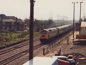
Yarnton railway station
Former railway station in Oxfordshire, England
Distance: Approx. 2222 meters
Latitude and longitude: 51.79917,-1.31357
Yarnton Junction was a three-platform station serving the village of Yarnton, Oxfordshire. It was built in 1861 at the junction of the Oxford, Worcester and Wolverhampton Railway and Witney Railway, north of Oxford. British Railways closed the station to passengers in 1962 and it was demolished c. 1965.

Campsfield House Immigration Removal Centre
United Kingdom immigration detention centre
Distance: Approx. 810 meters
Latitude and longitude: 51.82583333,-1.31083333
Campsfield House was an immigration detention centre located in Kidlington near Oxford, England, operated by private prison firm Group 4 under contract with the British government. For 25 years, it was the site of a regular monthly protest from human rights campaigners and saw a number of internal protests, hunger strikes and two suicides. However, it was highly praised by the Chief Inspector of Prisons at the last full inspection in 2014.
Kidlington railway station
Former railway station in England
Distance: Approx. 1593 meters
Latitude and longitude: 51.8299,-1.3001
Kidlington railway station is a former railway station in Oxfordshire, England, that opened in 1855 on the Oxford and Rugby Railway to serve the village of Kidlington and the adjacent town of Woodstock . It became a junction station in 1890 upon the opening of the Blenheim and Woodstock Branch Line, and served the area for over 100 years before falling victim to the programme of closures initiated by the Beeching Report in 1964. Following many proposals for its reopening, a new station to serve Kidlington opened in October 2015 at Oxford Parkway on the Oxford to Bicester Line.

Rushy Meadows
Distance: Approx. 1007 meters
Latitude and longitude: 51.824,-1.303
Rushy Meadows is an 8.9-hectare (22-acre) biological Site of Special Scientific Interest on the western outskirts of Kidlington in Oxfordshire. This site consists of unimproved alluvial grasslands on the bank of the Oxford Canal. The species-rich sward is dominated by hard rush, and other plants include water avens, which is very uncommon in the Thames Basin, pepper saxifrage, devil's bit scabious, early marsh orchid and distant sedge.
Weather in this IP's area
few clouds
15 Celsius
15 Celsius
14 Celsius
16 Celsius
1011 hPa
75 %
1011 hPa
1003 hPa
10000 meters
6.17 m/s
210 degree
20 %
07:35:13
18:05:09