Country:
Region:
City:
Latitude and Longitude:
Time Zone:
Postal Code:
IP information under different IP Channel
ip-api
Country
Region
City
ASN
Time Zone
ISP
Blacklist
Proxy
Latitude
Longitude
Postal
Route
Luminati
Country
Region
nh
City
amsterdam
ASN
Time Zone
Europe/Amsterdam
ISP
Eurofiber Nederland BV
Latitude
Longitude
Postal
IPinfo
Country
Region
City
ASN
Time Zone
ISP
Blacklist
Proxy
Latitude
Longitude
Postal
Route
db-ip
Country
Region
City
ASN
Time Zone
ISP
Blacklist
Proxy
Latitude
Longitude
Postal
Route
ipdata
Country
Region
City
ASN
Time Zone
ISP
Blacklist
Proxy
Latitude
Longitude
Postal
Route
Popular places and events near this IP address

Eurovision Song Contest 1970
International song competition
Distance: Approx. 587 meters
Latitude and longitude: 52.34138889,4.88833333
The Eurovision Song Contest 1970 was the 15th edition of the annual Eurovision Song Contest and took place in Amsterdam, Netherlands. Organised by the European Broadcasting Union (EBU) and host broadcaster Nederlandse Omroep Stichting (NOS), the contest was held at the RAI Congrescentrum on 21 March 1970, and was hosted by Dutch television presenter Willy Dobbe. Twelve countries participated in the contest this year.
Vossius Gymnasium
Public gymnasium school in Amsterdam, North Holland, Netherlands
Distance: Approx. 901 meters
Latitude and longitude: 52.3459,4.8843
Vossius Gymnasium is a public gymnasium in Amsterdam, North Holland, Netherlands. It was established in 1926 and is named after Gerardus Vossius. In 2014, it was ranked best VWO school in Amsterdam and 4th in the country by RTL Nieuws.

Amsterdam RAI station
Railway station in Amsterdam, Netherlands
Distance: Approx. 807 meters
Latitude and longitude: 52.33666667,4.89055556
Amsterdam RAI (Dutch: Rijwiel en Automobiel Industrie) is a railway station situated in southern Amsterdam, Netherlands. It is located between the two directions of the A10 Amsterdam ring road. It is also a metro station at which GVB runs two lines.

RAI Amsterdam Convention Centre
Distance: Approx. 587 meters
Latitude and longitude: 52.34138889,4.88833333
RAI Amsterdam Convention Centre, formerly Amsterdam RAI Exhibition and Convention Centre or simply RAI Amsterdam (Dutch pronunciation: [raːi] , acronym for Rijwiel en Automobiel Industrie), is a complex of conference and exhibition halls in the Zuidas business district of Amsterdam, Netherlands. Opened in 1961, the RAI welcomed its 75 millionth visitor in February 2001. Up to 2 million people visit the RAI every year.

Nieuwe Pijp
Neighborhood of Amsterdam in North Holland, Netherlands
Distance: Approx. 884 meters
Latitude and longitude: 52.35070278,4.89904444
Nieuwe Pijp (English: New Pipe) is a neighbourhood in Amsterdam, Netherlands. It is part of the borough of Amsterdam-Zuid. The Nieuwe Pijp is bordered by Ceintuurbaan and Sarphatipark in the north, Van Woustraat in the east, Amstel Canal in the south and Boerenwetering canal in the west.
Rivierenbuurt
Neighbourhood of Amsterdam in North Holland, Netherlands
Distance: Approx. 272 meters
Latitude and longitude: 52.34527778,4.8975
Rivierenbuurt is a neighbourhood of Amsterdam, Netherlands. The neighbourhood is situated in the eastern part of the borough of Amsterdam-Zuid, bordered by the river Amstel to the east, the Boerenwetering canal in the west, the Amstelkanaal in the north and the A10 motorway in the south. In 2013, the Rivierenbuurt had approximately 28,400 residents.

Zomerdijkstraat
Street in Amsterdam
Distance: Approx. 479 meters
Latitude and longitude: 52.3425,4.90361111
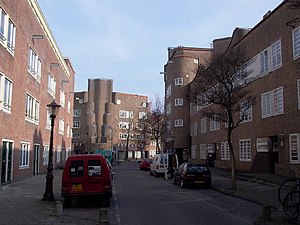
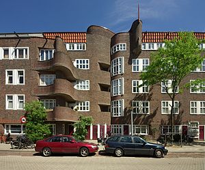
The Zomerdijkstraat is a small street in the Amsterdam neighborhood Rivierenbuurt, consisting of apartment buildings and a hallmark building, the studio complex at the Zomerdijkstraat. A classified monument, the building was designed by the functionalist architects Piet Zanstra, J.H.L. Giesen en K.L. Sijmons. The building is a pivotal work in Dutch architecture of the early thirties.
Ciel Bleu
Restaurant in Amsterdam, Netherlands
Distance: Approx. 668 meters
Latitude and longitude: 52.34867778,4.89393333
Ciel Bleu is a restaurant located in the Okura Hotel, a five-star hotel, in Amsterdam, Netherlands. It is a fine dining restaurant and was awarded one Michelin star from 2005 to 2007 and two Michelin stars from 2008 to present. GaultMillau awarded the restaurant 19.0 out of 20 points.

Zorgvlied (cemetery)
Dutch cemetery
Distance: Approx. 855 meters
Latitude and longitude: 52.33555556,4.90027778
Zorgvlied (Dutch pronunciation: [ˈzɔr(ə)xflit]) is a cemetery on the Amsteldijk in Amsterdam, the Netherlands, on the left bank of the river Amstel. The cemetery was opened in 1870 by the city of Amstelveen which still owns and operates it, though since 1896 (when city lines were redrawn) it is located within the boundaries of the city of Amsterdam. One of the country's best-known cemeteries, it is notable for the large number of celebrities, especially from the literary and theater worlds, buried there.

Yamazato
Restaurant in Amsterdam, Netherlands
Distance: Approx. 645 meters
Latitude and longitude: 52.34839722,4.89360833
Yamazato is a restaurant housed in the Okura Hotel in Amsterdam in the Netherlands. It is a fine dining restaurant and has had one Michelin star since 2002. According to Misset Horeca, the American restaurant guide Zagat praised the restaurant in 2001, shortly before Yamazato earned its Michelin star.

Europaplein metro station
Station on the North–South Line of the Amsterdam Metro
Distance: Approx. 311 meters
Latitude and longitude: 52.34166667,4.8925
Europaplein metro station (Dutch: Station Europaplein) is a station on the Route 52 (North–South Line) of the Amsterdam Metro in Amsterdam, Netherlands. It was opened on 22 July 2018. Europaplein is an underground station situated in the Zuidas neighbourhood of Amsterdam-Zuid (Amsterdam South).

6th Montessori School Anne Frank
Public primary school in Netherlands founded in 1933
Distance: Approx. 184 meters
Latitude and longitude: 52.3428,4.8939
The 6th Montessori School Anne Frank (Dutch: 6e Montessorischool Anne Frank) (or Anne Frank School (Dutch: Anne Frankschool) for short) is a public Montessori primary school in the Rivierenbuurt, Amsterdam.
Weather in this IP's area
mist
7 Celsius
7 Celsius
7 Celsius
8 Celsius
1026 hPa
91 %
1026 hPa
1026 hPa
900 meters
1.54 m/s
220 degree
75 %
07:45:52
17:02:15

