144.178.250.11 - IP Lookup: Free IP Address Lookup, Postal Code Lookup, IP Location Lookup, IP ASN, Public IP
Country:
Region:
City:
Location:
Time Zone:
Postal Code:
IP information under different IP Channel
ip-api
Country
Region
City
ASN
Time Zone
ISP
Blacklist
Proxy
Latitude
Longitude
Postal
Route
Luminati
Country
ASN
Time Zone
Europe/Brussels
ISP
Eurofiber Nederland BV
Latitude
Longitude
Postal
IPinfo
Country
Region
City
ASN
Time Zone
ISP
Blacklist
Proxy
Latitude
Longitude
Postal
Route
IP2Location
144.178.250.11Country
Region
oost-vlaanderen
City
merelbeke
Time Zone
Europe/Brussels
ISP
Language
User-Agent
Latitude
Longitude
Postal
db-ip
Country
Region
City
ASN
Time Zone
ISP
Blacklist
Proxy
Latitude
Longitude
Postal
Route
ipdata
Country
Region
City
ASN
Time Zone
ISP
Blacklist
Proxy
Latitude
Longitude
Postal
Route
Popular places and events near this IP address

East Flanders
Province of Belgium
Distance: Approx. 668 meters
Latitude and longitude: 51,3.75
East Flanders (Dutch: Oost-Vlaanderen [ˌoːst ˈflaːndərə(n)] ; French: Flandre-Orientale [flɑ̃dʁ ɔʁjɑ̃tal]; German: Ostflandern [ˈɔstˌflandɐn] ; West Flemish: Ôost-Vloandern) is a province of Belgium. It borders (clockwise from the North) the Dutch province of Zeeland and the Flemish province of Antwerp, Flemish Brabant, Hainaut and West Flanders. It has an area of 3,007 km2 (1,161 sq mi), divided into six administrative districts containing 60 municipalities, and a population of over 1.57 million as of January 2024.

Melle, Belgium
Municipality in Flemish Community, Belgium
Distance: Approx. 3819 meters
Latitude and longitude: 51,3.8
Melle (Dutch pronunciation: [ˈmɛlə] ) is a municipality located in the Belgian province of East Flanders. The municipality comprises the villages of Gontrode and Melle proper. On 1 January 2018 Melle had a total population of 11,574.
Merelbeke
Municipality in Flemish Community, Belgium
Distance: Approx. 668 meters
Latitude and longitude: 51,3.75
Merelbeke (Dutch pronunciation: [ˈmeːrəlˌbeːkə]) is a municipality located in the Flemish province of East Flanders, in Belgium. The municipality comprises the villages of Bottelare, Lemberge, Melsen, Merelbeke proper, Munte and Schelderode. In 2021, Merelbeke had a total population of 24,779.

Bottelare
Village in East Flanders, Belgium
Distance: Approx. 3110 meters
Latitude and longitude: 50.96666667,3.75
Bottelare is a village in the province of East Flanders, Belgium, at the edge of the Flemish Ardennes. It is now part of the municipality of Merelbeke. During the 17th century, Bottelare became a famous pilgrimage place, dedicated to Saint Anne.

Planet Group Arena
Football stadium in Ghent, Belgium
Distance: Approx. 2549 meters
Latitude and longitude: 51.01611111,3.73416667
The Planet Group arena (also called Arteveldestadion) is a multi-use stadium in Ghent, Belgium, until 2024 known as Ghelamco Arena. It hosts the home matches of football club K.A.A. Gent and was officially opened on 17 July 2013, making it the first newly built Belgian football stadium since 1974. The stadium seats 20,185 and replaced the Jules Ottenstadion, which had been Gent's home since 1920.
CropDesign
Distance: Approx. 3049 meters
Latitude and longitude: 51.012923,3.714001
CropDesign is a biotech company located in Ghent, Belgium. The company develops a portfolio of agronomic traits for the global commercial seed markets. It has developed a technology platform to discover genetic traits for the improvement of corn, rice and other plants.

Zwijnaarde science park
Distance: Approx. 2938 meters
Latitude and longitude: 51.0094,3.71158
The Zwijnaarde science park is a science park of Ghent University, located in Zwijnaarde near Ghent (Belgium). The science park has an area of 52 hectare (ha) and comprises the Ardoyen campus (30 ha) of the University of Ghent and the Ardoyen science park (22 ha). The Ardoyen campus comprises several institutes of the engineering and science faculty of the university.

Maarke-Kerkem
Village in Flemish Region
Distance: Approx. 3110 meters
Latitude and longitude: 50.96666667,3.75
Maarke-Kerkem is a village in the Flemish Ardennes, the hilly southern part of the province of East Flanders, Belgium. It is formed by two hamlets, Maarke and Kerkem, and is incorporated in the municipality of Maarkedal. It is hosting the Saint Vincent Chapel, which was first erected around 1100.
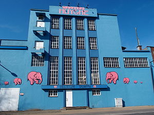
Huyghe Brewery
Belgian brewery
Distance: Approx. 4194 meters
Latitude and longitude: 51.00087,3.8052
Huyghe Brewery (Dutch: Brouwerij Huyghe) is a brewery founded in 1906 by Leon Huyghe in the city of Melle in East Flanders, Belgium. Its flagship beer is Delirium Tremens, a golden ale.

Zevergem
Village in Flemish Region
Distance: Approx. 4089 meters
Latitude and longitude: 50.979,3.6933
Zevergem is a village and deelgemeente (sub-municipality) of De Pinte in East Flanders, Belgium. It is located on the Scheldt about 8 kilometres (5.0 mi) south of Ghent.
Ghent/Industry Zone Heliport
Airport in Belgium
Distance: Approx. 3108 meters
Latitude and longitude: 51.02055556,3.73027778
Ghent/Industry Zone Heliport (ICAO: EBGT) is a heliport serving Ghent University Hospital located near Ghent, East Flanders, Belgium.

Ghent University Hospital
Hospital in Ghent, Belgium
Distance: Approx. 3576 meters
Latitude and longitude: 51.024,3.726
Ghent University Hospital (Dutch: Universitair Ziekenhuis Gent; UZ Gent) is one of the largest hospitals in Belgium. It is closely linked to Ghent University, the university's rector also being the hospital's president. Both the university and the hospital are autonomous entities of the Flemish Government.
Weather in this IP's area
scattered clouds
0 Celsius
-3 Celsius
-0 Celsius
2 Celsius
1004 hPa
88 %
1004 hPa
1003 hPa
10000 meters
3.3 m/s
8.24 m/s
245 degree
49 %

