Country:
Region:
City:
Latitude and Longitude:
Time Zone:
Postal Code:
IP information under different IP Channel
ip-api
Country
Region
City
ASN
Time Zone
ISP
Blacklist
Proxy
Latitude
Longitude
Postal
Route
Luminati
Country
ASN
Time Zone
America/Chicago
ISP
LEVEL3
Latitude
Longitude
Postal
IPinfo
Country
Region
City
ASN
Time Zone
ISP
Blacklist
Proxy
Latitude
Longitude
Postal
Route
db-ip
Country
Region
City
ASN
Time Zone
ISP
Blacklist
Proxy
Latitude
Longitude
Postal
Route
ipdata
Country
Region
City
ASN
Time Zone
ISP
Blacklist
Proxy
Latitude
Longitude
Postal
Route
Popular places and events near this IP address
Hillsboro, Oregon
City in Oregon, United States
Distance: Approx. 1389 meters
Latitude and longitude: 45.52722222,-122.93611111
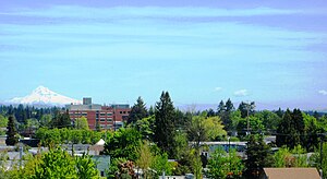
Hillsboro ( HILZ-burr-oh) is a city in the U.S. state of Oregon and is the county seat of Washington County. Situated in the Tualatin Valley on the west side of the Portland metropolitan area, the city hosts many high-technology companies, such as Intel, locally known as the Silicon Forest. The population was 106,447 at the 2020 census, making Hillsboro the fifth-most populous city in Oregon.
Hawthorn Farm station
Distance: Approx. 1158 meters
Latitude and longitude: 45.529982,-122.930703
Hawthorn Farm is a light rail station on the MAX Blue and Red lines in Hillsboro, Oregon, United States. Opened in 1998, it is the 15th stop westbound on the Westside MAX. The TriMet owned station does not have a parking lot nor bus connections. Artwork at the station utilizes electronics to provide waiting passengers with indicators of approaching trains, the wind's direction, and sounds from a neighboring wetlands area.

Hillsboro Airport
Airport in Hillsboro, Oregon
Distance: Approx. 1081 meters
Latitude and longitude: 45.54039389,-122.949825
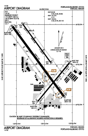
Hillsboro Airport (IATA: HIO, ICAO: KHIO), also known as Portland–Hillsboro Airport, is a corporate, general aviation and flight-training airport serving the city of Hillsboro, in Washington County, Oregon, United States. It is one of three airports in the Portland, Oregon, metropolitan area owned and operated by the Port of Portland. Established in 1928, it is Oregon's second busiest airport (in terms of total aircraft operations) at over 200,000 operations annually.
Hillsboro School District
School district in Oregon, United States
Distance: Approx. 538 meters
Latitude and longitude: 45.544448,-122.934726
The Hillsboro School District 1J is a unified school district located in Hillsboro, Oregon, United States. The district operates 26 elementary schools, four middle schools, and four high schools. Founded in 1851, the school district covers Hillsboro, Scholls, Reedville, North Plains, West Union, and other area communities.
Harold Wass Ray House
Historic house in Oregon, United States
Distance: Approx. 1560 meters
Latitude and longitude: 45.53055556,-122.92083333
The Harold Wass Ray House is a historic home in Hillsboro in the U.S. state of Oregon. Built in 1935 for businessman Harold Wass Ray (1884-1969), it was listed on the National Register of Historic Places in 1994. The two-story structure is of a Prairie School and Craftsman in architectural style.
FEI Company
American microscope technology company
Distance: Approx. 598 meters
Latitude and longitude: 45.542697,-122.92963
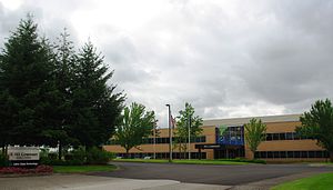
FEI Company (Field Electron and Ion Company) was an American company that designed, manufactured, and supported microscope technology. Headquartered in Hillsboro, Oregon, FEI had over 2,800 employees and sales and service operations in more than 50 countries around the world. Formerly listed on the NASDAQ, it is now a subsidiary of Thermo Fisher Scientific.
Metro West Ambulance
Distance: Approx. 922 meters
Latitude and longitude: 45.544877,-122.926776
Metro West Ambulance is an ambulance company based in the U.S. state of Oregon with ambulances and wheelie vans along the Oregon Coast (under the names Pacific West Ambulance, Bay Cities Ambulance, and Medix Ambulance). Metro West also manages the Vernonia Volunteer Ambulance Association. In addition to daily emergency ambulance services, Metro West also serves customers through a comprehensive wheelchair van service, special event medical support for Portland's Moda Center, the Oregon State Fair, and many other events throughout the year.
Hillsboro Public Library
Library in Oregon, US
Distance: Approx. 356 meters
Latitude and longitude: 45.54288889,-122.93627778
The Hillsboro Public Library is a two-location public library system in Hillsboro, Oregon, United States. First opened in 1914 in a Carnegie library building, the system provides services to a population area of 137,000 people. As of 2015, the system had a usage of 922,000 visits per year, with circulation nearly 3 million items per year.
TriQuint Semiconductor
American semiconductor company
Distance: Approx. 68 meters
Latitude and longitude: 45.540308,-122.935939
TriQuint Semiconductor was a semiconductor company that designed, manufactured, and supplied high-performance RF modules, components and foundry services. The company was founded in 1985 in Beaverton, Oregon before moving to neighboring Hillsboro, Oregon. In February 2014, Greensboro, North Carolina-based RF Micro Devices and TriQuint announced a merger in which the new company would be Qorvo, Inc., with the merger completed on January 1, 2015.
Binford & Mort
Publisher based in Oregon, United States
Distance: Approx. 1207 meters
Latitude and longitude: 45.5292905,-122.9316473
Binford & Mort Publishing is a book publishing company located in Hillsboro, Oregon, United States. Founded in 1930, the company was previously known as Metropolitan Press and Binfords & Mort. At one time they were the largest book publisher in the Pacific Northwest.

American Blimp Corporation
US airship manufacturer
Distance: Approx. 1439 meters
Latitude and longitude: 45.53913,-122.95444
American Blimp Corporation (ABC) is an American privately owned Hillsboro, Oregon-based company that is the largest manufacturer of blimps in the United States. It manufactures the hardware and rigging for the Lightship and Spector brands of airships. In 2012, American Blimp Corporation and The Lightship Group were acquired by Van Wagner Communications LLC, and became referred to as the Van Wagner Airship Group.
Classic Aircraft Aviation Museum
Aviation museum in Hillsboro, Oregon
Distance: Approx. 1430 meters
Latitude and longitude: 45.532628,-122.951313
The Classic Aircraft Aviation Museum is an aviation museum located in Hillsboro in the U.S. state of Oregon. Started in 1998, the one of the museum's with about 5 aircraft is located at the Hillsboro Airport in the Portland metropolitan area. Aircraft at the museum are either maintained in flyable condition or are restored so that they can be flown once again.
Weather in this IP's area
broken clouds
8 Celsius
8 Celsius
7 Celsius
10 Celsius
1022 hPa
92 %
1022 hPa
1015 hPa
10000 meters
1.54 m/s
75 %
06:54:55
16:55:38


