144.129.55.19 - IP Lookup: Free IP Address Lookup, Postal Code Lookup, IP Location Lookup, IP ASN, Public IP
Country:
Region:
City:
Location:
Time Zone:
Postal Code:
IP information under different IP Channel
ip-api
Country
Region
City
ASN
Time Zone
ISP
Blacklist
Proxy
Latitude
Longitude
Postal
Route
Luminati
Country
Region
ca
City
bakersfield
ASN
Time Zone
America/Los_Angeles
ISP
BHN-33363
Latitude
Longitude
Postal
IPinfo
Country
Region
City
ASN
Time Zone
ISP
Blacklist
Proxy
Latitude
Longitude
Postal
Route
IP2Location
144.129.55.19Country
Region
california
City
bakersfield
Time Zone
America/Los_Angeles
ISP
Language
User-Agent
Latitude
Longitude
Postal
db-ip
Country
Region
City
ASN
Time Zone
ISP
Blacklist
Proxy
Latitude
Longitude
Postal
Route
ipdata
Country
Region
City
ASN
Time Zone
ISP
Blacklist
Proxy
Latitude
Longitude
Postal
Route
Popular places and events near this IP address

Bakersfield, California
City in California, United States
Distance: Approx. 18 meters
Latitude and longitude: 35.37333333,-119.01888889
Bakersfield is a city in and the county seat of Kern County, California, United States. The city covers about 151 sq mi (390 km2) near the southern end of the San Joaquin Valley, which is located in the Central Valley region. Bakersfield's population as of the 2020 Census was 403,455, making it the 47th-most populous city in the United States and the 9th-most populous in California.

Mechanics Bank Arena
Indoor arena in Bakersfield, California
Distance: Approx. 472 meters
Latitude and longitude: 35.37208,-119.013723
Mechanics Bank Arena is a multi-purpose arena in Bakersfield, California. Located downtown at the corner of Truxtun Avenue and N Street, it was built in 1998, and was originally known as Centennial Garden, a name submitted by local resident Brian Landis. Bay Area-based Mechanics Bank has held the naming rights since September 2019, following their merger with Rabobank NA, which had held the naming rights since 2005.

Downtown Bakersfield
Neighborhood in Bakersfield, California
Distance: Approx. 530 meters
Latitude and longitude: 35.37805556,-119.01888889
Downtown is the central business district for Bakersfield, California. It contains several of the city's major theaters, sports complex, museums, and historical landmarks. What is considered to be "downtown" Bakersfield varies.

Beale Memorial Clock Tower
Historic site in Bakersfield, California
Distance: Approx. 115 meters
Latitude and longitude: 35.374329,-119.018838
Beale Memorial Clock Tower is a clock tower located in Bakersfield, California. It was a gift to the city, built by Truxtun Beale in memory of his mother, Mary Edwards Beale, the wife of Edward Fitzgerald Beale. The original clock tower was built in the middle of the intersection of 17th Street and Chester Avenue, and was dedicated on April 4, 1904.

Padre Hotel
Hotel in Bakersfield, California
Distance: Approx. 359 meters
Latitude and longitude: 35.3754,-119.0217
The Padre Hotel is a historical landmark hotel located on the corner of 18th and H streets in Bakersfield, California. Originally constructed in 1928 as a luxury hotel and restaurant, the eight-story building went through an extensive renovation and reopened in 2010.

Bakersfield Californian Building
United States historic place
Distance: Approx. 201 meters
Latitude and longitude: 35.375,-119.01944444
The Bakersfield Californian Building is a historic office building in Bakersfield, California. The structure was placed on the National Register of Historic Places (NRHP) on March 10, 1983. It was built for the newspaper The Bakersfield Californian.

First Baptist Church (Bakersfield, California)
Historic church in California, United States
Distance: Approx. 342 meters
Latitude and longitude: 35.37388889,-119.015
The First Baptist Church, also known as the Bell Towers, is a historic church complex built in 1931 in Bakersfield, California. The church moved to a new campus in 1977 and the building presently used as an office building. The structure was placed on the National Register of Historic Places (NRHP) on January 2, 1979.

Tevis Block
United States historic place
Distance: Approx. 411 meters
Latitude and longitude: 35.37666667,-119.02055556
The Tevis Block, also known as the Kern County Land Company Building, is a historic office building in Bakersfield, California. The structure was placed on the National Register of Historic Places (NRHP) on March 29, 1984.

Jastro Building
United States historic place
Distance: Approx. 437 meters
Latitude and longitude: 35.37638889,-119.02166667
The Jastro Building, also known as the Standard Oil Building, is a historic office building in Bakersfield, California. The structure was placed on the National Register of Historic Places (NRHP) on September 22, 1983.
Kern Community College District
Public community colleges in Kern County, California, United States
Distance: Approx. 536 meters
Latitude and longitude: 35.3781,-119.0182
Kern Community College District is a community college district in Kern County, California. Colleges part of the district are: Bakersfield College, Porterville College, and Cerro Coso Community College.
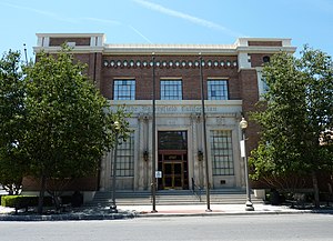
Kern County Hall of Records
Government Records Repository in Bakersfield, California
Distance: Approx. 59 meters
Latitude and longitude: 35.37363,-119.01921
The Kern County Hall of Records is a government building in Bakersfield, California. It is the repository of records for Kern County. The building is located in the Civic Center, Downtown.
Great Bakersfield Fire of 1889
Distance: Approx. 406 meters
Latitude and longitude: 35.37694444,-119.01888889
The Great Bakersfield Fire of 1889 was a conflagration in Bakersfield, California. The fire would burn for three hours and destroyed most of the town (later reincorporated as a city). In total, 196 buildings were destroyed, one man was killed and 1,500 people were homeless.
Weather in this IP's area
clear sky
9 Celsius
8 Celsius
8 Celsius
13 Celsius
1024 hPa
82 %
1024 hPa
1009 hPa
10000 meters
1.79 m/s
2.68 m/s
229 degree
