144.129.51.8 - IP Lookup: Free IP Address Lookup, Postal Code Lookup, IP Location Lookup, IP ASN, Public IP
Country:
Region:
City:
Location:
Time Zone:
Postal Code:
ISP:
ASN:
language:
User-Agent:
Proxy IP:
Blacklist:
IP information under different IP Channel
ip-api
Country
Region
City
ASN
Time Zone
ISP
Blacklist
Proxy
Latitude
Longitude
Postal
Route
db-ip
Country
Region
City
ASN
Time Zone
ISP
Blacklist
Proxy
Latitude
Longitude
Postal
Route
IPinfo
Country
Region
City
ASN
Time Zone
ISP
Blacklist
Proxy
Latitude
Longitude
Postal
Route
IP2Location
144.129.51.8Country
Region
california
City
bakersfield
Time Zone
America/Los_Angeles
ISP
Language
User-Agent
Latitude
Longitude
Postal
ipdata
Country
Region
City
ASN
Time Zone
ISP
Blacklist
Proxy
Latitude
Longitude
Postal
Route
Popular places and events near this IP address
California State University, Bakersfield
Public university in Bakersfield, California
Distance: Approx. 3587 meters
Latitude and longitude: 35.35,-119.104
California State University, Bakersfield (CSUB, Cal State Bakersfield, or CSU Bakersfield) is a public university in Bakersfield, California. It was established in 1965 as Kern State College and officially in 1968 as California State College Bakersfield on a 375-acre (152 ha) campus, becoming the 20th school in the California State University system. The university offers 39 different bachelor's degree programs, 17 master's degree programs, and a doctoral program in Educational Leadership (Ed.D.).
West High School (Bakersfield, California)
School in Bakersfield, California, United States
Distance: Approx. 1027 meters
Latitude and longitude: 35.34305556,-119.05916667
West High School is a public high school located in Bakersfield, California, United States. The school serves about 2,000 students in grades 9 to 12 in the Kern High School District. The school has been accredited by the Western Association of Schools and Colleges—for the first time in 1969 and most recently in 2020, for a fixed term after each evaluation.
Kern City, Bakersfield, California
Community in Bakersfield in California, United States
Distance: Approx. 1935 meters
Latitude and longitude: 35.35388889,-119.07333333
Kern City is a former unincorporated community now incorporated in Bakersfield in Kern County, California. It is located 4 miles (6.4 km) west-southwest of downtown Bakersfield, at an elevation of 387 feet (118 m). Kern City was founded as a planned retirement community in 1961.
Quailwood, Bakersfield, California
Community in Bakersfield in California, United States
Distance: Approx. 2464 meters
Latitude and longitude: 35.35555556,-119.08277778
Quailwood is a former unincorporated community now incorporated into Bakersfield in Kern County, California. It lies at an elevation of 384 feet (117 m).

Valley Plaza Mall
Shopping mall in Bakersfield, California
Distance: Approx. 3071 meters
Latitude and longitude: 35.338,-119.034
Valley Plaza Mall is a shopping mall in Bakersfield, California. It is the largest mall in the San Joaquin Valley. The mall is situated near California State Route 99, the city's main north–south freeway.
Southwest Bakersfield
Region in Bakersfield in California, United States
Distance: Approx. 3050 meters
Latitude and longitude: 35.31805556,-119.09194444
Southwest Bakersfield (commonly referred to simply as The Southwest) is the southwest region of Bakersfield, California. It is roughly bounded by the Kern River to the north and Oak Street/Wible Road to the east. The other boundaries are the city limits themselves.
Carrier Canal
Distance: Approx. 2955 meters
Latitude and longitude: 35.36361111,-119.06611111
Carrier Canal is an irrigation canal in Kern County, California. It originates from a common diversion at Manor Street in Bakersfield, which also supplies the Kern Island Canal and Eastside Canal. The common diversion originates from the Kern River about 1 mile (1.6 km) south of Gordon's Ferry.
Patriots Park (Bakersfield)
Distance: Approx. 792 meters
Latitude and longitude: 35.34027778,-119.06
Patriots Park is a public park in Bakersfield, California. It is constructed on 20 acres (8.1 ha) at the corner of Ming Ave and New Stine Rd, although the park wraps around an apartment complex at the exact corner.

West Bakersfield Interchange
Freeway interchange in Bakersfield, California
Distance: Approx. 3110 meters
Latitude and longitude: 35.35277778,-119.03944444
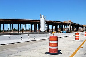
The West Bakersfield Interchange is a freeway interchange in Bakersfield, California, west of downtown. It connects State Route 99 (Golden State Freeway) with SR 58 (Mojave Freeway). These routes represent the heart of the Bakersfield freeway network.
Olde Stockdale, California
Census-designated place in California
Distance: Approx. 1572 meters
Latitude and longitude: 35.3476,-119.07937222
Olde Stockdale is an unincorporated community and census-designated place (CDP) in Kern County, California. The population was 568 at the 2020 census.
Benton Park, California
Place in California, United States
Distance: Approx. 3603 meters
Latitude and longitude: 35.34643889,-119.02981389
Benton Park is a census-designated place (CDP) in Kern County, California. Although it is designated by the census as its own place, it is functionally a neighborhood of Bakersfield.
Old Stine, California
Census-designated place near Bakersfield, California, U.S.
Distance: Approx. 2236 meters
Latitude and longitude: 35.34775,-119.04692222
Old Stine is a census-designated place (CDP) in Kern County, California. The CDP is within Bakersfield's census county division,: Maps and surrounded by the city of Bakersfield on all sides except for the east, where it borders Benton Park.: Maps As listed in the Geographic Names Information System, its elevation is 390 feet.
Weather in this IP's area
clear sky
14 Celsius
13 Celsius
13 Celsius
15 Celsius
1012 hPa
66 %
1012 hPa
1005 hPa
10000 meters
5.66 m/s
340 degree