144.129.50.22 - IP Lookup: Free IP Address Lookup, Postal Code Lookup, IP Location Lookup, IP ASN, Public IP
Country:
Region:
City:
Location:
Time Zone:
Postal Code:
ISP:
ASN:
language:
User-Agent:
Proxy IP:
Blacklist:
IP information under different IP Channel
ip-api
Country
Region
City
ASN
Time Zone
ISP
Blacklist
Proxy
Latitude
Longitude
Postal
Route
db-ip
Country
Region
City
ASN
Time Zone
ISP
Blacklist
Proxy
Latitude
Longitude
Postal
Route
IPinfo
Country
Region
City
ASN
Time Zone
ISP
Blacklist
Proxy
Latitude
Longitude
Postal
Route
IP2Location
144.129.50.22Country
Region
california
City
bakersfield
Time Zone
America/Los_Angeles
ISP
Language
User-Agent
Latitude
Longitude
Postal
ipdata
Country
Region
City
ASN
Time Zone
ISP
Blacklist
Proxy
Latitude
Longitude
Postal
Route
Popular places and events near this IP address

Mechanics Bank Arena
Indoor arena in Bakersfield, California
Distance: Approx. 2876 meters
Latitude and longitude: 35.37208,-119.013723
Mechanics Bank Arena is a multi-purpose arena in Bakersfield, California. Located downtown at the corner of Truxtun Avenue and N Street, it was built in 1998, and was originally known as Centennial Garden, a name submitted by local resident Brian Landis. Bay Area-based Mechanics Bank has held the naming rights since September 2019, following their merger with Rabobank NA, which had held the naming rights since 2005.
Bakersfield High School
School in Bakersfield, California, United States
Distance: Approx. 2367 meters
Latitude and longitude: 35.36916667,-119.02277778
Bakersfield High School (BHS) is a public four-year high school located in Bakersfield, California, United States. Opened in 1893, Bakersfield High School serves grades ninth through twelfth within the Kern High School District.

McMurtrey Aquatic Center
Swimming, diving, and recreational facility in Bakersfield, California
Distance: Approx. 2681 meters
Latitude and longitude: 35.369954,-119.013047
The McMurtrey Aquatic Center is a swimming, diving, and recreational facility in the city of Bakersfield, California. It is located near the Mechanics Bank Arena in downtown Bakersfield. The Aquatic Center opened in June 2004.

KGEO
Radio station in Bakersfield, California
Distance: Approx. 1456 meters
Latitude and longitude: 35.34805556,-119.00916667
KGEO (1230 AM, branded on-air as "ESPN Bakersfield") is a commercial radio station in Bakersfield, California. It broadcasts a sports radio format with shows from ESPN Radio and the Infinity Sports Network. KGEO is the flagship station of locally-based American General Media, with studios located at the Easton Business Complex in southwest Bakersfield.
Bakersfield Community Theatre
Distance: Approx. 1936 meters
Latitude and longitude: 35.33312,-119.01416
Bakersfield Community Theatre (BCT) in Bakersfield, California is the oldest continuing community theatre in California; and the second oldest amateur community theatre in the Western United States: the Tacoma Little Theatre, est. 1918 in Tacoma, Washington, is the oldest. Officially established in 1927, BCT has been putting on a full season of plays and musicals starting when Albert Johnson directed the beginning of a continuous string of productions.

Valley Plaza Mall
Shopping mall in Bakersfield, California
Distance: Approx. 1370 meters
Latitude and longitude: 35.338,-119.034
Valley Plaza Mall is a shopping mall in Bakersfield, California. It is the largest mall in the San Joaquin Valley. The mall is situated near California State Route 99, the city's main north–south freeway.
Beale Park (Bakersfield)
Distance: Approx. 1586 meters
Latitude and longitude: 35.36222222,-119.02416667
Beale Park is a public park located in Bakersfield, California. It is Bakersfield’s first park, located on Oleander St.

West Bakersfield Interchange
Freeway interchange in Bakersfield, California
Distance: Approx. 1398 meters
Latitude and longitude: 35.35277778,-119.03944444
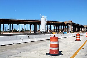
The West Bakersfield Interchange is a freeway interchange in Bakersfield, California, west of downtown. It connects State Route 99 (Golden State Freeway) with SR 58 (Mojave Freeway). These routes represent the heart of the Bakersfield freeway network.
Bak-Anime
Anime convention in Bakersfield, California
Distance: Approx. 1699 meters
Latitude and longitude: 35.34305556,-119.0075
Bak-Anime is an annual two-day anime convention held at the Kern County Fairgrounds in Bakersfield, California by the staff of SacAnime. The convention is the sister conventions to the Bakersfield Comic Con, Sacramento Comic, Toy and Anime Show (Sac-Con), and SacAnime.
Benton Park, California
Place in California, United States
Distance: Approx. 454 meters
Latitude and longitude: 35.34643889,-119.02981389
Benton Park is a census-designated place (CDP) in Kern County, California, United States. Although it is designated by the census as its own place, it is functionally a neighborhood of Bakersfield.
Casa Loma, Kern County, California
Place in California, United States
Distance: Approx. 2463 meters
Latitude and longitude: 35.34323056,-118.99871111
Casa Loma is an unincorporated community and census-designated place (CDP) in Kern County, California. Although it is designated by the census as its own place, it is functionally a neighborhood of Bakersfield.
Old Stine, California
Census-designated place near Bakersfield, California, U.S.
Distance: Approx. 1973 meters
Latitude and longitude: 35.34775,-119.04692222
Old Stine is a census-designated place (CDP) in Kern County, California. The CDP is within Bakersfield's census county division,: Maps and surrounded by the city of Bakersfield on all sides except for the east, where it borders Benton Park.: Maps As listed in the Geographic Names Information System, its elevation is 390 feet.
Weather in this IP's area
clear sky
9 Celsius
8 Celsius
9 Celsius
9 Celsius
1023 hPa
73 %
1023 hPa
1010 hPa
10000 meters
2.24 m/s
3.13 m/s
212 degree