144.129.48.236 - IP Lookup: Free IP Address Lookup, Postal Code Lookup, IP Location Lookup, IP ASN, Public IP
Country:
 USA
USARegion:
City:
Location:
Time Zone:
Postal Code:
ISP:
ASN:
language:
User-Agent:
Proxy IP:
Blacklist:
IP information under different IP Channel
ip-api
Country
Region
City
ASN
Time Zone
ISP
Blacklist
Proxy
Latitude
Longitude
Postal
Route
db-ip
Country
Region
City
ASN
Time Zone
ISP
Blacklist
Proxy
Latitude
Longitude
Postal
Route
IPinfo
Country
Region
City
ASN
Time Zone
ISP
Blacklist
Proxy
Latitude
Longitude
Postal
Route
IP2Location
144.129.48.236Country
usRegion
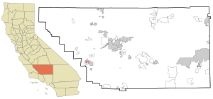
california
City
taft
Time Zone
America/Los_Angeles
ISP
Language
User-Agent
Latitude
Longitude
Postal
ipdata
Country
Region
City
ASN
Time Zone
ISP
Blacklist
Proxy
Latitude
Longitude
Postal
Route
Popular places and events near this IP address

Dustin Acres, California
Census-designated place in California, United States
Distance: Approx. 6346 meters
Latitude and longitude: 35.21944444,-119.39055556
Dustin Acres is a census-designated place (CDP) in Kern County, California, United States. Dustin Acres is located 6.5 miles (10 km) north-northeast of Taft, at an elevation of 384 feet (117 m). The population was 652 at the 2010 census, up from 585 at the 2000 census.

Ford City, California
Census-designated place in California, United States
Distance: Approx. 3164 meters
Latitude and longitude: 35.15444444,-119.45611111
Ford City is a census-designated place (CDP) in Kern County, California, United States. Ford City is located 1 mile (1.61 km) north of Taft, at an elevation of 892 feet (272 m). The population was 4,348 at the 2020 census, up from 4,278 at the 2010 census.

South Taft, California
Census-designated place in California, United States
Distance: Approx. 4813 meters
Latitude and longitude: 35.13472222,-119.45611111
South Taft is a census-designated place (CDP) in Kern County, California, United States. South Taft is located 0.5 miles (0.8 km) south of Taft, at an elevation of 1,017 feet (310 m). The population was 2,169 at the 2010 census, up from 1,898 at the time of the 2000 census.

Taft, California
City in California, United States
Distance: Approx. 4118 meters
Latitude and longitude: 35.1425,-119.45638889
Taft (formerly Moron, Moro, and Siding Number Two) is a city in the foothills at the extreme southwestern edge of the San Joaquin Valley, in Kern County, California. Taft is located 32 miles (51 km) west-southwest of Bakersfield, at an elevation of 955 feet (291 m). The population was 9,327 at the 2010 census.
Taft Heights, California
Census-designated place in California, United States
Distance: Approx. 5740 meters
Latitude and longitude: 35.13472222,-119.4725
Taft Heights (formerly, Boust City) is a census-designated place (CDP) in Kern County, California, United States. Taft Heights is located 1 mile (1.6 km) west-southwest of Taft, at an elevation of 1,178 feet (359 m). The population was 1,949 at the 2010 census, up from 1,865 at the 2000 census.

Valley Acres, California
Census-designated place in California, United States
Distance: Approx. 4326 meters
Latitude and longitude: 35.20611111,-119.40666667
Valley Acres is a census-designated place (CDP) in Kern County, California, United States. Valley Acres is located 5.2 miles (8.4 km) north-northeast of Taft, at an elevation of 420 feet (128.02 m). The population was 527 at the 2010 census, up from 512 at the 2000 census.

Taft College
Public community college in Taft, California
Distance: Approx. 3788 meters
Latitude and longitude: 35.14944444,-119.46
Taft College is a public community college in Taft, California. It is a part of the California Community Colleges system and is accredited by the Accrediting Commission for Community and Junior Colleges. The college is one of only a few community colleges in California to have on-campus housing.
Taft Airport
Airport in Taft, California
Distance: Approx. 3578 meters
Latitude and longitude: 35.14111111,-119.44111111
Taft Airport (FAA LID: L17), also known as Taft-Kern County Airport, is a public airport located one mile (1.6 km) east of Taft, serving Kern County, California, USA. This general aviation airport covers 71 acres (29 ha) and has one runway. It is home to a skydive operation known as Skydive Taft. Runway 07 is marked with a runway-width X. Landings on 07 are not allowed; landings on 25 are allowed, and takeoffs from 07 and 25 are allowed.

Taft Union High School
School district in California
Distance: Approx. 4038 meters
Latitude and longitude: 35.146508,-119.460462
Taft Union High School is located in Taft in Kern County, California, in the United States. Taft High was founded in 1912. Taft is a small city of fewer than 10,000, and the school also serves the surrounding rural area, which in the early 21st century has a total population of about 20,000.

Midway-Sunset Oil Field
Oil field in Kern County, San Joaquin Valley, California
Distance: Approx. 5476 meters
Latitude and longitude: 35.1301,-119.4608
The Midway-Sunset Oil Field is a large oil field in Kern County, San Joaquin Valley, California in the United States. It is the largest known oilfield in California and also the largest oil field in the country by total oil in place (around 27 billion barrels of mostly heavy oil), though Alaska's Prudhoe Bay Oil Field and the East Texas Oil Field have larger total production values of over 13 billion barrels and 5.4 billion barrels respectively compared to Midway-Sunset which has produced nearly 4 billion barrels. The field was discovered in 1894, and through the end of 2023 had produced close to 4 billion barrels (640,000,000 m3) of oil.

Buena Vista Oil Field
Historic site in miles N of McKittrick, California
Distance: Approx. 1681 meters
Latitude and longitude: 35.1865,-119.4304
The Buena Vista Oil Field, formerly the Naval Petroleum Reserve No. 2 (NPR-2) is a large oil field in Kern County, San Joaquin Valley, California in the United States. Discovered in 1909, and having a cumulative production of approximately 686 million barrels (109,100,000 m3), it is the tenth-largest oil field in California as of 2024.
The Fort (Taft, California)
United States historic place
Distance: Approx. 4073 meters
Latitude and longitude: 35.15055556,-119.465
The Fort is a government building located at the intersection of Ash and Lincoln Sts. in Taft, California. The building is a replica of Sutter's Fort in Sacramento.
Weather in this IP's area
overcast clouds
10 Celsius
9 Celsius
10 Celsius
10 Celsius
1023 hPa
55 %
1023 hPa
981 hPa
10000 meters
1.34 m/s
2.68 m/s
345 degree
87 %