143.59.192.103 - IP Lookup: Free IP Address Lookup, Postal Code Lookup, IP Location Lookup, IP ASN, Public IP
Country:
Region:
City:
Location:
Time Zone:
Postal Code:
IP information under different IP Channel
ip-api
Country
Region
City
ASN
Time Zone
ISP
Blacklist
Proxy
Latitude
Longitude
Postal
Route
Luminati
Country
Region
tn
City
knoxville
ASN
Time Zone
America/New_York
ISP
WOW-INTERNET
Latitude
Longitude
Postal
IPinfo
Country
Region
City
ASN
Time Zone
ISP
Blacklist
Proxy
Latitude
Longitude
Postal
Route
IP2Location
143.59.192.103Country
Region
tennessee
City
knoxville
Time Zone
America/New_York
ISP
Language
User-Agent
Latitude
Longitude
Postal
db-ip
Country
Region
City
ASN
Time Zone
ISP
Blacklist
Proxy
Latitude
Longitude
Postal
Route
ipdata
Country
Region
City
ASN
Time Zone
ISP
Blacklist
Proxy
Latitude
Longitude
Postal
Route
Popular places and events near this IP address

Knoxville, Tennessee
City in Tennessee, United States
Distance: Approx. 256 meters
Latitude and longitude: 35.9617,-83.9232
Knoxville is a city in and the county seat of Knox County, Tennessee, United States, on the Tennessee River. As of the 2020 United States census, Knoxville's population was 190,740, making it the largest city in the East Tennessee Grand Division and the state's third-most-populous city after Nashville and Memphis. It is the principal city of the Knoxville metropolitan area, which had a population of 879,773 in 2020.

Sunsphere
Observation tower in Knoxville, Tennessee
Distance: Approx. 256 meters
Latitude and longitude: 35.9617,-83.9232
The Sunsphere is a 266-foot (81 m) tall hexagonal steel truss structure located in World's Fair Park in downtown Knoxville, Tennessee, United States. It is topped with the 75-foot (23 m) gold-colored glass sphere that served as the symbol of the 1982 World's Fair. Directly across a man-made pond from the Tennessee Amphitheater, they are the only remaining structures from the fair.

Tennessee Theatre
United States historic place
Distance: Approx. 213 meters
Latitude and longitude: 35.96222222,-83.91944444
The Tennessee Theatre is a movie palace in downtown Knoxville, Tennessee. The theater was built in 1928 in the 1908 Burwell Building, considered Knoxville's first skyscraper. The theater and Burwell Building were added to the National Register of Historic Places in 1982, and the theater was extensively restored in the early 2000s.

St. John's Cathedral (Knoxville, Tennessee)
Church in Tennessee, United States
Distance: Approx. 245 meters
Latitude and longitude: 35.96209167,-83.91870556
St. John's Cathedral located at 413 Cumberland Avenue in Knoxville, Tennessee, is the cathedral church of the Episcopal Diocese of East Tennessee.

Lawson McGhee Library
Library in Knoxville, Tennessee
Distance: Approx. 218 meters
Latitude and longitude: 35.96229,-83.919476
The Lawson McGhee Library is the main library of Knox County Public Library in Knoxville, Tennessee. It is located at 500 West Church Avenue in downtown Knoxville. It is currently the oldest, continuously operating public library in Tennessee.

James Park House
Historic house in Tennessee, United States
Distance: Approx. 223 meters
Latitude and longitude: 35.96166667,-83.91861111
The James Park House is a historic house located at 422 West Cumberland Avenue in Knoxville, Tennessee, United States. The house's foundation was built by Governor John Sevier in the 1790s, and the house itself was built by Knoxville merchant and mayor, James Park (1770–1853), in 1812, making it the second-oldest building in Downtown Knoxville after Blount Mansion. The house is listed on the National Register of Historic Places, and currently serves as the headquarters for the Gulf and Ohio Railways.

First Baptist Church (Knoxville, Tennessee)
Historic church in Tennessee, United States
Distance: Approx. 192 meters
Latitude and longitude: 35.96027778,-83.91861111
First Baptist Church is a historic church located in Knoxville, Tennessee. It is on the National Register of Historic Places. The congregation was organized in 1843 by James and John Moses.

Church Street United Methodist Church (Knoxville, Tennessee)
United States historic place
Distance: Approx. 58 meters
Latitude and longitude: 35.96111111,-83.92055556
Church Street United Methodist Church is a United Methodist church located on Henley Street in downtown Knoxville, Tennessee. The church building is considered a Knoxville landmark and is listed on the National Register of Historic Places.

Medical Arts Building (Knoxville, Tennessee)
United States historic place
Distance: Approx. 92 meters
Latitude and longitude: 35.96083333,-83.91972222
The Medical Arts Building is an office high-rise located at 603 Main Street in Knoxville, Tennessee, United States. Completed in 1931, the 10-story structure originally provided office space for physicians and dentists, and at the time was considered the "best equipped" medical building in the South. The building has been listed on the National Register of Historic Places as one of the region's best examples of a Gothic Revival-style office building.

Knoxville Convention Center
Convention center in Knoxville, Tennessee
Distance: Approx. 198 meters
Latitude and longitude: 35.96091667,-83.92286111
The Knoxville Convention Center is a 500,000-square-foot convention center in Knoxville, Tennessee, occupying the former location of the US Pavilion of the 1982 World's Fair. It offers 120,000 square feet (11,000 m2) of exhibit space.

United States Post Office and Courthouse (Knoxville, Tennessee)
United States historic place
Distance: Approx. 165 meters
Latitude and longitude: 35.96083333,-83.91888889
The United States Post Office and Courthouse, commonly called the Knoxville Post Office, is a state building located at 501 Main Street in Knoxville, Tennessee, United States. Constructed in 1934 for use as a post office and federal courthouse, the building contains numerous Art Deco and Moderne elements, and is clad in Tennessee marble. While the building is still used as a branch post office, the court section is now used by the state courts.

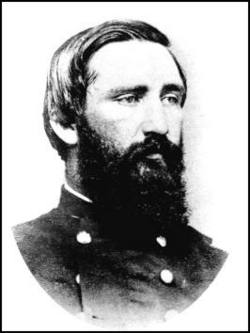
Sanders' Knoxville Raid
Battle of the American Civil War
Distance: Approx. 256 meters
Latitude and longitude: 35.9617,-83.9232
Sanders' Knoxville Raid (June 14–24, 1863) saw 1,500 Union cavalry and mounted infantry led by Colonel William P. Sanders raid East Tennessee before the Knoxville campaign during the American Civil War. The successful raid began at Mount Vernon, Kentucky and moved south, passing near Kingston, Tennessee. Moving east from the Kingston area, the raiders struck the East Tennessee and Georgia Railroad at Lenoir Station.
Weather in this IP's area
scattered clouds
8 Celsius
6 Celsius
7 Celsius
9 Celsius
1012 hPa
92 %
1012 hPa
979 hPa
10000 meters
2.24 m/s
3.58 m/s
319 degree
40 %