143.116.105.113 - IP Lookup: Free IP Address Lookup, Postal Code Lookup, IP Location Lookup, IP ASN, Public IP
Country:
Region:
City:
Location:
Time Zone:
Postal Code:
IP information under different IP Channel
ip-api
Country
Region
City
ASN
Time Zone
ISP
Blacklist
Proxy
Latitude
Longitude
Postal
Route
Luminati
Country
ASN
Time Zone
America/Chicago
ISP
SANMINA-SCI
Latitude
Longitude
Postal
IPinfo
Country
Region
City
ASN
Time Zone
ISP
Blacklist
Proxy
Latitude
Longitude
Postal
Route
IP2Location
143.116.105.113Country
Region
texas
City
carrollton
Time Zone
America/Chicago
ISP
Language
User-Agent
Latitude
Longitude
Postal
db-ip
Country
Region
City
ASN
Time Zone
ISP
Blacklist
Proxy
Latitude
Longitude
Postal
Route
ipdata
Country
Region
City
ASN
Time Zone
ISP
Blacklist
Proxy
Latitude
Longitude
Postal
Route
Popular places and events near this IP address
Farmers Branch, Texas
City in Texas, United States
Distance: Approx. 3844 meters
Latitude and longitude: 32.92722222,-96.86388889
Farmers Branch, officially the City of Farmers Branch, is a city in Dallas County, Texas, United States. It is an inner-ring suburb of Dallas and is part of the Dallas–Fort Worth metroplex. Its population was 35,991 at the 2020 census.

Carrollton, Texas
City in Texas, United States
Distance: Approx. 10 meters
Latitude and longitude: 32.95361111,-96.89027778
Carrollton is a city in Dallas, Denton, and Collin counties in the U.S. state of Texas. As of the 2020 census, its population was 133,434, making it the 27th-most populous city in Texas.
R. L. Turner High School
Secondary school in Carrollton, Dallas County, Texas, United States
Distance: Approx. 615 meters
Latitude and longitude: 32.94828,-96.8916
R. L. Turner High School is a public high school located in Carrollton, Texas, (USA) in the Carrollton-Farmers Branch Independent School District. The school serves portions of Carrollton, Farmers Branch, and Addison. In 2015, the school was rated "Met Standard" by the Texas Education Agency.
Carrollton-Farmers Branch Independent School District
School district in Texas, United States
Distance: Approx. 655 meters
Latitude and longitude: 32.95680556,-96.89625
Carrollton-Farmers Branch Independent School District (CFBISD) is a school district based in Carrollton, Texas, United States. The district covers most of the cities of Carrollton and Farmers Branch and parts of Addison, Coppell, Dallas, and Irving (including Valley Ranch and the Western part of Las Colinas). CFBISD has twenty-four elementary schools, six middle schools, five high schools, and three education centers.
Operation Kindness
U.S. non-profit organization
Distance: Approx. 4281 meters
Latitude and longitude: 32.967351,-96.847446
Operation Kindness is a no kill animal shelter for cats and dogs located in Carrollton, Texas. It is a non-profit organization and is funded through donations, receiving no government funding.
Dallas Christian College
Private college in Texas, U.S.
Distance: Approx. 4460 meters
Latitude and longitude: 32.9137,-96.8876
Dallas Christian College (DCC) is a private Christian college in Farmers Branch, Texas. It is affiliated with the Christian Church and accredited by the Association for Biblical Higher Education.
Newman Smith High School
Secondary school in Carrollton, Dallas County, Texas, United States
Distance: Approx. 2879 meters
Latitude and longitude: 32.97954,-96.89158
Newman Smith High School is a public high school in Carrollton, Texas, United States in the Carrollton-Farmers Branch Independent School District. The school opened in 1975, and is named after the former CFBISD superintendent Newman Smith. Smith High School serves sections of Carrollton and Dallas.
Farmers Branch station
DART light rail station in Farmers Branch, Texas
Distance: Approx. 3572 meters
Latitude and longitude: 32.922004,-96.896229
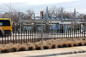
Farmers Branch station (formerly Farmers Branch Park & Ride) is a DART light rail station in Farmers Branch, Texas. It serves the Green Line. The station initially opened as a bus-only park & ride facility in the 1990s.
Downtown Carrollton station
DART light rail station in Carrollton, Texas
Distance: Approx. 1689 meters
Latitude and longitude: 32.954572,-96.908353
Downtown Carrollton station is a DART light rail station in Carrollton, Texas. It serves the DART Green Line. This station will serve as an inaugural stop on the Silver Line.

Vitruvian Park
Commercial development in Texas
Distance: Approx. 4088 meters
Latitude and longitude: 32.935037,-96.852615
Vitruvian Park is a multi-family, retail and commercial development in Addison, Texas. The development is just west of the Dallas North Tollway, approximately one mile north of I-635/LBJ Freeway between Midway Road and Marsh Lane in Addison's southwest quadrant. Adjacent to the community are Brookhaven Country Club, Brookhaven College, Greenhill School, Parish Episcopal School, and a shopping center.
The Saint Anthony School
Distance: Approx. 2371 meters
Latitude and longitude: 32.970073,-96.906541
The St. Anthony School - Carrollton, Texas is a secular, accredited therapeutic school located in Carrollton Texas. The school is one of several private schools in the area.
Honors Academy
American group of state charter schools
Distance: Approx. 1184 meters
Latitude and longitude: 32.9431,-96.8893
Honors Academy Charter School District was a group of state charter schools with its administrative offices in Farmers Branch, Texas, in the Dallas-Fort Worth Metroplex.
Weather in this IP's area
clear sky
8 Celsius
5 Celsius
7 Celsius
10 Celsius
1015 hPa
54 %
1015 hPa
994 hPa
10000 meters
5.14 m/s
190 degree


