142.76.1.156 - IP Lookup: Free IP Address Lookup, Postal Code Lookup, IP Location Lookup, IP ASN, Public IP
Country:
Region:
City:
Location:
Time Zone:
Postal Code:
ISP:
ASN:
language:
User-Agent:
Proxy IP:
Blacklist:
IP information under different IP Channel
ip-api
Country
Region
City
ASN
Time Zone
ISP
Blacklist
Proxy
Latitude
Longitude
Postal
Route
db-ip
Country
Region
City
ASN
Time Zone
ISP
Blacklist
Proxy
Latitude
Longitude
Postal
Route
IPinfo
Country
Region
City
ASN
Time Zone
ISP
Blacklist
Proxy
Latitude
Longitude
Postal
Route
IP2Location
142.76.1.156Country
Region
ontario
City
toronto
Time Zone
America/Toronto
ISP
Language
User-Agent
Latitude
Longitude
Postal
ipdata
Country
Region
City
ASN
Time Zone
ISP
Blacklist
Proxy
Latitude
Longitude
Postal
Route
Popular places and events near this IP address

Lawrence Park, Toronto
Neighbourhood in Toronto, Ontario, Canada
Distance: Approx. 747 meters
Latitude and longitude: 43.722,-79.388
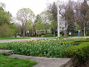
Lawrence Park is a neighbourhood in Toronto, Ontario, Canada. It is bordered by Yonge Street to the west and Bayview Avenue to the east, and from Blythwood Ravine on the south to Lawrence Avenue on the north. Lawrence Park was one of Toronto's first planned garden suburbs.
Glendon College
College in Ontario
Distance: Approx. 713 meters
Latitude and longitude: 43.7275,-79.3785
Glendon College is a public liberal arts college in Toronto, Ontario, Canada. Formally the federated bilingual campus of York University, it is one of the school's nine colleges and 11 faculties with 100 full-time faculty members and a student population of about 2,100. Founded as the first permanent establishment of York University, the school began academic operation under the mentorship of the University of Toronto in September 1960.

CNIB Foundation
Organization for the blind based in Canada
Distance: Approx. 364 meters
Latitude and longitude: 43.71793056,-79.37768611
The CNIB Foundation (French: Fondation INCA) is a Canadian charitable organization and volunteer agency dedicated to assisting Canadians who are blind or living with vision loss, and to provide information about vision health for all Canadians. Founded in 1918 as the Canadian National Institute for the Blind (French: Institut national canadien pour les aveugles) to assist soldiers who had been blinded in the First World War, CNIB originally offered sheltered care and specialized employment to people with vision loss. It has since expanded to include other programs and services, including research, public education, rehabilitation counselling and training, advocacy and an alternative-format library for people living with a print disability.
Radio Glendon
Online radio station at Glendon College in Toronto
Distance: Approx. 763 meters
Latitude and longitude: 43.72777778,-79.37666667
Radio Glendon is a Canadian online radio station, which broadcasts on radio-glendon.ca in Toronto, Ontario. It is the campus radio station of the city's Glendon College, a campus of York University. Radio Glendon offers a variety of programs in both English and French, and the programming schedule features both independent and mainstream music.
Toronto French School
Day school in Toronto, Ontario, Canada
Distance: Approx. 839 meters
Latitude and longitude: 43.728,-79.383
The Toronto French School (TFS), founded in 1962, is an independent, bilingual, co-educational, non-denominational school in Toronto, Ontario, Canada. Charles III, as King of Canada, is the royal patron of the school. The school rebranded in 2011 to become TFS – Canada's International School.
Holland Bloorview Kids Rehabilitation Hospital
Hospital in Toronto, Ontario, Canada
Distance: Approx. 559 meters
Latitude and longitude: 43.718447,-79.3729
Holland Bloorview Kids Rehabilitation Hospital is Canada's largest children's rehabilitation hospital. It is located in Toronto, Ontario, Canada. It was founded in 1899, by a group of community-minded women who met in Toronto to discuss the creation of a "Home for Incurable Children".

Sunnybrook Health Sciences Centre
Hospital in Ontario, Canada
Distance: Approx. 375 meters
Latitude and longitude: 43.7227,-79.374697
Sunnybrook Health Sciences Centre (SHSC), commonly known as Sunnybrook Hospital or simply Sunnybrook, is an academic health science centre located in Toronto, Ontario, Canada. The hospital is the largest trauma centre in Canada. It is accredited as a Level I trauma centre by the Trauma Association of Canada and the American College of Surgeons, the first hospital outside of the United States to achieve ACS accreditation.
Mount Hope Catholic Cemetery
Cemetery in Toronto, Ontario, Canada
Distance: Approx. 735 meters
Latitude and longitude: 43.7151,-79.3826
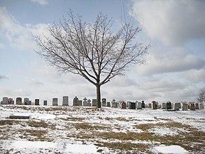
Mount Hope Catholic Cemetery is a Catholic cemetery at 305 Erskine Avenue in Toronto, Ontario, Canada.

Don Valley West (provincial electoral district)
Provincial electoral district in Ontario, Canada
Distance: Approx. 1037 meters
Latitude and longitude: 43.73,-79.375
Don Valley West is a provincial electoral district in Toronto, Ontario, Canada. It elects one member to the Legislative Assembly of Ontario. It was created in 1999 from parts of Don Mills, York Mills, York East and Eglinton.
Bridle Path–Sunnybrook–York Mills
Neighbourhood in Toronto, Ontario, Canada
Distance: Approx. 82 meters
Latitude and longitude: 43.72111111,-79.37777778
Bridle Path–Sunnybrook–York Mills is a municipal and census district in Toronto, Ontario, Canada, and it is the name officially designated by Toronto City Hall. Traditionally, Torontonians regard this area as five distinct neighbourhoods that were formerly in North York before it was amalgamated into Toronto in 1998. The area is part of the federal and provincial electoral district of Don Valley West, and Toronto electoral ward 25: Don Valley West (North).

Bayview Bridge (Toronto)
Bridge in Ontario, Canada
Distance: Approx. 1034 meters
Latitude and longitude: 43.7302,-79.3814
The Bayview Bridge is a deck truss bridge over the West Don River in Toronto, Ontario, Canada. The six-lane bridge carries Bayview Avenue across the Don Valley, connecting with Lawrence Avenue East at its southern end. Built in 1929, the bridge helped spur the development of the Bridle Path, an affluent neighbourhood northeast of the bridge's span.

Canadian Language Museum
Language museum in Ontario, Canada
Distance: Approx. 756 meters
Latitude and longitude: 43.72767,-79.37641
The Canadian Language Museum (French: Le Musée canadien des langues), is a language museum and registered charity located in Toronto, Ontario, Canada. Its mission is to promote an appreciation of all of the languages used in Canada, and of their role in the development of the country. The museum was established in 2011 and opened its permanent gallery space in 2016.
Weather in this IP's area
overcast clouds
-5 Celsius
-12 Celsius
-5 Celsius
-4 Celsius
1022 hPa
64 %
1022 hPa
1004 hPa
10000 meters
10.73 m/s
14.31 m/s
240 degree
100 %


