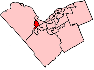
Country:
 Canada
Region:
City:
Latitude and Longitude:
Time Zone:
Postal Code:
IP information under different IP Channel
ip-api
Country
Region
City
ASN
Time Zone
ISP
Blacklist
Proxy
Latitude
Longitude
Postal
Route
IPinfo
Country
Region
City
ASN
Time Zone
ISP
Blacklist
Proxy
Latitude
Longitude
Postal
Route
MaxMind
Country
Region
City
ASN
Time Zone
ISP
Blacklist
Proxy
Latitude
Longitude
Postal
Route
Luminati
Country
CAASN
Time Zone
America/Toronto
ISP
HYDROONETELECOM
Latitude
Longitude
Postal
db-ip
Country
Region
City
ASN
Time Zone
ISP
Blacklist
Proxy
Latitude
Longitude
Postal
Route
ipdata
Country
Region
City
ASN
Time Zone
ISP
Blacklist
Proxy
Latitude
Longitude
Postal
Route
Popular places and events near this IP address

A. Y. Jackson Secondary School (Ottawa)
School in Ottawa, Ontario, Canada
Distance: Approx. 2154 meters
Latitude and longitude: 45.295,-75.87972222
A. Y. Jackson Secondary School is a community high school in the Glen Cairn neighbourhood of the Kanata suburb of Ottawa, Ontario, Canada. It is part of the Ottawa-Carleton District School Board and was first opened in 1976. The school was named after A. Y. Jackson, the famed Canadian painter and one of the founders of the Group of Seven.

Terry Fox station
Distance: Approx. 1152 meters
Latitude and longitude: 45.30944444,-75.90666667
Terry Fox station is a bus stop on Ottawa, Ontario, Canada's transitway served by OC Transpo buses and named after cancer research activist Terry Fox. It is located in the western transitway section and is the main western terminal of routes 61 and 62 for all trips not extended to/from Stittsville. It is located adjacent the Kanata Centrum shopping centre at Kanata Avenue and Earl Grey Drive, just east of the Highway 417 exit at Terry Fox Drive.
Kanata North Ward
Place in Ontario, Canada
Distance: Approx. 2108 meters
Latitude and longitude: 45.31666667,-75.91666667
Kanata North Ward or Ward 4 (French: Quartier Kanata-Nord) is a ward in the city of Ottawa, Ontario, Canada. The ward was created in 2006 when its predecessor, Kanata Ward, split in two main parts. The original Kanata Ward covered all of the former City of Kanata.

Kanata Lakes
Neighbourhood in Ottawa, Ontario, Canada
Distance: Approx. 2207 meters
Latitude and longitude: 45.31442222,-75.92448611
Kanata Lakes also known as Marchwood-Lakeside is a neighbourhood in Kanata North Ward in the west end of the city of Ottawa, Ontario, Canada. Prior to amalgamation in 2001, it was located within the City of Kanata. It is located north of the Queensway, west of Beaverbrook, east of Terry Fox Drive, and south of Morgan's Grant.

Hazeldean Mall
Shopping mall
Distance: Approx. 2263 meters
Latitude and longitude: 45.302,-75.878
Hazeldean Mall is a shopping centre located in the Kanata district of Ottawa, Ontario, Canada. It is located at the intersection of Eagleson Road and Hazeldean Road, where Hazeldean Road turns into Robertson Road. It was the first enclosed shopping centre constructed in Kanata.

Bell Sensplex
Four-pad ice facility in the city of Ottawa, Ontario, Canada
Distance: Approx. 269 meters
Latitude and longitude: 45.297442,-75.909094
The Bell Sensplex is a four-pad ice facility, located in Ottawa, Ontario, Canada. It is the primary practice facility of the Ottawa Senators NHL team. In a partnership with the city of Ottawa, it is also used for minor hockey and hosts the annual Bell Capital Cup ice hockey tournament.

Kanata Theatre
Distance: Approx. 587 meters
Latitude and longitude: 45.295748,-75.900813
Kanata Theatre (informally known as KT) is a community theatre organization, operates the Ron Maslin Playhouse, a 350-seat theatre located in the Kanata district of Ottawa, Ontario, Canada. It was opened in May 1996 by Merle Nicholds, then the mayor of Kanata. The Building was designed by Peter Smith, who also designed the Princess of Wales Theatre in Toronto.
Glen Cairn
Distance: Approx. 2025 meters
Latitude and longitude: 45.29361111,-75.88194444
Glen Cairn is a neighbourhood in Kanata South Ward in the west end of Ottawa, Ontario, Canada. It is also the name of a public school in the area. Prior to amalgamation in 2001, it was located in the City of Kanata.
Katimavik-Hazeldean
Distance: Approx. 1372 meters
Latitude and longitude: 45.30555556,-75.89166667
Katimavik-Hazeldean is a neighbourhood in Kanata South Ward in the west end of Ottawa, Ontario, Canada. It is located in the former City of Kanata which amalgamated into Ottawa in 2001. It is located in south-central Kanata, bounded by Eagleson Road to the east, Hazeldean Road to the south, the Carp River to the west, and Highway 417 to the north.
Kanata Town Centre
Office building in Ottawa, Canada
Distance: Approx. 1723 meters
Latitude and longitude: 45.3125406,-75.895679
The Kanata Town Centre is a three-storey office building with a smaller one-storey retail component in the city of Ottawa, Ontario, Canada. It is located at 150 Katimavik Road, south of Highway 417, in the Katimavik-Hazeldean community of the Kanata area. It contains approximately 10,000 square metres (110,000 sq ft) of gross floor area.

Canadian Tire Centre
Multipurpose arena in Ottawa, Canada
Distance: Approx. 1633 meters
Latitude and longitude: 45.29694444,-75.92722222
Canadian Tire Centre (French: Centre Canadian Tire) is a multi-purpose arena in the suburb of Kanata in Ottawa, Ontario, Canada. It opened in January 1996 as the Palladium and was also known as Corel Centre (French: Centre Corel) from 1996 to 2006 and Scotiabank Place (French: Place Banque Scotia) from 2006 to 2013. The arena is primarily used for ice hockey, serving as the home arena of the Ottawa Senators of the National Hockey League (NHL) since its opening in 1996, and as a temporary home for the Ottawa 67's of the Ontario Hockey League during renovations at their arena.

Canadian Tire Centre station
Transit station in Ottawa, Ontario, Canada
Distance: Approx. 1550 meters
Latitude and longitude: 45.29861111,-75.92638889
Canadian Tire Centre is an OC Transpo Station in Ottawa, Ontario. It is located in the north parking lot at the Canadian Tire Centre in the western suburb of Kanata. The station also has a park and ride facility served weekdays between the hours of 5:45 a.m.
Weather in this IP's area
clear sky
1 Celsius
0 Celsius
1 Celsius
2 Celsius
1031 hPa
90 %
1031 hPa
1018 hPa
10000 meters
1.34 m/s
2.24 m/s
224 degree
4 %
07:24:04
18:12:58