142.40.179.249 - IP Lookup: Free IP Address Lookup, Postal Code Lookup, IP Location Lookup, IP ASN, Public IP
Country:
Region:
City:
Location:
Time Zone:
Postal Code:
IP information under different IP Channel
ip-api
Country
Region
City
ASN
Time Zone
ISP
Blacklist
Proxy
Latitude
Longitude
Postal
Route
Luminati
Country
Region
es
City
vitoria
ASN
Time Zone
America/Sao_Paulo
ISP
Vale SA
Latitude
Longitude
Postal
IPinfo
Country
Region
City
ASN
Time Zone
ISP
Blacklist
Proxy
Latitude
Longitude
Postal
Route
IP2Location
142.40.179.249Country
Region
ontario
City
toronto
Time Zone
America/Toronto
ISP
Language
User-Agent
Latitude
Longitude
Postal
db-ip
Country
Region
City
ASN
Time Zone
ISP
Blacklist
Proxy
Latitude
Longitude
Postal
Route
ipdata
Country
Region
City
ASN
Time Zone
ISP
Blacklist
Proxy
Latitude
Longitude
Postal
Route
Popular places and events near this IP address

Bridle Path, Toronto
Neighbourhood in Toronto, Ontario, Canada
Distance: Approx. 1153 meters
Latitude and longitude: 43.733,-79.368
The Bridle Path is a residential neighbourhood in Toronto, Ontario, Canada. It is characterized by large multimillion-dollar mansions and two to four acre (8,000 to 16,000 m2) lot sizes. It makes up part of Bridle Path–Sunnybrook–York Mills.
Don Mills Centre
Distance: Approx. 1447 meters
Latitude and longitude: 43.735,-79.345
The Don Mills Centre was a shopping mall in Toronto, Ontario, Canada. It was located on a 44-acre (17.8 ha) commercial site, at the southwest corner of Don Mills Road and Lawrence Avenue East in Toronto. There were at least 98 stores during the height of the mall's existence.

Leaside Aerodrome
Airport in Leaside, Ontario
Distance: Approx. 1454 meters
Latitude and longitude: 43.71277778,-79.35916667
Leaside Aerodrome was an airport in the Town of Leaside, Ontario (now a neighbourhood of Toronto). It opened in 1917 as a Royal Flying Corps airfield during the First World War.
Inn on the Park
Distance: Approx. 975 meters
Latitude and longitude: 43.719528,-79.349248
Inn on the Park was a luxury hotel which was formerly located on a hill overlooking Leslie Street and Eglinton Avenue in North York, Ontario (now Toronto). It was one of the early Toronto hotels operated by the Four Seasons Hotel chain.

Edwards Gardens
Botanical garden in Toronto, Ontario, Canada
Distance: Approx. 911 meters
Latitude and longitude: 43.73388889,-79.35944444
Edwards Gardens is a botanical garden located on the southwest corner of Leslie Street and Lawrence Avenue East in Toronto, Ontario, Canada. It is also the site of the Toronto Botanical Garden, a private not-for profit organization previously called the Civic Garden Centre. It is a former estate garden featuring annuals, roses and wildflowers and an extensive rockery.

Sunnybrook Health Sciences Centre
Hospital in Ontario, Canada
Distance: Approx. 1410 meters
Latitude and longitude: 43.7227,-79.374697
Sunnybrook Health Sciences Centre (SHSC), commonly known as Sunnybrook Hospital or simply Sunnybrook, is an academic health science centre located in Toronto, Ontario, Canada. The hospital is the largest trauma centre in Canada. It is accredited as a Level I trauma centre by the Trauma Association of Canada and the American College of Surgeons, the first hospital outside of the United States to achieve ACS accreditation.

Don Valley West (provincial electoral district)
Provincial electoral district in Ontario, Canada
Distance: Approx. 1468 meters
Latitude and longitude: 43.73,-79.375
Don Valley West is a provincial electoral district in Toronto, Ontario, Canada. It elects one member to the Legislative Assembly of Ontario. It was created in 1999 from parts of Don Mills, York Mills, York East and Eglinton.

Shops at Don Mills
Shopping mall in Ontario, Canada
Distance: Approx. 1447 meters
Latitude and longitude: 43.735,-79.345
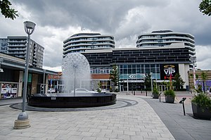
The Shops at Don Mills (corporately known as CF Shops at Don Mills) is a lifestyle centre-type shopping centre in Toronto, Ontario, Canada, located at Don Mills Road and Lawrence Avenue East in Toronto. There are 72 retail stores with a total floor space of 47,550 square metres (or 511,824 square feet). Cadillac Fairview is the owner and manager of the shopping centre.

Sunnybrook Park
Municipal park in Toronto
Distance: Approx. 329 meters
Latitude and longitude: 43.723,-79.359
Sunnybrook Park is a large public park in Toronto, Ontario, Canada. It is located north of Leaside and south of the Bridle Path areas of the city. The park is home to many bike trails, dog parks, and Sunnybrook Stables.

Toronto Botanical Garden
Public park in Toronto, Ontario, Canada
Distance: Approx. 944 meters
Latitude and longitude: 43.73427,-79.35824
The Toronto Botanical Garden (TBG) is located at 777 Lawrence Avenue East at Leslie Street, in Toronto, Ontario, Canada. Termed "The little garden with big ideas", the TBG is nearly four acres and features 17 themed "city-sized gardens". Located in the north-east corner of Edwards Gardens, the TBG is a non-profit horticultural and educational organization with a mission to connect people, plants and the natural world through education, inspiration and leadership.

Don Mills Trail
Cycling and walking trail in Toronto
Distance: Approx. 1057 meters
Latitude and longitude: 43.735,-79.35444444
The Don Mills Trail (also known as the Leaside Spur Trail) is a 3-kilometre (1.9 mi) cycling and walking trail in Toronto, Ontario, Canada. The trail runs south from York Mills Road, east of and roughly parallel to Leslie Street. The city built the trail on the roadbed of a former railway line, known as the Leaside Spur.

Research Enterprises Limited
Distance: Approx. 1463 meters
Latitude and longitude: 43.712821,-79.354868
Research Enterprises Limited (REL for short) was a short-lived Toronto-based Crown Corporation that built electronics and optical instruments during World War II. They existed only six years from late 1940 until 1946, and were active only from late 1941, but during that period they became Leaside's largest employer, producing C$220 million worth of radar systems and optical instruments ($3,677 million in 2025). After the war, the government rapidly closed the various wartime companies it had started. After REL was closed, their factories formed the basis of a Corning Glass plant, Philips Electronics, and a variety of other firms.
Weather in this IP's area
light snow
-8 Celsius
-14 Celsius
-9 Celsius
-7 Celsius
1018 hPa
77 %
1018 hPa
1001 hPa
10000 meters
4.47 m/s
8.05 m/s
320 degree
100 %

