142.254.237.133 - IP Lookup: Free IP Address Lookup, Postal Code Lookup, IP Location Lookup, IP ASN, Public IP
Country:
Region:
City:
Location:
Time Zone:
Postal Code:
ISP:
ASN:
language:
User-Agent:
Proxy IP:
Blacklist:
IP information under different IP Channel
ip-api
Country
Region
City
ASN
Time Zone
ISP
Blacklist
Proxy
Latitude
Longitude
Postal
Route
db-ip
Country
Region
City
ASN
Time Zone
ISP
Blacklist
Proxy
Latitude
Longitude
Postal
Route
IPinfo
Country
Region
City
ASN
Time Zone
ISP
Blacklist
Proxy
Latitude
Longitude
Postal
Route
IP2Location
142.254.237.133Country
Region
california
City
compton
Time Zone
America/Los_Angeles
ISP
Language
User-Agent
Latitude
Longitude
Postal
ipdata
Country
Region
City
ASN
Time Zone
ISP
Blacklist
Proxy
Latitude
Longitude
Postal
Route
Popular places and events near this IP address

Compton, California
City in California, United States
Distance: Approx. 461 meters
Latitude and longitude: 33.89666667,-118.225
Compton is a city located in the Gateway Cities region of southern Los Angeles County, California, United States, situated south of downtown Los Angeles. Compton is one of the oldest cities in the county, and on May 11, 1888, was the eighth city in Los Angeles County to incorporate. As of the 2020 census, the city had a total population of 95,740.

Compton High School
Public high school in California, US
Distance: Approx. 847 meters
Latitude and longitude: 33.89111111,-118.22722222
Compton High School is a high school in Compton, California, United States, part of the Compton Unified School District.

Compton Unified School District
School district in California, United States
Distance: Approx. 594 meters
Latitude and longitude: 33.89138889,-118.21666667
Compton Unified School District is a school district headquartered in Compton, California, United States. The district serves almost all of Compton, all of East Rancho Dominguez, most of Willowbrook CDP, portions of Carson, Lynwood, West Rancho Dominguez CDP, and a small sliver of Paramount.

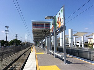
Compton station
Los Angeles Metro Rail station
Distance: Approx. 427 meters
Latitude and longitude: 33.8975,-118.2243
Compton station is an at-grade light rail station on the A Line of the Los Angeles Metro Rail system. The station is located alongside the Union Pacific freight railroad's Wilmington Subdivision (the historic route of the Pacific Electric Railway), at its intersection with Compton Boulevard, after which the station is named, in the city of Compton, California.
Artesia station
Los Angeles Metro Rail station
Distance: Approx. 2162 meters
Latitude and longitude: 33.8766,-118.2227
Artesia station is an at-grade light rail station on the A Line of the Los Angeles Metro Rail system. The station is located alongside the Union Pacific freight railroad's Wilmington Subdivision (the historic route of the Pacific Electric Railway), at its intersection with Artesia Boulevard, after which the station is named, in the city of Compton, California. Artesia is a park and ride station with 380 parking spaces.

Los Angeles Airways Flight 417
1968 helicopter accident
Distance: Approx. 1912 meters
Latitude and longitude: 33.9,-118.2
Los Angeles Airways Flight 417 was a Sikorsky S-61 helicopter that crashed on August 14, 1968 in the city of Compton, California. All eighteen passengers and three crew members were killed. The aircraft was destroyed by impact and fire.

Downtown Compton
Place in California, United States
Distance: Approx. 703 meters
Latitude and longitude: 33.8962,-118.2277
Downtown Compton is the major business district of Compton, California. Downtown Compton started out as a thriving and safe environment throughout the early 1950s to the mid-1970s. When gang violence and robberies sparked in the 70s businesses began to move out and relocate leaving Downtown Compton a ghost town.

Heritage House (Compton, California)
California historic landmark
Distance: Approx. 536 meters
Latitude and longitude: 33.89285556,-118.22458889
The Heritage House is the oldest remaining house in Compton, California. It was built in 1869 at 209 South Acacia Street. In 1869, when A. R. Loomis built it, the home had two rooms; later owners added more rooms.

Martin Luther King, Jr. Memorial (Compton)
Sculpture in Compton, California
Distance: Approx. 500 meters
Latitude and longitude: 33.895,-118.2254
The Martin Luther King, Jr. Memorial is a memorial dedicated to Martin Luther King Jr. in the civic center of Compton, California.
Eagle Tree
Historic tree in California
Distance: Approx. 1540 meters
Latitude and longitude: 33.9077,-118.2114
The Eagle Tree was a historic California sycamore (Platanus racemosa) tree near the crossing of Long Beach Boulevard and the I-105 in Compton, California. It was used as one of the boundary markers for the border of Rancho San Pedro. The tree, which started growing around the turn of the 17th century, was toppled in 2022, from a combination of disease and a long history of vandalism and government neglect.
Angeles Abbey Memorial Park
Historic cemetery in Compton, California
Distance: Approx. 1322 meters
Latitude and longitude: 33.8987,-118.2062
Angeles Abbey Memorial Park, also known as the Angeles Abbey Cemetery, is a historic cemetery in Compton, California. It was built in 1923 and is known for its elaborate main building. It has over 35,000 plots filled and barely has any room for additional burials, meaning that the cemetery's finances are declining.
Compton Swap Meet
Swap meet in Compton, California
Distance: Approx. 1894 meters
Latitude and longitude: 33.9101,-118.2088
The Compton Swap Meet (officially Compton Fashion Center) was an indoor swap meet that sold the music of early gangsta rap artists. Wan Joon Kim began selling records of the genre at his stall, Cycadelic Records, in the 1980s. He became known as the "godfather of gangsta rap".
Weather in this IP's area
broken clouds
11 Celsius
10 Celsius
10 Celsius
12 Celsius
1014 hPa
88 %
1014 hPa
1015 hPa
10000 meters
4.12 m/s
270 degree
75 %
