142.254.236.211 - IP Lookup: Free IP Address Lookup, Postal Code Lookup, IP Location Lookup, IP ASN, Public IP
Country:
Region:
City:
Location:
Time Zone:
Postal Code:
ISP:
ASN:
language:
User-Agent:
Proxy IP:
Blacklist:
IP information under different IP Channel
ip-api
Country
Region
City
ASN
Time Zone
ISP
Blacklist
Proxy
Latitude
Longitude
Postal
Route
db-ip
Country
Region
City
ASN
Time Zone
ISP
Blacklist
Proxy
Latitude
Longitude
Postal
Route
IPinfo
Country
Region
City
ASN
Time Zone
ISP
Blacklist
Proxy
Latitude
Longitude
Postal
Route
IP2Location
142.254.236.211Country
Region
california
City
tujunga
Time Zone
America/Los_Angeles
ISP
Language
User-Agent
Latitude
Longitude
Postal
ipdata
Country
Region
City
ASN
Time Zone
ISP
Blacklist
Proxy
Latitude
Longitude
Postal
Route
Popular places and events near this IP address

California's 28th congressional district
U.S. House district for California
Distance: Approx. 158 meters
Latitude and longitude: 34.25,-118.29138889
California's 28th congressional district is a congressional district in the U.S. state of California, in Los Angeles County. The district is regarded as a Democratic stronghold and has been held by the Democratic Party since 2003 and is currently represented by Democrat Judy Chu. Following redistricting ahead of the 2022 election cycle, the 18th district was relocated to the San Gabriel Valley.
Bolton Hall (California)
United States historic place
Distance: Approx. 266 meters
Latitude and longitude: 34.25262956,-118.28830093
Bolton Hall is a historic American Craftsman-era stone building in Tujunga, Los Angeles, California. Built in 1913, Bolton Hall was originally used as a community center for the utopian community of Los Terrenitos. From 1920 until 1957, it was used as an American Legion hall, the San Fernando Valley's second public library, Tujunga City Hall, and a jail.
Rancho Tujunga
Distance: Approx. 3307 meters
Latitude and longitude: 34.28,-118.3
Rancho Tujunga was a 6,661-acre (26.96 km2) Mexican land grant in the western Crescenta Valley and northeastern San Fernando Valley, in present-day Los Angeles County, California. It was granted in 1840 by Mexican governor Juan Alvarado to Francisco Lopez and Pedro Lopez. The rancho lands included the present-day Los Angeles communities of Lake View Terrace, Sunland, and Tujunga.

Verdugo Hills High School
Public school in Los Angeles
Distance: Approx. 1413 meters
Latitude and longitude: 34.26218,-118.2986
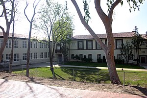
Verdugo Hills High School (VHHS) is a public school located in the Tujunga community of Los Angeles, California, United States, within the Los Angeles Unified School District (LAUSD). The school serves students from several areas of Los Angeles, including Sunland-Tujunga, Lake View Terrace, and portions of North Hollywood, Sun Valley, and Shadow Hills.
Verdugo Hills Cemetery
Historic site in Tujunga, California
Distance: Approx. 1338 meters
Latitude and longitude: 34.26166667,-118.28333333
The Verdugo Hills of Peace Pioneer Cemetery, or Verdugo Hills Cemetery, located in Tujunga, Los Angeles, California, opened in 1922 and closed in 1976.
Sunland-Tujunga, Los Angeles
Neighborhood of Los Angeles in California, United States
Distance: Approx. 312 meters
Latitude and longitude: 34.25222222,-118.2875
Sunland-Tujunga is a Los Angeles city neighborhood within the Crescenta Valley and Verdugo Mountains. Sunland and Tujunga began as separate settlements and today are linked through a single police station, branch library, neighborhood council, chamber of commerce, city council district, and high school. The merging of these communities under a hyphenated name goes back as far as 1928.
Chamlian Armenian School
Private school in Glendale, CA
Distance: Approx. 2713 meters
Latitude and longitude: 34.23864444,-118.26550833
Chamlian Armenian School (Armenian: Շամլեան Ազգային Վարժարան) is an Armenian elementary school in Glendale, California. Chamlian Armenian School teaches grades from kindergarten through 8.

Monte Vista Hotel
Former hotel in Los Angeles, California
Distance: Approx. 2733 meters
Latitude and longitude: 34.26138889,-118.31777778
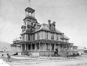
The Monte Vista Hotel was a building which had been formerly located at the intersection of what today are Fenwick Street and Floralita Avenue in the Sunland-Tujunga district of Los Angeles. It was considered the first structure built in the district as well as the last surviving structure of a larger, pre-existing facility known as the Monte Vista Lodge.

Tuna Canyon Detention Station
Distance: Approx. 696 meters
Latitude and longitude: 34.25,-118.2833
Tuna Canyon Detention Station was a temporary detention facility used for holding hundreds of Japanese Americans who were considered enemy aliens by the U.S. government and to be risks to the nation's security. The detention camp was located in Tujunga at a former Civilian Conservation (CCC) Camp, constructed in 1933. The camp was converted into the Tuna Canyon Detention Station just after the bombing of Pearl Harbor.

La Tuna Fire
2017 wildfire in Southern California
Distance: Approx. 3304 meters
Latitude and longitude: 34.229,-118.267
The La Tuna Fire was a wildfire in the Verdugo Mountains in Los Angeles County, Southern California, in September 2017. The fire began from undetermined causes on the afternoon of September 1 in La Tuna Canyon, and burned 7,194 acres (2,911 ha) before its containment on September 9. The fire caused at least ten injuries, the destruction of five homes and five outbuildings, and the evacuations of hundreds more.

Chatsworth Calera
Historic site in Chatsworth, Los Angeles
Distance: Approx. 1849 meters
Latitude and longitude: 34.23472222,-118.29194444
Chatsworth Calera also called Chatsworth Reservoir Kiln Site is one of the few surviving structures of the early 1800s lime industry. This kiln marked the introduction to California of the European industrial process for vitrifying limestone building blocks which were used in the construction of the San Fernando mission and other mission buildings. The word "Calera" is Spanish for "limestone quarry" or "limekiln".
Shekinah Church
Christian church in California, US
Distance: Approx. 1071 meters
Latitude and longitude: 34.2521,-118.3023
Shekinah Church, also known as Shekinah Church International, is a Christian congregation based in the Tujunga neighborhood of Los Angeles, California. It was founded by Robert Shinn in 1994.
Weather in this IP's area
moderate rain
8 Celsius
5 Celsius
6 Celsius
9 Celsius
1014 hPa
92 %
1014 hPa
948 hPa
10000 meters
4.63 m/s
140 degree
100 %
